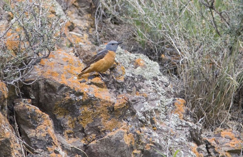
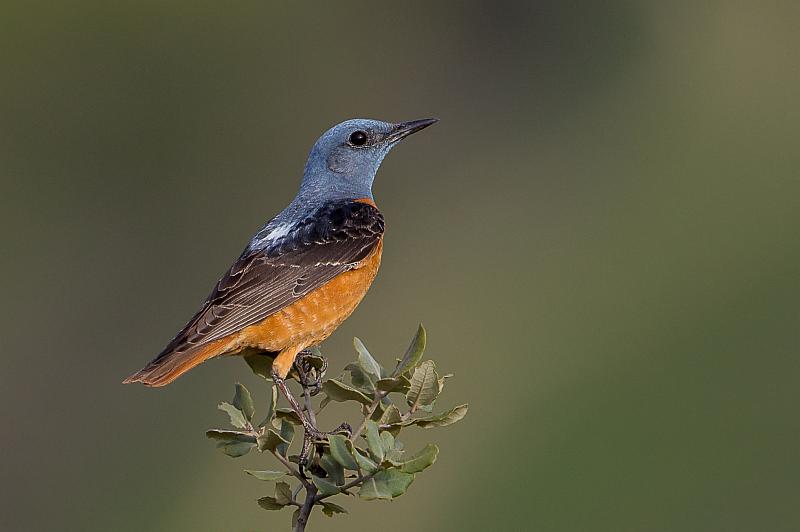
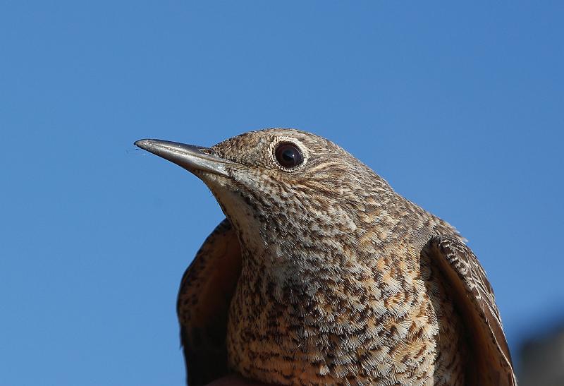
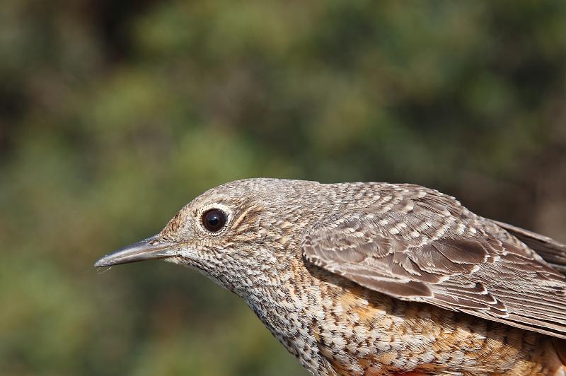
Natura 2000 related content is now shown on the Biodiversity Information System for Europe, BISE. Please go to BISE or use the Natura 2000 map viewer for the latest information.
Kingdom: Animalia > Phylum: Chordata > Class: Aves > Order: Passeriformes > Family: Saxicolidae > Genus: Monticola > Species: Monticola saxatilis

Rock Thrush - Monticola saxatilis (Linnaeus, 1766)

Images from the web

Quick facts

Threat status Europe Least Concern (IUCN)
EU Population status
Unknown
Protected by EU Birds Directive and 2 other international agreements
Natura 2000 sites 478 are designated for this species
Breeding habitats
  • heathland and shrub
  • sparsely vegetated land
Natura 2000 species code A280

Distribution

The distribution map is currently disabled. A new map solution will soon become available. In the meantime, please consult other species distribution map providers listed in the Other resources panel below.

Threat and EU population status

IUCN Red List status of threatened species

The IUCN Red List threat status assesses the risk of extinction.

EU population status

The status of the population at the EU level was evaluated at the species level; this was based on the reports delivered by Member States under Article 12 of the Birds Directive (see fact sheet below). The EU status assessment can cover several subspecies/subspecific population units. For more information, please consult the species fact sheet and link below.

IUCN Red List Category
Not Evaluated
Near Threatened
Regionally Extinct
Not Applicable
Vulnerable
Extinct in the Wild
Data Deficient
Endangered
Extinct
Least Concern
Critically Endangered
Population status categories for bird species under the Birds Directive
Secure
Near Threatened, declining or depleted
Threatened (i.e. vulnerable, endangered, critically endangered, regionally extinct)
Unknown or not evaluated

Natura 2000 sites

Protected in the following Natura 2000 sites

Sitecode Country Site name Action
CY5000004 Cyprus ETHNIKO DASIKO PARKO TROODOUS Map
CY6000002 Cyprus ALYKES LARNAKAS Map
ES0000003 Spain Picos de Europa Map
ES0000007 Spain Cañón del Río Lobos - ZEPA Map
ES0000010 Spain Sierra de Guadarrama - ZEPA Map
ES0000016 Spain ORDESA Y MONTE PERDIDO Map
ES0000018 Spain Prepirineu Central català Map
ES0000022 Spain Aigüestortes Map
ES0000024 Spain Doñana Map
ES0000032 Spain Torcal de Antequera Map
ES0000035 Spain Sierras de Cazorla, Segura y Las Villas Map
ES0000057 Spain Alto Lozoya Map
ES0000069 Spain Embalse de Cornalvo y Sierra Bermeja Map
ES0000072 Spain Sierra Grande de Hornachos Map
ES0000115 Spain Hoces del Río Duratón Map
ES0000116 Spain Valle de Iruelas Map
ES0000136 Spain ESTEPAS DE BELCHITE - EL PLANERÓN - LA LOMAZA Map
ES0000137 Spain LOS VALLES Map
ES0000149 Spain POSETS - MALADETA Map
ES0000164 Spain Sierra de Ayllón Map
ES0000173 Spain Sierra Espuña Map
ES0000184 Spain Valle del Tiétar - ZEPA Map
ES0000185 Spain Cerro de Guisando - ZEPA Map
ES0000186 Spain Pinares del Bajo Alberche - ZEPA Map
ES0000187 Spain Montes de Miranda de Ebro y Ameyugo - ZEPA Map
ES0000189 Spain Campo Azálvaro - Pinares de Peguerinos - ZEPA Map
ES0000192 Spain Humada - Peña Amaya - ZEPA Map
ES0000193 Spain Sierra de la Tesla-Valdivielso - ZEPA Map
ES0000203 Spain Altos de Barahona - ZEPA Map
ES0000206 Spain Cañones del Duero - ZEPA Map
ES0000210 Spain Alto Sil Map
ES0000219 Spain Río Alagón Map
ES0000244 Spain Gorobel mendilerroa / Sierra Sálvada Map
ES0000255 Spain Páramo de Layna - ZEPA Map
ES0000259 Spain Sierra de Mojantes Map
ES0000277 Spain COLLARADA - IBÓN DE IP Map
ES0000278 Spain VIÑAMALA Map
ES0000279 Spain ALTO CINCA Map
ES0000280 Spain COTIELLA - SIERRA FERRERA Map
ES0000281 Spain EL TURBÓN Y SIERRA DE SÍS Map
ES0000283 Spain SIERRAS DE LEYRE Y ORBA Map
ES0000285 Spain SAN JUAN DE LA PEÑA Y PEÑA OROEL Map
ES0000286 Spain SIERRA DE CANCIÁS - SILVES Map
ES0000287 Spain SIERRAS DE SANTO DOMINGO Y CABALLERA Y RÍO ONSELLA Map
ES0000288 Spain SIERRA DE MONGAY Map
ES0000292 Spain LOMA LA NEGRA - BARDENAS Map
ES0000293 Spain MONTES DE ZUERA, CASTEJÓN DE VALDEJASA Y EL CASTELLAR Map
ES0000295 Spain SIERRA DE ALCUBIERRE Map
ES0000297 Spain SIERRA DE MONCAYO - LOS FAYOS - SIERRA DE ARMAS Map
ES0000298 Spain MATARRAÑA - AIGUABARREIX Map
ES0000299 Spain DESFILADEROS DEL RÍO JALÓN Map
ES0000300 Spain RÍO HUERVA Y LAS PLANAS Map
ES0000303 Spain DESFILADEROS DEL RÍO MARTÍN Map
ES0000304 Spain PARAMERAS DE CAMPO VISIEDO Map
ES0000305 Spain PARAMERAS DE ALFAMBRA Map
ES0000306 Spain RÍO GUADALOPE - MAESTRAZGO Map
ES0000307 Spain PUERTOS DE BECEITE Map
ES0000308 Spain PARAMERAS DE POZONDÓN Map
ES0000309 Spain MONTES UNIVERSALES - SIERRA DEL TREMEDAL Map
ES0000355 Spain Hurdes Map
ES0000357 Spain Altos Campos de Gómara Map
ES0000360 Spain Cihuela-Deza Map
ES0000363 Spain Monteagudo de las Vicarías Map
ES0000364 Spain Omaña - ZEPA Map
ES0000370 Spain Sierra de Gata y Valle de las Pilas Map
ES0000374 Spain Ancares Map
ES0000376 Spain Baixa Limia - Serra do Xurés Map
ES1120001 Spain Ancares - Courel Map
ES1130001 Spain Baixa Limia Map
ES1130002 Spain Macizo Central Map
ES2110004 Spain Arkamu-Gibillo-Arrastaria Map
ES2110009 Spain Gorbeia Map
ES2110018 Spain Arabako hegoaldeko mendilerroak / Sierras meridionales de Álava Map
ES2110019 Spain Izki Map
ES2120002 Spain Aizkorri-Aratz Map
ES2120003 Spain Izarraitz Map
ES2120008 Spain Hernio-Gazume Map
ES2120011 Spain Aralar Map
ES2120016 Spain Aiako harria Map
ES2430101 Spain MUELAS DEL JILOCA: EL CAMPO Y LA TORRETA Map
ES2430105 Spain HOCES DEL RÍO MESA Map
ES4110002 Spain Sierra de Gredos Map
ES4110086 Spain Encinares de la Sierra de Ávila - ZEPA Map
ES4120012 Spain Sierra de la Demanda - ZEPA Map
ES4120028 Spain Monte Santiago Map
ES4120030 Spain Montes Obarenes Map
ES4120031 Spain Sabinares del Arlanza - ZEPA Map
ES4120036 Spain Hoces del Alto Ebro y Rudrón - ZEPA Map
ES4130003 Spain Picos de Europa en Castilla y León Map
ES4130010 Spain Sierra de los Ancares Map
ES4130022 Spain Montes Aquilanos Map
ES4130024 Spain Sierra de la Cabrera - ZEPA Map
ES4130035 Spain Valle de San Emiliano Map
ES4140011 Spain Fuentes Carrionas y Fuente Cobre-Montaña Palentina Map
ES4150005 Spain Las Batuecas-Sierra de Francia -ZEPA Map
ES4150006 Spain Candelario - ZEPA Map
ES4150039 Spain Quilamas - ZEPA Map
ES4160008 Spain Hoces del Río Riaza - ZEPA Map
ES4170013 Spain Sierra de Urbión Map
ES4170044 Spain Sierra del Moncayo - ZEPA Map
ES4190009 Spain Lago de Sanabria y alrededores - ZEPA Map
ES4320039 Spain Sierra de las Villuercas y Valle del Guadarranque Map
ES5120002 Spain Capçaleres del Ter i del Freser Map
ES5120003 Spain Serra Cavallera Map
ES5120007 Spain Cap de Creus Map
ES5130003 Spain Alt Pallars Map
ES5130004 Spain Baish Aran Map
ES5130005 Spain Era Artiga de Lin - Eth Portilhon Map
ES5130008 Spain Serra d'Aubenç i Roc de Cogul Map
ES5130010 Spain Serra de Boumort-Collegats Map
ES5130012 Spain Vall Alta de Serradell-Serra de Sant Gervàs Map
ES5140009 Spain Tivissa-Vandellòs-Llaberia Map
ES6110003 Spain Sierra Maria - Los Vélez Map
ES6130002 Spain Sierras Subbéticas Map
ES6140004 Spain Sierra Nevada Map
ES6160007 Spain Sierra Mágina Map
ES6170006 Spain Sierra de Las Nieves Map
ES6170007 Spain Sierras de Tejeda, Almijara y Alhama Map
GR1250001 Greece OROS OLYMPOS Map
GR1260010 Greece OROS BELES Map
GR1310002 Greece VALIA KALNTA KAI TECHNITI LIMNI AOOU Map
GR2130002 Greece KORYFES OROUS SMOLIKAS Map
GR2130007 Greece OROS LAKMOS (PERISTERI) Map
GR2130009 Greece OROS TYMFI (GKAMILA) Map
GR2410002 Greece OROS PARNASSOS Map
GR2440007 Greece ETHNIKOS DRYMOS OITIS - KOILADA ASOPOU Map
IT1110080 Italy Val Troncea Map
IT1140004 Italy Alta Val Formazza Map
IT1160021 Italy Gruppo del Tenibres Map
IT1160024 Italy Colle e Lago della Maddalena, Val Puriac Map
IT1160056 Italy Alpi Marittime Map
IT1160057 Italy Alte Valli Pesio e Tanaro Map
IT1160058 Italy Gruppo del Monviso e Bosco dell'Alevè Map
IT1201000 Italy Parco Nazionale del Gran Paradiso Map
IT1202000 Italy Parco naturale Mont Avic Map
IT1204010 Italy Ambienti Glaciali del Monte Bianco Map
IT1204030 Italy Val Ferret Map
IT1313712 Italy Cima di Piano Cavallo - Bric Cornia Map
IT1313776 Italy Piancavallo Map
IT1314609 Italy Monte Monega - Monte Prearba Map
IT1314610 Italy Monte Saccarello - Monte Fronté Map
IT1314611 Italy Monte Gerbonte Map
IT1314677 Italy Saccarello - Garlenda Map
IT1314678 Italy Sciorella Map
IT1314679 Italy Toraggio - Gerbonte Map
IT1315421 Italy Monte Toraggio - Monte Pietravecchia Map
IT1315481 Italy Ceppo Tomena Map
IT1330213 Italy Conglomerato di Vobbia Map
IT1331012 Italy Lago Marcotto - Roccabruna - Gifarco - Lago della Nave Map
IT1331104 Italy Parco dell'Aveto Map
IT1331578 Italy Beigua - Turchino Map
IT2020009 Italy Valle del Dosso Map
IT2020301 Italy Triangolo Lariano Map
IT2020302 Italy Monte Generoso Map
IT2020303 Italy Valsolda Map
IT2030002 Italy Grigna Meridionale Map
IT2030003 Italy Monte Barro Map
IT2030301 Italy Monte Barro Map
IT2040001 Italy Val Viera e Cime di Fopel Map
IT2040002 Italy Motto di Livigno - Val Saliente Map
IT2040003 Italy Val Federia Map
IT2040005 Italy Valle della Forcola Map
IT2040006 Italy La Vallaccia - Pizzo Filone Map
IT2040007 Italy Passo e Monte di Foscagno Map
IT2040008 Italy Cime di Plator e Monte delle Scale Map
IT2040011 Italy Monte Vago - Val di Campo - Val Nera Map
IT2040012 Italy Val Viola Bormina - Ghiacciaio di Cima dei Piazzi Map
IT2040016 Italy Monte di Scerscen - Ghiacciai di Scerscen - Monte Motta Map
IT2040018 Italy Val Codera Map
IT2040019 Italy Bagni di Masino - Pizzo Badile Map
IT2040021 Italy Val di Togno - Pizzo Scalino Map
IT2040027 Italy Valle del Bitto di Gerola Map
IT2040034 Italy Valle d'Arigna e Ghiacciaio di Pizzo di Coca Map
IT2040036 Italy Val Belviso Map
IT2040044 Italy Parco Nazionale dello Stelvio Map
IT2060001 Italy Valtorta e Valmoresca Map
IT2060002 Italy Valle di Piazzatorre - Isola di Fondra Map
IT2060003 Italy Alta Val Brembana - Laghi Gemelli Map
IT2060004 Italy Alta Val di Scalve Map
IT2060005 Italy Val Sedornia - Val Zurio - Pizzo della Presolana Map
IT2060006 Italy Boschi del Giovetto di Paline Map
IT2060007 Italy Valle Asinina Map
IT2060008 Italy Valle Parina Map
IT2060009 Italy Val Nossana - Cima di Grem Map
IT2060301 Italy Monte Resegone Map
IT2060304 Italy Val di Scalve Map
IT2070002 Italy Monte Piccolo - Monte Colmo Map
IT2070003 Italy Val Rabbia e Val Galinera Map
IT2070004 Italy Monte Marser - Corni di Bos Map
IT2070005 Italy Pizzo Badile - Alta Val Zumella Map
IT2070006 Italy Pascoli di Crocedomini - Alta Val Caffaro Map
IT2070007 Italy Vallone del Forcel Rosso Map
IT2070010 Italy Piz Olda - Val Malga Map
IT2070012 Italy Torbiere di Val Braone Map
IT2070013 Italy Ghiacciaio dell'Adamello Map
IT2070015 Italy Monte Cas - Cima di Corlor Map
IT2070017 Italy Valli di San Antonio Map
IT2070019 Italy Sorgente Funtanì Map
IT2070021 Italy Valvestino Map
IT2070022 Italy Corno della Marogna Map
IT2070302 Italy Val Caffaro Map
IT2070303 Italy Val Grigna Map
IT3120003 Italy Alta Val del Monte Map
IT3120051 Italy Stagni della Vela - Soprasasso Map
IT3120074 Italy Marocche di Dro Map
IT3120079 Italy Lago di Loppio Map
IT3120104 Italy Monte Baldo - Cima Valdritta Map
IT3120110 Italy Terlago Map
IT3120114 Italy Monte Zugna Map
IT3120147 Italy Monti Lessini Ovest Map
IT3210021 Italy Monte Pastello Map
IT3210039 Italy Monte Baldo Ovest Map
IT3220002 Italy Granezza Map
IT3230022 Italy Massiccio del Grappa Map
IT3230025 Italy Gruppo del Visentin: M. Faverghera - M. Cor Map
IT3230083 Italy Dolomiti Feltrine e Bellunesi Map
IT3260017 Italy Colli Euganei - Monte Lozzo - Monte Ricco Map
IT3310006 Italy Foresta del Cansiglio Map
IT4010002 Italy Monte Menegosa, Monte Lama, Groppo di Gora Map
IT4010003 Italy Monte Nero, Monte Maggiorasca, La Ciapa Liscia Map
IT4010005 Italy Pietra Parcellara e Pietra Perduca Map
IT4020006 Italy Monte Prinzera Map
IT4020011 Italy Groppo di Gorro Map
IT4020020 Italy Crinale dell'Appennino parmense Map
IT4030001 Italy Monte Acuto, Alpe di Succiso Map
IT4030003 Italy Monte la Nuda, Cima Belfiore, Passo del Cerreto Map
IT4030004 Italy Val d'Ozola, Monte Cusna Map
IT4030006 Italy Monte Prado Map
IT4040001 Italy Monte Cimone, Libro Aperto, Lago di Pratignano Map
IT4040002 Italy Monte Rondinaio, Monte Giovo Map
IT4040003 Italy Sassi di Roccamalatina e di Sant'Andrea Map
IT4050002 Italy Corno alle Scale Map
IT4070011 Italy Vena del Gesso Romagnola Map
IT4080001 Italy Foresta di Campigna, Foresta la Lama, Monte Falco Map
IT4080002 Italy Acquacheta Map
IT4080003 Italy Monte Gemelli, Monte Guffone Map
IT4080005 Italy Monte Zuccherodante Map
IT4080008 Italy Balze di Verghereto, Monte Fumaiolo, Ripa della Moia Map
IT4080010 Italy Careste presso Sarsina Map
IT4090002 Italy Torriana, Montebello, Fiume Marecchia Map
IT5110002 Italy Monte Orsaro Map
IT5110003 Italy Monte Matto - Monte Malpasso Map
IT5110004 Italy Monte Acuto - Groppi di Camporaghena Map
IT5110005 Italy Monte La Nuda - Monte Tondo Map
IT5120001 Italy Monte Sillano - Passo Romecchio Map
IT5120002 Italy Monte Castellino - Le Forbici Map
IT5120003 Italy Parco dell'Orecchiella - Pania di Corfino - Lamarossa Map
IT5120004 Italy Pania di Corfino Map
IT5130001 Italy Alta Valle del Sestaione Map
IT5130005 Italy Libro Aperto - Cima Tauffi Map
IT5130006 Italy Monte Spigolino - Monte Gennaio Map
IT5140001 Italy Passo della Raticosa, Sassi di San Zanobi e della Mantesca Map
IT5140002 Italy Sasso di Castro e Monte Beni Map
IT5140003 Italy Conca di Firenzuola Map
IT5140004 Italy Giogo - Colla di Casaglia Map
IT5140005 Italy Muraglione - Acqua Cheta Map
IT5160012 Italy Monte Capanne e promontorio dell'Enfola Map
IT5180001 Italy Crinale Monte Falterona - Monte Falco - Monte Gabrendo Map
IT5180008 Italy Sasso di Simone e Simoncello Map
IT5180011 Italy Pascoli montani e cespuglieti del Pratomagno Map
IT5210007 Italy Valle delle Prigioni (Monte Cucco) Map
IT5210008 Italy Valle del Rio Freddo (Monte Cucco) Map
IT5210009 Italy Monte Cucco (sommità) Map
IT5210010 Italy Le Gorghe Map
IT5210037 Italy Selva di Cupigliolo Map
IT5210071 Italy Monti Sibillini (versante umbro) Map
IT5220025 Italy Bassa Valnerina: Monte Fionchi - Cascata delle Marmore Map
IT5310003 Italy Monti Sasso Simone e Simoncello Map
IT5310005 Italy Settori sommitali Monte Carpegna e Costa dei Salti Map
IT5310026 Italy Monte Carpegna e Sasso Simone e Simoncello Map
IT5330004 Italy Monte Bove Map
IT5330005 Italy Monte Castel Manardo - Tre Santi Map
IT5330029 Italy Dalla Gola del Fiastrone al Monte Vettore Map
IT5340003 Italy Monte dell'Ascensione Map
IT5340004 Italy Montagna dei Fiori Map
IT5340013 Italy Monte Porche - Palazzo Borghese - Monte Argentella Map
IT5340021 Italy Monte dell'Ascensione Map
IT6020005 Italy Monti Reatini Map
IT6020025 Italy Monti della Laga (Area Sommitale) Map
IT6030043 Italy Monti Lepini Map
IT6040043 Italy Monti Ausoni e Aurunci Map
IT6050028 Italy Massiccio del Monte Cairo (aree sommitali) Map
IT7110099 Italy Gole del Sagittario Map
IT7110100 Italy Monte Genzana Map
IT7110128 Italy Parco Nazionale Gran Sasso - Monti della Laga Map
IT7110130 Italy Sirente Velino Map
IT7110202 Italy Gran Sasso Map
IT7110204 Italy Maiella Sud Ovest Map
IT7110205 Italy Parco Nazionale d'Abruzzo Map
IT7120132 Italy Parco Nazionale d'Abruzzo, Lazio e Molise ed aree limitrofe Map
IT7120201 Italy Monti della Laga e Lago di Campotosto Map
IT7120213 Italy Montagne dei Fiori e di Campli e Gole del Salinello Map
IT7130031 Italy Fonte di Papa Map
IT7140129 Italy Parco Nazionale della Maiella Map
IT7140203 Italy Maiella Map
IT8030037 Italy Vesuvio e Monte Somma Map
IT9210105 Italy Dolomiti di Pietrapertosa Map
IT9210190 Italy Monte Paratiello Map
IT9210195 Italy Monte Raparo Map
IT9210200 Italy Monte Sirino Map
IT9210205 Italy Monte Volturino Map
IT9220260 Italy Valle Basento Grassano Scalo - Grottole Map
ITA010002 Italy Isola di Marettimo Map
ITA010016 Italy Monte Cofano e Litorale Map
ITA010017 Italy Capo San Vito, Monte Monaco, Zingaro, Faraglioni Scopello, Monte Sparacio Map
ITA010019 Italy Isola di Pantelleria: Montagna Grande e Monte Gibele Map
ITA010020 Italy Isola di Pantelleria - Area Costiera, Falesie e Bagno dell'Acqua Map
ITA020016 Italy Monte Quacella, Monte dei Cervi, Pizzo Carbonara, Monte Ferro, Pizzo Otiero Map
ITA020021 Italy Montagna Longa, Pizzo Montanello Map
ITA040001 Italy Isola di Linosa Map
ITA040002 Italy Isola di Lampedusa e Lampione Map
PTCON0001 Portugal Peneda / Gerês Map
PTCON0002 Portugal Montesinho / Nogueira Map
PTZPE0002 Portugal Serra do Gerês Map
SI5000002 Slovenia Snežnik - Pivka Map
SI5000019 Slovenia Julijci Map
SI5000020 Slovenia Breginjski Stol Map
SI5000021 Slovenia Vipavski rob Map
SKCHVU013 Slovakia Mala Fatra Map
SKCHVU027 Slovakia Slovensky kras Map
ITB022212 Italy Supramonte di Oliena, Orgosolo e Urzulei - Su Sercone Map
IT9210120 Italy La Falconara Map
IT1180026 Italy Capanne di Marcarolo Map
IT1342907 Italy Monte Antessio - Chiusola Map
IT5210047 Italy Monti Serano - Brunette (sommità) Map
IT9210270 Italy Appennino Lucano, Monte Volturino Map
IT5220014 Italy Valle del Serra (Monti Martani) Map
ES6200004 Spain Sierras y Vega Alta del Segura y Ríos Alhárabe y Moratalla Map
ITA020006 Italy Capo Gallo Map
IT5210027 Italy Monte Subasio (sommità) Map
ES6200018 Spain Sierra de la Muela Map
CY6000004 Cyprus DASOS STAVROVOUNIOU Map
IT2030601 Italy Grigne Map
ITA020038 Italy Sugherete di Contrada Serradaino Map
IT2010401 Italy Parco Regionale Campo dei Fiori Map
IT7110096 Italy Gole di San Venanzio Map
ES4240024 Spain Sierra de Caldereros Map
ES6110008 Spain Sierras de Gádor y Enix Map
ITA040013 Italy Arcipelago delle Pelagie - area marina e terrestre Map
ES4320037 Spain Sierra de Gata Map
IT2040601 Italy Bagni di Masino - Pizzo Badile - Val di Mello - Val Torrone - Piano di Preda Rossa Map
ITA020015 Italy Complesso Calanchivo di Castellana Sicula Map
ITA020004 Italy Monte S. Salvatore, Monte Catarineci, Vallone Mandarini, ambienti umidi Map
IT3341002 Italy Aree Carsiche della Venezia Giulia Map
IT5120009 Italy Monte Sumbra Map
IT5220010 Italy Monte Solenne (Valnerina) Map
IT7110207 Italy Monti Simbruini Map
ES2410069 Spain SIERRA DE ESDOLOMADA Y MORRONES DE GÜEL Map
IT1331718 Italy Monte Fasce Map
ITA020003 Italy Boschi di San Mauro Castelverde Map
IT2040602 Italy Valle dei Ratti - Cime di Gaiazzo Map
IT1331909 Italy Monte Zatta - Passo Bocco - Passo Chiapparino - Monte Bossea Map
IT5210068 Italy Laghetto e Piano di Gavelli (Monte Coscerno) Map
ITA020020 Italy Querceti sempreverdi di Geraci Siculo e Castelbuono Map
ES4230014 Spain Serranía de Cuenca Map
IT9210180 Italy Monte della Madonna di Viggiano Map
ES6200016 Spain Revolcadores Map
IT1342806 Italy Monte Verruga - Monte Zenone - Roccagrande - Monte Pu Map
IT2040401 Italy Parco Regionale Orobie Valtellinesi Map
ES5110001 Spain Massís del Montseny Map
IT5120010 Italy Valle del Serra - Monte Altissimo Map
IT5220013 Italy Monte Torre Maggiore (Monti Martani) Map
IT9210250 Italy Timpa delle Murge Map
IT3120157 Italy Stelvio Map
ES5120024 Spain Montgrony Map
IT7110206 Italy Monte Sirente e Monte Velino Map
ES5120026 Spain Tossa Plana de Lles-Puigpedrós Map
IT8030036 Italy Vesuvio Map
IT1160062 Italy Alte Valli Stura e Maira Map
IT2020010 Italy Lago di Segrino Map
ITA010027 Italy Arcipelago delle Egadi - area marina e terrestre Map
IT1343511 Italy Monte Cornoviglio - Monte Fiorito - Monte Dragnone Map
IT5220016 Italy Monte la Pelosa - Colle Fergiara (Valnerina) Map
IT1342908 Italy Monte Gottero - Passo del Lupo Map
ES4240017 Spain Parameras de Maranchón, hoz del Mesa y Aragoncillo Map
IT7140212 Italy Abetina di Rosello e Cascate del Rio Verde Map
IT6020014 Italy Piana di Rascino Map
IT1202020 Italy Mont Avic e Mont Emilius Map
ES4320011 Spain Las Hurdes Map
IT5220015 Italy Fosso Salto del Cieco (Ferentillo) Map
IT7212121 Italy Gruppo della Meta - Catena delle Mainarde Map
IT2010019 Italy Monti della Valcuvia Map
IT3321001 Italy Alpi Carniche Map
IT7110075 Italy Serra e Gole di Celano - Val d'Arano Map
PTCON0025 Portugal Montemuro Map
IT8030021 Italy Monte Somma Map
ITA020026 Italy Monte Pizzuta, Costa del Carpineto, Moarda Map
IT2070401 Italy Parco Naturale Adamello Map
CY5000005 Cyprus AKROTIRIO ASPRO - PETRA ROMIOU Map
IT7222287 Italy La Gallinola - Monte Miletto - Monti del Matese Map
IT6020007 Italy Gruppo Monte Terminillo Map
CY4000014 Cyprus PERIOCHI DRYMOU Map
ITA010029 Italy Monte Cofano, Capo San Vito e Monte Sparagio Map
IT2070402 Italy Alto Garda Bresciano Map
CY3000005 Cyprus KAVO GKREKO Map
IT5110006 Italy Monte Sagro Map
ES1130007 Spain Pena Trevinca Map
IT3120159 Italy Brenta Map
IT9210025 Italy Bosco della Farneta Map
ITA020023 Italy Raffo Rosso, Monte Cuccio e Vallone Sagana Map
ES4320038 Spain Sierra de Gredos y Valle del Jerte Map
IT7110091 Italy Monte Arunzo e Monte Arezzo Map
IT5210066 Italy Media Val Casana (Monti Coscerno - Civitella) Map
ITA020050 Italy Parco delle Madonie Map
ES6200017 Spain Sierra de Villafuerte Map
PTCON0003 Portugal Alvão / Marão Map
ITA020014 Italy Monte Pellegrino Map
CY2000004 Cyprus DASOS MACHAIRA Map
IT1323201 Italy Finalese - Capo Noli Map
IT1140021 Italy Val Formazza Map
IT1331402 Italy Beigua - Monte Dente - Gargassa - Pavaglione Map
ITA020017 Italy Complesso Pizzo Dipilo e Querceti su calcare Map
CY2000005 Cyprus MADARI - PAPOUTSA Map
CY2000006 Cyprus DASOS PAFOU Map
IT9210245 Italy Serra di Crispo, Grande Porta del Pollino e Pietra Castello Map
ES5130009 Spain Serra de Turp i Mora Condal-Valldan Map
IT2060506 Italy Belviso Barbellino Map
IT5120013 Italy Monte Tambura - Monte Sella Map
IT3340006 Italy Carso Triestino e Goriziano Map
IT5210063 Italy Monti Coscerno - Civitella - Aspra (sommità) Map
IT5120006 Italy Monte Prato Fiorito - Monte Coronato - Valle dello Scesta Map
IT7212168 Italy Valle Porcina - Torrente Vandra - Cesarata Map
IT2060401 Italy Parco Regionale Orobie Bergamasche Map
IT7212125 Italy Pesche - MonteTotila Map
ITA020002 Italy Boschi di Gibilmanna e Cefalù Map
IT5120012 Italy Monte Croce - Monte Matanna Map
IT5120005 Italy Monte Romecchio - Monte Rondinaio - Poggione Map
IT1324011 Italy Monte Ravinet - Rocca Barbena Map
IT6040027 Italy Monte Redentore (versante sud) Map
ES4230013 Spain Hoces del Cabriel, Guadazaón y ojos de Moya Map
CY4000004 Cyprus VOUNI PANAGIAS Map
IT1315806 Italy Monte Nero - Monte Bignone Map
ES6140001 Spain Sierra de Baza Map
ITA020045 Italy Rocca di Sciara Map
IT5120014 Italy Monte Corchia - Le Panie Map
ITB021103 Italy Monti del Gennargentu Map
IT6030035 Italy Monte Guadagnolo Map
IT1331501 Italy Praglia - Pracaban - Monte Leco - Punta Martin Map
IT9210271 Italy Appennino Lucano, Valle Agri, Monte Sirino, Monte Raparo Map
ITA010030 Italy Isola di Pantelleria e area marina circostante Map
IT9210265 Italy Valle del Noce Map
ITA020049 Italy Monte Pecoraro e Pizzo Cirina Map
ES1130008 Spain Pena Maseira Map
IT5150001 Italy La Calvana Map
IT7212135 Italy Montagnola Molisana Map
IT5120008 Italy Valli glaciali di Orto di Donna e Solco d'Equi Map
IT5210055 Italy Gola del Corno - Stretta di Biselli Map
ROSPA0045 Romania Grădiștea Muncelului - Ciclovina Map
ROSPA0009 Romania Beștepe - Mahmudia Map
ROSPA0032 Romania Deniz Tepe Map
ROSPA0036 Romania Dumbrăveni Map
ROSPA0025 Romania Cozia - Buila - Vânturarița Map
ROSPA0020 Romania Cheile Nerei - Beușnița Map
ES0000437 Spain Pena Trevinca Map
IT9210150 Italy Monte Coccovello - Monte Crivo - Monte Crive Map
CY3000007 Cyprus FRAGMA ACHNAS Map
CY2000015 Cyprus VOUNOKORFES MADARIS - PAPOUTSAS Map
CY4000010 Cyprus CHERSONISOS AKAMA Map
CY4000023 Cyprus ZONI EIDIKIS PROSTASIAS CHERSONISOS AKAMA Map
CY2000013 Cyprus PERIOCHI TZIONIA Map
GR2130013 Greece EVRYTERI PERIOCHI ATHAMANIKON OREON Map
IT3120176 Italy Monte Sadron Map
IT3120177 Italy Dolomiti di Brenta Map
IT4090006 Italy Versanti occidentali del Monte Carpegna, Torrente Messa, Poggio di Miratoio Map
IT3120173 Italy Monte Baldo di Brentonico Map
AT2209000 Austria Niedere Tauern Map
AT3301000 Austria Hohe Tauern, Tirol Map
AT3303000 Austria Valsertal Map
AT1205000 Austria Wachau - Jauerling Map
AT3305000 Austria Ötztaler Alpen Map
AT2220000 Austria Zirbitzkogel Map
AT2112000 Austria Villacher Alpe (Dobratsch) Map
ROSPA0133 Romania Munții Călimani Map
ROSPA0129 Romania Masivul Ceahlău Map
PLC120002 Poland Pieniny Map
PTZPE0003 Portugal Montesinho / Nogueira Map
CY3000002 Cyprus SPA KAVO GKREKO Map
ES2110024 Spain Valderejo-Sobrón-Árcenako mendilerroa / Valderejo-Sobrón-Sierra de Árcena Map

Protected sites

Please note the site map takes a while to display.

Common names and synonyms

Common Name Language Reference
Codirossone Italian Hagemeijer, W.J.M. & Blair, M.J.
Kivikkorastas Finnish Hagemeijer, W.J.M. & Blair, M.J.
Kövirigó Hungarian Hagemeijer, W.J.M. & Blair, M.J.
Melro-das-rochas Portuguese Hagemeijer, W.J.M. & Blair, M.J.
Monticole de roche French Hagemeijer, W.J.M. & Blair, M.J.
Nagórnik Polish Hagemeijer, W.J.M. & Blair, M.J.
nagórnik (drozd skalny) Polish Polish NRC
Rock Thrush English Hagemeijer, W.J.M. & Blair, M.J.
Rode Rotslijster Dutch Hagemeijer, W.J.M. & Blair, M.J.
Roquero Rojo Spanish Hagemeijer, W.J.M. & Blair, M.J.
Steinrötel German Hagemeijer, W.J.M. & Blair, M.J.
Stentrast Swedish Hagemeijer, W.J.M. & Blair, M.J.

Other resources

CoL (accepted name) Catalogue of Life
EBCC Atlas of breeding birds European Bird Census Council's Atlas of Breeding Birds
EURing code:11620 European bird-ringing
EoL Encyclopedia of Life
Fauna Europaea Fauna Europaea
GBIF Global Biodiversity Information Facility
ITIS (Valid name) Interagency Taxonomic Information System
NCBI search National Center for Biotechnology Information
PESI (Accepted) Pan-European Species directories Infrastructure
Wikipedia Wikipedia

External data

Population distribution from "Birds in Europe" editions 1 and 2

These publications present a thorough and detailed review of the conservation status of European birds. Based on detailed breeding and wintering population data collected in each country, the report provides a review of the population sizes and trends of Species of European Conservation Concern.

44 items found, displaying all items.1
Country Biogeographic region Min / Max (Units) Period Status Quality Source Published
Albania 300/1000 (pairs) 2002 Breeding Species generally well known, but only poor or incomplete quantitative data available Birds in Europe 2 (1990-2000) 2004-01-01
Albania 2000/5000 (pairs) 1981 Breeding Species generally well known, but only poor or incomplete quantitative data available Birds in Europe 1 (1970-1990) 1994-01-01
Andorra 50/100 (pairs) 1999-2001 Breeding Species generally well known, but only poor or incomplete quantitative data available Birds in Europe 2 (1990-2000) 2004-01-01
Andorra Alpine 50/80 (pairs) 1992 Breeding Species poorly known, with no quantitative data available Birds in Europe 1 (1970-1990) 1994-01-01
Armenia 10000/15000 (pairs) 1997-2002 Breeding Species generally well known, but only poor or incomplete quantitative data available Birds in Europe 2 (1990-2000) 2004-01-01
Austria 30/150 (pairs) 1998-2002 Breeding Reliable quantitative data (e.g. atlas survey or monitoring data, etc.) are available for the whole period and region in question Birds in Europe 2 (1990-2000) 2004-01-01
Austria 30/60 (pairs) - Breeding Species poorly known, with no quantitative data available Birds in Europe 1 (1970-1990) 1994-01-01
Azerbaijan 1000/10000 (pairs) 1996-2000 Breeding Reliable quantitative data (e.g. atlas survey or monitoring data, etc.) are available for the whole period and region in question Birds in Europe 2 (1990-2000) 2004-01-01
Bulgaria 1200/2500 (pairs) 1996-2002 Breeding Species poorly known, with no quantitative data available Birds in Europe 2 (1990-2000) 2004-01-01
Bulgaria 1000/5000 (pairs) - Breeding Species poorly known, with no quantitative data available Birds in Europe 1 (1970-1990) 1994-01-01
Croatia 1000/5000 (pairs) 2002 Breeding Reliable quantitative data (e.g. atlas survey or monitoring data, etc.) are available for the whole period and region in question Birds in Europe 2 (1990-2000) 2004-01-01
Croatia 3000/5000 (pairs) - Breeding No qualification Birds in Europe 1 (1970-1990) 1994-01-01
France 10000/20000 (pairs) 2000 Breeding Species generally well known, but only poor or incomplete quantitative data available Birds in Europe 2 (1990-2000) 2004-01-01
France 500/1000 (pairs) 1990 Breeding Species poorly known, with no quantitative data available Birds in Europe 1 (1970-1990) 1994-01-01
Georgia Present/Present (pairs) 2003 Breeding Reliable quantitative data (e.g. atlas survey or monitoring data, etc.) are available for the whole period and region in question Birds in Europe 2 (1990-2000) 2004-01-01
Greece 10000/20000 (pairs) 1995-2000 Breeding Reliable quantitative data (e.g. atlas survey or monitoring data, etc.) are available for the whole period and region in question Birds in Europe 2 (1990-2000) 2004-01-01
Greece Mediterranean 10000/20000 (pairs) - Breeding Species generally well known, but only poor or incomplete quantitative data available Birds in Europe 1 (1970-1990) 1994-01-01
Hungary 20/30 (pairs) 1998-2002 Breeding Species generally well known, but only poor or incomplete quantitative data available Birds in Europe 2 (1990-2000) 2004-01-01
Hungary Pannonian 20/50 (pairs) - Breeding Species generally well known, but only poor or incomplete quantitative data available Birds in Europe 1 (1970-1990) 1994-01-01
Italy 5000/10000 (pairs) 2003 Breeding Reliable quantitative data (e.g. atlas survey or monitoring data, etc.) are available for the whole period and region in question Birds in Europe 2 (1990-2000) 2004-01-01
Italy 5000/10000 (pairs) - Breeding Species poorly known, with no quantitative data available Birds in Europe 1 (1970-1990) 1994-01-01
Macedonia (FYR) 1000/2499 (pairs) 1990-2000 Breeding Reliable quantitative data (e.g. atlas survey or monitoring data, etc.) are available for the whole period and region in question Birds in Europe 2 (1990-2000) 2004-01-01
Moldova, Republic of 5/25 (pairs) 1990-2000 Breeding Species generally well known, but only poor or incomplete quantitative data available Birds in Europe 2 (1990-2000) 2004-01-01
Moldova, Republic of 400/600 (pairs) 1989 Breeding Reliable quantitative data (e.g. atlas survey or monitoring data, etc.) are available for the whole period and region in question Birds in Europe 1 (1970-1990) 1994-01-01
Poland 0/10 (pairs) 1990-2000 Breeding Species generally well known, but only poor or incomplete quantitative data available Birds in Europe 2 (1990-2000) 2004-01-01
Poland 0/10 (pairs) - Breeding No qualification Birds in Europe 1 (1970-1990) 1994-01-01
Portugal 50/500 (pairs) 2002 Breeding Reliable quantitative data (e.g. atlas survey or monitoring data, etc.) are available for the whole period and region in question Birds in Europe 2 (1990-2000) 2004-01-01
Portugal 100/1000 (pairs) 1989 Breeding Species generally well known, but only poor or incomplete quantitative data available Birds in Europe 1 (1970-1990) 1994-01-01
Romania 1200/1500 (pairs) 2000-2002 Breeding Reliable quantitative data (e.g. atlas survey or monitoring data, etc.) are available for the whole period and region in question Birds in Europe 2 (1990-2000) 2004-01-01
Romania 100/400 (pairs) - Breeding Species generally well known, but only poor or incomplete quantitative data available Birds in Europe 1 (1970-1990) 1994-01-01
Russian Federation 5000/15000 (pairs) 1990-2000 Breeding Reliable quantitative data (e.g. atlas survey or monitoring data, etc.) are available for the whole period and region in question Birds in Europe 2 (1990-2000) 2004-01-01
Serbia and Montenegro 1000/1400 (pairs) 1990-2002 Breeding Species generally well known, but only poor or incomplete quantitative data available Birds in Europe 2 (1990-2000) 2004-01-01
Slovakia 15/30 (pairs) 1990-1999 Breeding Species generally well known, but only poor or incomplete quantitative data available Birds in Europe 2 (1990-2000) 2004-01-01
Slovakia 30/60 (pairs) - Breeding Species generally well known, but only poor or incomplete quantitative data available Birds in Europe 1 (1970-1990) 1994-01-01
Slovenia 150/250 (pairs) 1999-2000 Breeding Species generally well known, but only poor or incomplete quantitative data available Birds in Europe 2 (1990-2000) 2004-01-01
Slovenia 200/500 (pairs) - Breeding Species poorly known, with no quantitative data available Birds in Europe 1 (1970-1990) 1994-01-01
Spain 2500/9999 (pairs) 1998-2002 Breeding Reliable quantitative data (e.g. atlas survey or monitoring data, etc.) are available for the whole period and region in question Birds in Europe 2 (1990-2000) 2004-01-01
Spain 3500/4800 (pairs) - Breeding Species generally well known, but only poor or incomplete quantitative data available Birds in Europe 1 (1970-1990) 1994-01-01
Switzerland 800/1200 (pairs) 1993-1996 Breeding Species poorly known, with no quantitative data available Birds in Europe 2 (1990-2000) 2004-01-01
Switzerland 500/700 (pairs) 1986-1991 Breeding Species generally well known, but only poor or incomplete quantitative data available Birds in Europe 1 (1970-1990) 1994-01-01
Turkey 50000/200000 (pairs) 2001 Breeding Reliable quantitative data (e.g. atlas survey or monitoring data, etc.) are available for the whole period and region in question Birds in Europe 2 (1990-2000) 2004-01-01
Turkey 5000/50000 (pairs) - Breeding Species poorly known, with no quantitative data available Birds in Europe 1 (1970-1990) 1994-01-01
Ukraine 850/900 (pairs) 1990-2000 Breeding Species generally well known, but only poor or incomplete quantitative data available Birds in Europe 2 (1990-2000) 2004-01-01
Ukraine 20/50 (pairs) 1986 Breeding Species generally well known, but only poor or incomplete quantitative data available Birds in Europe 1 (1970-1990) 1994-01-01
Source: BirdLife International

Population trends from "Birds in Europe" editions 1 and 2

These publications present a thorough and detailed review of the conservation status of European birds. Based on detailed breeding and wintering population data collected in each country, the report provides a review of the population sizes and trends of Species of European Conservation Concern.

44 items found, displaying all items.1
Country Biogeographic region Period Status Trend Quality Source Published
Albania 1990-2000 Breeding Stable between 0% to 19% Species poorly known, with no quantitative data available Birds in Europe 2 (1990-2000) 2004
Albania 1970-1990 Breeding Information not available Information not available Birds in Europe 1 (1970-1990) 1994
Andorra 1990-2000 Breeding Stable between 0% to 19% Species poorly known, with no quantitative data available Birds in Europe 2 (1990-2000) 2004
Andorra Alpine 1970-1990 Breeding Small decrease of 20-49% Species poorly known, with no quantitative data available Birds in Europe 1 (1970-1990) 1994
Armenia 1990-2000 Breeding Unknown Species poorly known, with no quantitative data available Birds in Europe 2 (1990-2000) 2004
Austria 1990-2000 Breeding Stable between 0% to 19% Species poorly known, with no quantitative data available Birds in Europe 2 (1990-2000) 2004
Austria 1970-1990 Breeding Small decrease of 20-49% Species poorly known, with no quantitative data available Birds in Europe 1 (1970-1990) 1994
Azerbaijan 1990-2000 Breeding Stable between 0% to 19% Species poorly known, with no quantitative data available Birds in Europe 2 (1990-2000) 2004
Bulgaria 1990-2000 Breeding Increasing between 0% to 19% Species generally well known, but only poor or incomplete quantitative data available Birds in Europe 2 (1990-2000) 2004
Bulgaria 1970-1990 Breeding Stable, or change of less than 20% Species poorly known, with no quantitative data available Birds in Europe 1 (1970-1990) 1994
Croatia 1990-2000 Breeding Stable between 0% to 19% Species poorly known, with no quantitative data available Birds in Europe 2 (1990-2000) 2004
Croatia 1970-1990 Breeding Small increase of 20-49% No qualification Birds in Europe 1 (1970-1990) 1994
France 1990-2000 Breeding Unknown Species poorly known, with no quantitative data available Birds in Europe 2 (1990-2000) 2004
France 1970-1990 Breeding Small decrease of 20-49% Species generally well known, but only poor or incomplete quantitative data available Birds in Europe 1 (1970-1990) 1994
Georgia 1990-2000 Breeding Unknown Species poorly known, with no quantitative data available Birds in Europe 2 (1990-2000) 2004
Greece 1990-2000 Breeding Stable between 0% to 19% Species poorly known, with no quantitative data available Birds in Europe 2 (1990-2000) 2004
Greece Mediterranean 1970-1990 Breeding Stable, or change of less than 20% Species poorly known, with no quantitative data available Birds in Europe 1 (1970-1990) 1994
Hungary 1990-2000 Breeding Decreasing between 50% to 79% Species generally well known, but only poor or incomplete quantitative data available Birds in Europe 2 (1990-2000) 2004
Hungary Pannonian 1970-1990 Breeding Large decrease of at least 50% Species generally well known, but only poor or incomplete quantitative data available Birds in Europe 1 (1970-1990) 1994
Italy 1990-2000 Breeding Decreasing between 0% to 19% Species poorly known, with no quantitative data available Birds in Europe 2 (1990-2000) 2004
Italy 1970-1990 Breeding Small decrease of 20-49% Species poorly known, with no quantitative data available Birds in Europe 1 (1970-1990) 1994
Macedonia (FYR) 1990-2000 Breeding Stable between 0% to 19% Species poorly known, with no quantitative data available Birds in Europe 2 (1990-2000) 2004
Moldova, Republic of 1990-2000 Breeding Decreasing : 80 % Species poorly known, with no quantitative data available Birds in Europe 2 (1990-2000) 2004
Moldova, Republic of 1970-1990 Breeding Small decrease of 20-49% Reliable quantitative data (e.g. atlas survey or monitoring data, etc.) are available for the whole period and region in question Birds in Europe 1 (1970-1990) 1994
Poland 1990-2000 Breeding Stable between 0% to 19% Species generally well known, but only poor or incomplete quantitative data available Birds in Europe 2 (1990-2000) 2004
Poland 1970-1990 Breeding Information not available Information not available Birds in Europe 1 (1970-1990) 1994
Portugal 1990-2000 Breeding Stable between 0% to 19% Species poorly known, with no quantitative data available Birds in Europe 2 (1990-2000) 2004
Portugal 1970-1990 Breeding Small decrease of 20-49% Species generally well known, but only poor or incomplete quantitative data available Birds in Europe 1 (1970-1990) 1994
Romania 1990-2000 Breeding Stable between 0% to 19% Species generally well known, but only poor or incomplete quantitative data available Birds in Europe 2 (1990-2000) 2004
Romania 1970-1990 Breeding Stable, or change of less than 20% Species generally well known, but only poor or incomplete quantitative data available Birds in Europe 1 (1970-1990) 1994
Russian Federation 1990-2000 Breeding Decreasing between 20% to 29% Species poorly known, with no quantitative data available Birds in Europe 2 (1990-2000) 2004
Serbia and Montenegro 1990-2000 Breeding Decreasing between 0% to 19% Species generally well known, but only poor or incomplete quantitative data available Birds in Europe 2 (1990-2000) 2004
Slovakia 1990-2000 Breeding Decreasing between 50% to 79% Species generally well known, but only poor or incomplete quantitative data available Birds in Europe 2 (1990-2000) 2004
Slovakia 1970-1990 Breeding Large decrease of at least 50% Species generally well known, but only poor or incomplete quantitative data available Birds in Europe 1 (1970-1990) 1994
Slovenia 1990-2000 Breeding Decreasing between 0% to 19% Species poorly known, with no quantitative data available Birds in Europe 2 (1990-2000) 2004
Slovenia 1970-1990 Breeding Stable, or change of less than 20% Species poorly known, with no quantitative data available Birds in Europe 1 (1970-1990) 1994
Spain 1990-2000 Breeding Unknown Species poorly known, with no quantitative data available Birds in Europe 2 (1990-2000) 2004
Spain 1970-1990 Breeding Small decrease of 20-49% Species generally well known, but only poor or incomplete quantitative data available Birds in Europe 1 (1970-1990) 1994
Switzerland 1990-2000 Breeding Decreasing between 0% to 19% Species generally well known, but only poor or incomplete quantitative data available Birds in Europe 2 (1990-2000) 2004
Switzerland 1970-1990 Breeding Stable, or change of less than 20% Species generally well known, but only poor or incomplete quantitative data available Birds in Europe 1 (1970-1990) 1994
Turkey 1990-2000 Breeding Stable between 0% to 19% Species poorly known, with no quantitative data available Birds in Europe 2 (1990-2000) 2004
Turkey 1970-1990 Breeding Information not available Information not available Birds in Europe 1 (1970-1990) 1994
Ukraine 1990-2000 Breeding Stable between 0% to 19% Species poorly known, with no quantitative data available Birds in Europe 2 (1990-2000) 2004
Ukraine 1970-1990 Breeding Large decrease of at least 50% Species generally well known, but only poor or incomplete quantitative data available Birds in Europe 1 (1970-1990) 1994
Source: BirdLife International
European Environment Agency (EEA)
Kongens Nytorv 6
1050 Copenhagen K
Denmark
Phone: +45 3336 7100