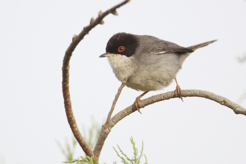
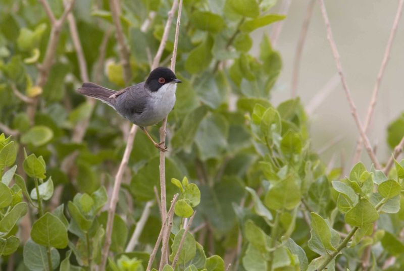
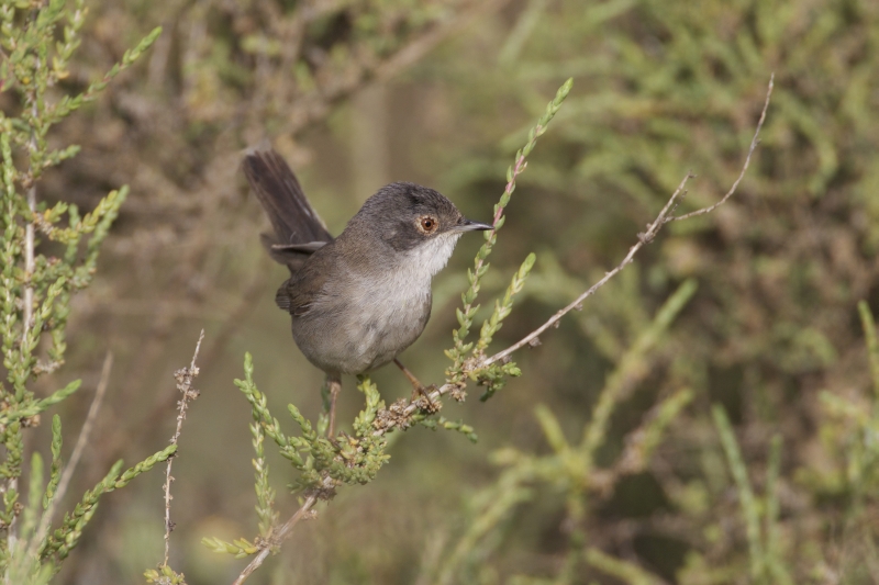
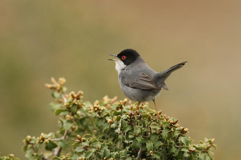
Sardinian Warbler - Sylvia melanocephala (Gmelin, 1789)
Quick facts
| Threat status Europe | Least Concern (IUCN) |
|---|---|
| EU Population status |
|
| Protected by | EU Birds Directive and 2 other international agreements |
| Natura 2000 sites | 264 are designated for this species |
| Breeding habitats |
|
| Natura 2000 species code | A305 |
Distribution
Threat and EU population status
IUCN Red List status of threatened species
The IUCN Red List threat status assesses the risk of extinction.
EU population status
The status of the population at the EU level was evaluated at the species level; this was based on the reports delivered by Member States under Article 12 of the Birds Directive (see fact sheet below). The EU status assessment can cover several subspecies/subspecific population units. For more information, please consult the species fact sheet and link below.
Natura 2000 sites
Protected in the following Natura 2000 sites
Protected sites
Please note the site map takes a while to display.Legal status
Mentioned in the following international legal instruments and agreements
| Legal text | Annex | Conditions | More information |
|---|---|---|---|
| Directive 2009/147/EC of the European Parliament and of the Council, of 30 November 2009, on the conservation of wild birds (EU Birds Directive) | http://ec.europa.eu/environm...rective/index_en.htm | ||
| Convention on the conservation of European wildlife and natural habitats (Bern Convention) | (All species of old subfamily Sylviinae) | http://www.coe.int/t/dg4/cul.../bern/default_en.asp | |
| Convention on the Conservation of Migratory Species of Wild Animals. (Bonn Convention) | (Migratory species of Muscicapidae sensu lato spp.) | http://www.cms.int/ |
Common names and synonyms
| Curruca Cabecinegra | Spanish | Hagemeijer, W.J.M. & Blair, M.J. |
| Fauvette mélanocéphale | French | Hagemeijer, W.J.M. & Blair, M.J. |
| Kleine Zwartkop | Dutch | Hagemeijer, W.J.M. & Blair, M.J. |
| Kucsmás poszáta | Hungarian | Hagemeijer, W.J.M. & Blair, M.J. |
| Occhiocotto | Italian | Hagemeijer, W.J.M. & Blair, M.J. |
| Pokrzewka aksamitna | Polish | Hagemeijer, W.J.M. & Blair, M.J. |
| Samettipääkerttu | Finnish | Hagemeijer, W.J.M. & Blair, M.J. |
| Sammetshätta | Swedish | Hagemeijer, W.J.M. & Blair, M.J. |
| Samtkopfgrasmücke | German | Hagemeijer, W.J.M. & Blair, M.J. |
| Sardinian Warbler | English | Hagemeijer, W.J.M. & Blair, M.J. |
| Toutinegra-de-cabeça-preta | Portuguese | Hagemeijer, W.J.M. & Blair, M.J. |
Other resources
| EBCC Atlas of breeding birds | European Bird Census Council's Atlas of Breeding Birds |
| EURing code:12670 | European bird-ringing |
| EoL | Encyclopedia of Life |
| Fauna Europaea | Fauna Europaea |
| GBIF | Global Biodiversity Information Facility |
| ITIS (Valid name) | Interagency Taxonomic Information System |
| NCBI search | National Center for Biotechnology Information |
| PESI (Accepted) | Pan-European Species directories Infrastructure |
| Wikipedia | Wikipedia |
External data
Population distribution from "Birds in Europe" editions 1 and 2
These publications present a thorough and detailed review of the conservation status of European birds. Based on detailed breeding and wintering population data collected in each country, the report provides a review of the population sizes and trends of Species of European Conservation Concern.
| Country | Biogeographic region | Min / Max (Units) | Period | Status | Quality | Source | Published |
|---|---|---|---|---|---|---|---|
| Albania | 10000/20000 (pairs) | 2002 | Breeding | Species generally well known, but only poor or incomplete quantitative data available | Birds in Europe 2 (1990-2000) | 2004-01-01 | |
| Bosnia and Herzegovina | Present/Present (pairs) | 1990-2003 | Breeding | Reliable quantitative data (e.g. atlas survey or monitoring data, etc.) are available for the whole period and region in question | Birds in Europe 2 (1990-2000) | 2004-01-01 | |
| Bulgaria | 800/1200 (pairs) | 1996-2002 | Breeding | Species generally well known, but only poor or incomplete quantitative data available | Birds in Europe 2 (1990-2000) | 2004-01-01 | |
| Croatia | 50000/100000 (pairs) | 2002 | Breeding | Reliable quantitative data (e.g. atlas survey or monitoring data, etc.) are available for the whole period and region in question | Birds in Europe 2 (1990-2000) | 2004-01-01 | |
| Croatia | 50000/100000 (individuals) | 2002 | Wintering | Reliable quantitative data (e.g. atlas survey or monitoring data, etc.) are available for the whole period and region in question | Birds in Europe 2 (1990-2000) | 2004-01-01 | |
| Cyprus | 6000/12000 (pairs) | 1994-2002 | Breeding | Species generally well known, but only poor or incomplete quantitative data available | Birds in Europe 2 (1990-2000) | 2004-01-01 | |
| France | 150000/600000 (pairs) | 1998-2002 | Breeding | Reliable quantitative data (e.g. atlas survey or monitoring data, etc.) are available for the whole period and region in question | Birds in Europe 2 (1990-2000) | 2004-01-01 | |
| France | 200000/1000000 (pairs) | 1990 | Breeding | Species generally well known, but only poor or incomplete quantitative data available | Birds in Europe 1 (1970-1990) | 1994-01-01 | |
| Greece | 1000/2000 (individuals) | 1995-2000 | Wintering | Reliable quantitative data (e.g. atlas survey or monitoring data, etc.) are available for the whole period and region in question | Birds in Europe 2 (1990-2000) | 2004-01-01 | |
| Greece | 500000/1000000 (pairs) | 1995-2000 | Breeding | Reliable quantitative data (e.g. atlas survey or monitoring data, etc.) are available for the whole period and region in question | Birds in Europe 2 (1990-2000) | 2004-01-01 | |
| Greece | Mediterranean | 500000/1000000 (pairs) | - | Breeding | Species generally well known, but only poor or incomplete quantitative data available | Birds in Europe 1 (1970-1990) | 1994-01-01 |
| Italy | 500000/1000000 (pairs) | 2003 | Breeding | Reliable quantitative data (e.g. atlas survey or monitoring data, etc.) are available for the whole period and region in question | Birds in Europe 2 (1990-2000) | 2004-01-01 | |
| Italy | 300000/600000 (pairs) | - | Breeding | Species poorly known, with no quantitative data available | Birds in Europe 1 (1970-1990) | 1994-01-01 | |
| Macedonia (FYR) | 250/999 (pairs) | 1990-2000 | Breeding | Reliable quantitative data (e.g. atlas survey or monitoring data, etc.) are available for the whole period and region in question | Birds in Europe 2 (1990-2000) | 2004-01-01 | |
| Malta | 5000/10000 (individuals) | 1995-2002 | Wintering | Species generally well known, but only poor or incomplete quantitative data available | Birds in Europe 2 (1990-2000) | 2004-01-01 | |
| Malta | 3000/5000 (pairs) | 1990-2002 | Breeding | Species generally well known, but only poor or incomplete quantitative data available | Birds in Europe 2 (1990-2000) | 2004-01-01 | |
| Portugal | 100000/1000000 (pairs) | 2002 | Breeding | Reliable quantitative data (e.g. atlas survey or monitoring data, etc.) are available for the whole period and region in question | Birds in Europe 2 (1990-2000) | 2004-01-01 | |
| Portugal | 100000/1000000 (pairs) | 1989 | Breeding | Species generally well known, but only poor or incomplete quantitative data available | Birds in Europe 1 (1970-1990) | 1994-01-01 | |
| Serbia and Montenegro | 2000/3000 (pairs) | 1990-2002 | Breeding | Species generally well known, but only poor or incomplete quantitative data available | Birds in Europe 2 (1990-2000) | 2004-01-01 | |
| Slovenia | 100/300 (pairs) | 1998 | Breeding | Species generally well known, but only poor or incomplete quantitative data available | Birds in Europe 2 (1990-2000) | 2004-01-01 | |
| Spain | 990000/1900000 (pairs) | 1992 | Breeding | Reliable quantitative data (e.g. atlas survey or monitoring data, etc.) are available for the whole period and region in question | Birds in Europe 2 (1990-2000) | 2004-01-01 | |
| Spain | 990000/1900000 (pairs) | - | Breeding | Species generally well known, but only poor or incomplete quantitative data available | Birds in Europe 1 (1970-1990) | 1994-01-01 | |
| Turkey | 800000/2400000 (pairs) | 2001 | Breeding | Reliable quantitative data (e.g. atlas survey or monitoring data, etc.) are available for the whole period and region in question | Birds in Europe 2 (1990-2000) | 2004-01-01 | |
| United Kingdom - Gibraltar | 100/200 (pairs) | 2000 | Breeding | Species generally well known, but only poor or incomplete quantitative data available | Birds in Europe 2 (1990-2000) | 2004-01-01 |
Population trends from "Birds in Europe" editions 1 and 2
These publications present a thorough and detailed review of the conservation status of European birds. Based on detailed breeding and wintering population data collected in each country, the report provides a review of the population sizes and trends of Species of European Conservation Concern.
| Country | Biogeographic region | Period | Status | Trend | Quality | Source | Published |
|---|---|---|---|---|---|---|---|
| Albania | 1990-2000 | Breeding | Unknown | Species poorly known, with no quantitative data available | Birds in Europe 2 (1990-2000) | 2004 | |
| Bosnia and Herzegovina | 1990-2000 | Breeding | Unknown | Species poorly known, with no quantitative data available | Birds in Europe 2 (1990-2000) | 2004 | |
| Bulgaria | 1990-2000 | Breeding | Stable between 0% to 19% | Species poorly known, with no quantitative data available | Birds in Europe 2 (1990-2000) | 2004 | |
| Croatia | 1990-2000 | Breeding | Increasing between 50% to 79% | Species poorly known, with no quantitative data available | Birds in Europe 2 (1990-2000) | 2004 | |
| Croatia | 1990-2000 | Wintering | Increasing between 50% to 79% | Species poorly known, with no quantitative data available | Birds in Europe 2 (1990-2000) | 2004 | |
| Cyprus | 1990-2000 | Breeding | Increasing between 20% to 29% | Species generally well known, but only poor or incomplete quantitative data available | Birds in Europe 2 (1990-2000) | 2004 | |
| France | 1990-2000 | Breeding | Increasing : 44 % | Species poorly known, with no quantitative data available | Birds in Europe 2 (1990-2000) | 2004 | |
| France | 1970-1990 | Breeding | Fluctuating with changes of at least 20%, but no clear trend | Species generally well known, but only poor or incomplete quantitative data available | Birds in Europe 1 (1970-1990) | 1994 | |
| Greece | 1990-2000 | Breeding | Stable between 0% to 19% | Species poorly known, with no quantitative data available | Birds in Europe 2 (1990-2000) | 2004 | |
| Greece | 1990-2000 | Wintering | Unknown | Species poorly known, with no quantitative data available | Birds in Europe 2 (1990-2000) | 2004 | |
| Greece | Mediterranean | 1970-1990 | Breeding | Stable, or change of less than 20% | Species poorly known, with no quantitative data available | Birds in Europe 1 (1970-1990) | 1994 |
| Italy | 1990-2000 | Breeding | Stable between 0% to 19% | Species poorly known, with no quantitative data available | Birds in Europe 2 (1990-2000) | 2004 | |
| Italy | 1970-1990 | Breeding | Stable, or change of less than 20% | Species poorly known, with no quantitative data available | Birds in Europe 1 (1970-1990) | 1994 | |
| Macedonia (FYR) | 1990-2000 | Breeding | Stable between 0% to 19% | Species poorly known, with no quantitative data available | Birds in Europe 2 (1990-2000) | 2004 | |
| Malta | 1990-2000 | Breeding | Stable between 0% to 19% | Reliable quantitative data (e.g. atlas survey or monitoring data, etc.) are available for the whole period and region in question | Birds in Europe 2 (1990-2000) | 2004 | |
| Malta | 1990-2000 | Wintering | Stable between 0% to 19% | Species generally well known, but only poor or incomplete quantitative data available | Birds in Europe 2 (1990-2000) | 2004 | |
| Portugal | 1990-2000 | Breeding | Stable between 0% to 19% | Species poorly known, with no quantitative data available | Birds in Europe 2 (1990-2000) | 2004 | |
| Portugal | 1970-1990 | Breeding | Stable, or change of less than 20% | Species poorly known, with no quantitative data available | Birds in Europe 1 (1970-1990) | 1994 | |
| Serbia and Montenegro | 1990-2000 | Breeding | Stable between 0% to 19% | Species poorly known, with no quantitative data available | Birds in Europe 2 (1990-2000) | 2004 | |
| Slovenia | 1990-2000 | Breeding | Stable between 0% to 19% | Species poorly known, with no quantitative data available | Birds in Europe 2 (1990-2000) | 2004 | |
| Spain | 1990-2000 | Breeding | Unknown | Species poorly known, with no quantitative data available | Birds in Europe 2 (1990-2000) | 2004 | |
| Spain | 1970-1990 | Breeding | Small increase of 20-49% | Species generally well known, but only poor or incomplete quantitative data available | Birds in Europe 1 (1970-1990) | 1994 | |
| Turkey | 1990-2000 | Breeding | Stable between 0% to 19% | Species poorly known, with no quantitative data available | Birds in Europe 2 (1990-2000) | 2004 | |
| United Kingdom - Gibraltar | 1990-2000 | Breeding | Stable between 0% to 19% | Reliable quantitative data (e.g. atlas survey or monitoring data, etc.) are available for the whole period and region in question | Birds in Europe 2 (1990-2000) | 2004 |


