Natura 2000 related content is now shown on the Biodiversity Information System for Europe, BISE. Please go to BISE or use the Natura 2000 map viewer for the latest information.
Kingdom: Animalia > Phylum: Chordata > Class: Aves > Order: Ciconiiformes > Family: Ardeidae > Genus: Bubulcus > Species: Bubulcus ibis

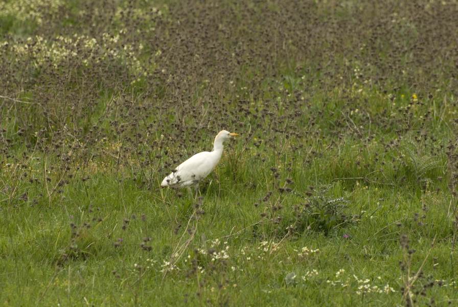
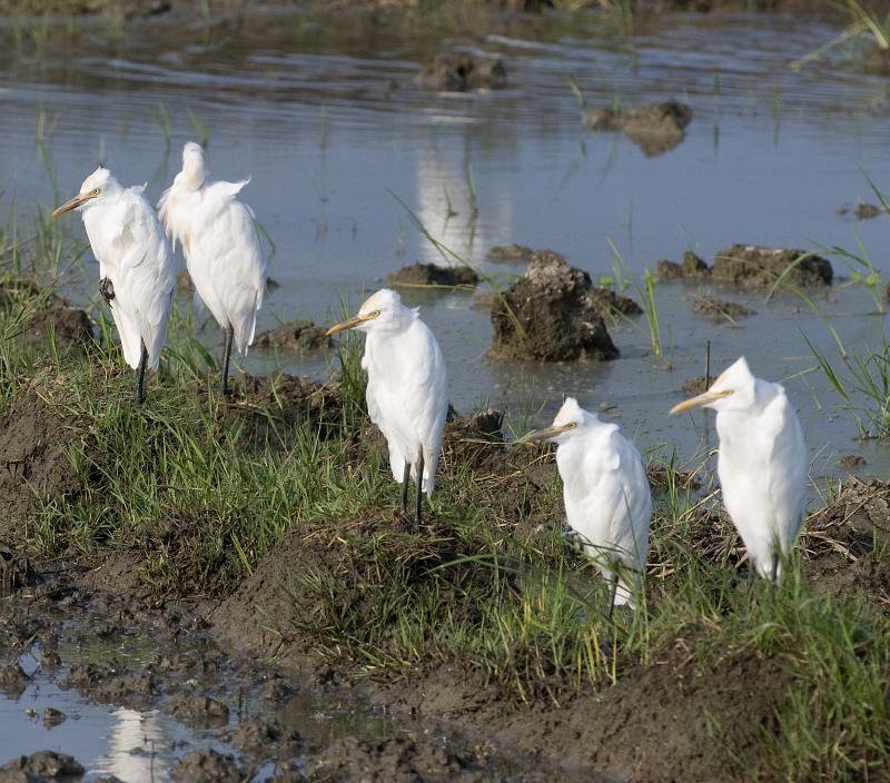
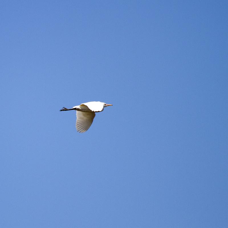
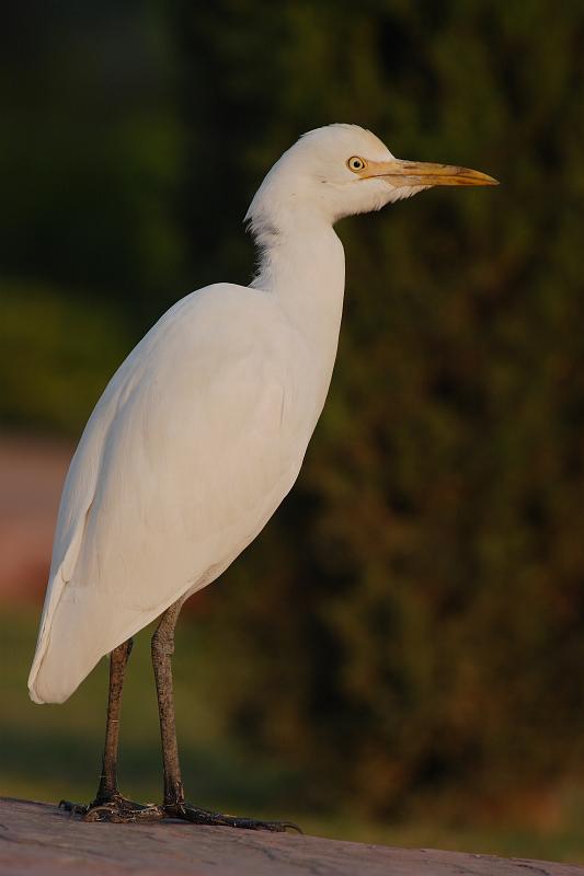
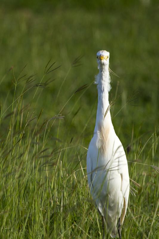
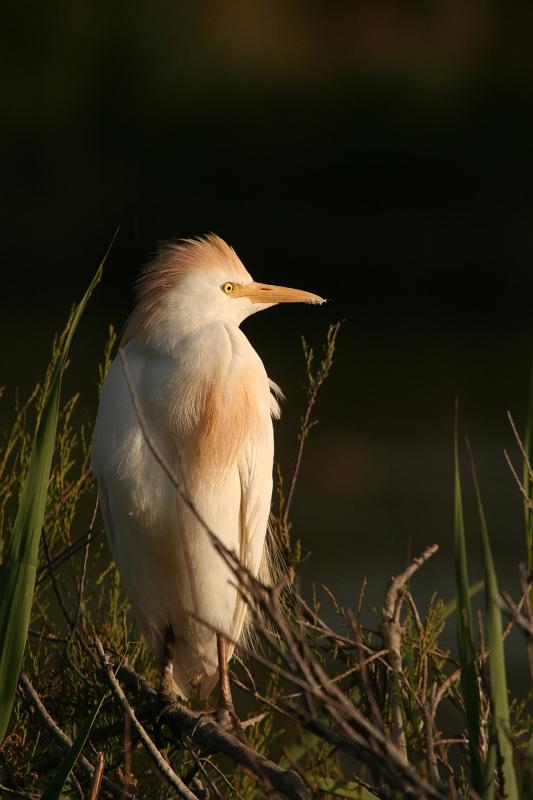
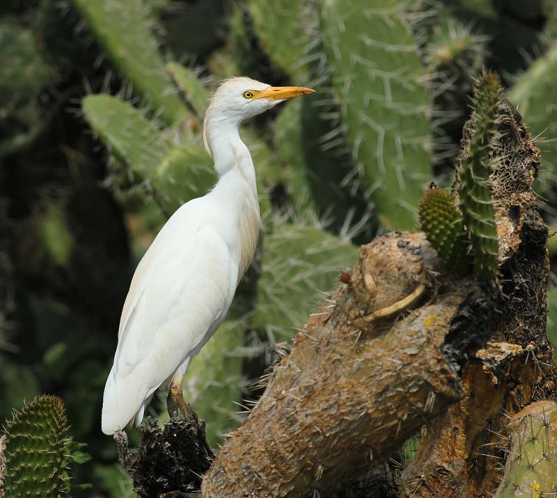
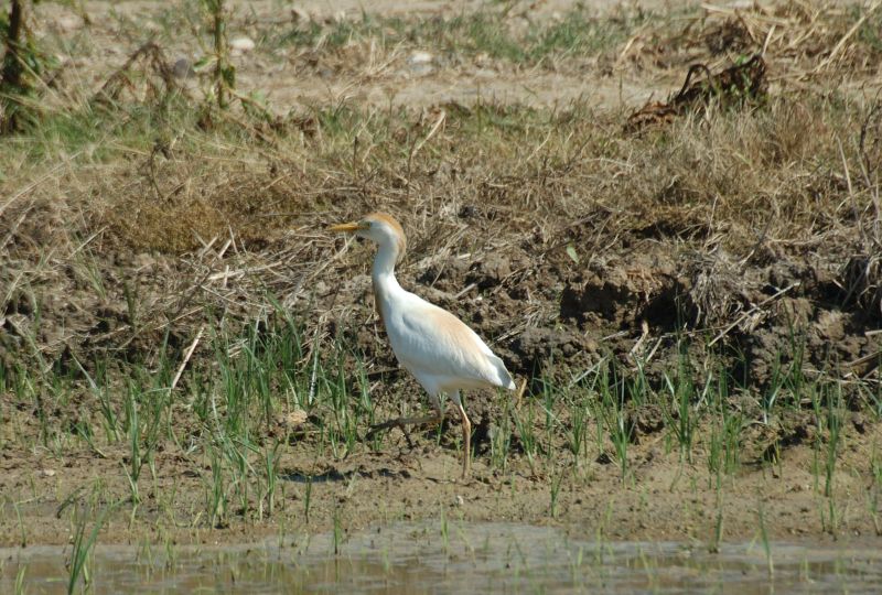
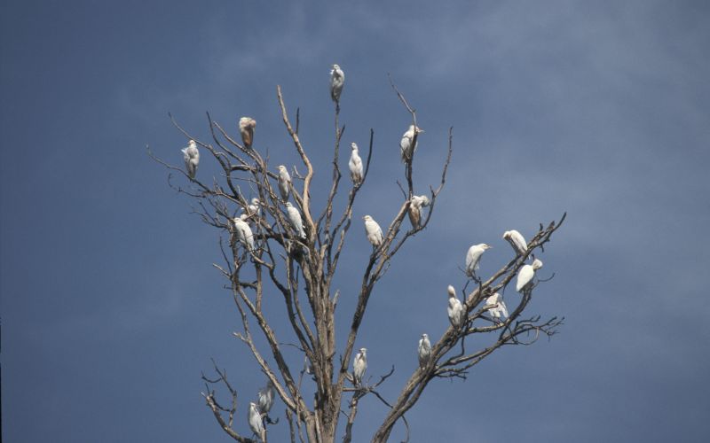
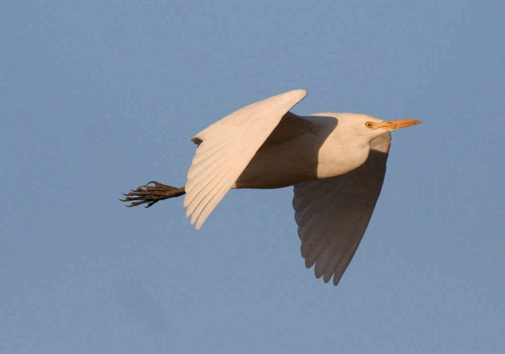
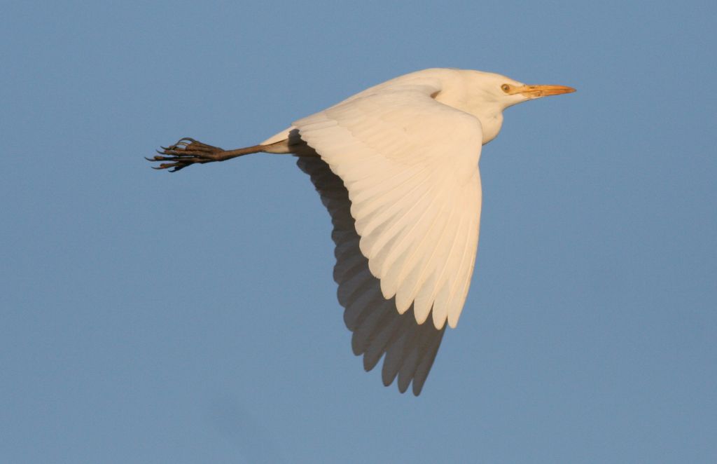
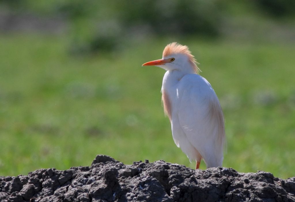
Cattle Egret - Bubulcus ibis (Linnaeus, 1758)

Images from the web

Quick facts

Threat status Europe Least Concern (IUCN)
EU Population status
Secure
Protected by EU Birds Directive and 3 other international agreements
Natura 2000 sites 379 are designated for this species
Natura 2000 species code A025

Distribution

The distribution map is currently disabled. A new map solution will soon become available. In the meantime, please consult other species distribution map providers listed in the Other resources panel below.

Threat and EU population status

IUCN Red List status of threatened species

The IUCN Red List threat status assesses the risk of extinction.

EU population status

The status of the population at the EU level was evaluated at the species level; this was based on the reports delivered by Member States under Article 12 of the Birds Directive (see fact sheet below). The EU status assessment can cover several subspecies/subspecific population units. For more information, please consult the species fact sheet and link below.

IUCN Red List Category
Not Evaluated
Near Threatened
Regionally Extinct
Not Applicable
Vulnerable
Extinct in the Wild
Data Deficient
Endangered
Extinct
Least Concern
Critically Endangered
Population status categories for bird species under the Birds Directive
Secure
Near Threatened, declining or depleted
Threatened (i.e. vulnerable, endangered, critically endangered, regionally extinct)
Unknown or not evaluated

Natura 2000 sites

Protected in the following Natura 2000 sites

Sitecode Country Site name Action
ES0000004 Spain Lagunas de Villafáfila Map
ES0000013 Spain Tablas de Daimiel Map
ES0000014 Spain Monfragüe y las Dehesas del Entorno Map
ES0000017 Spain CUENCA DE GALLOCANTA Map
ES0000019 Spain Aiguamolls de l'Alt Empordà Map
ES0000020 Spain Delta de l'Ebre Map
ES0000023 Spain L'Albufera Map
ES0000037 Spain Es Trenc - Salobrar de Campos Map
ES0000038 Spain S'Albufera de Mallorca Map
ES0000058 Spain el Fondo d'Elx-Crevillent Map
ES0000068 Spain Embalse de Orellana y Sierra de Pela Map
ES0000069 Spain Embalse de Cornalvo y Sierra Bermeja Map
ES0000071 Spain Llanos de Cáceres y Sierra de Fuentes Map
ES0000084 Spain Ses Salines d'Eivissa i Formentera Map
ES0000119 Spain Carrizales y sotos de Aranjuez Map
ES0000120 Spain Salinas de Santa Pola Map
ES0000134 Spain Embalse de las Cañas Map
ES0000135 Spain Estanca de los Dos Reinos Map
ES0000138 Spain GALACHOS DE LA ALFRANCA DE PASTRIZ, LA CARTUJA Y EL BURGO DE EBRO Map
ES0000142 Spain Cortados y cantiles de los ríos Jarama y Manzanares Map
ES0000144 Spain Urdaibaiko itsasadarra / Ría de Urdaibai Map
ES0000146 Spain Delta del Llobregat Map
ES0000147 Spain Marjal de Pego-Oliva Map
ES0000161 Spain Laguna de El Hito Map
ES0000168 Spain Llanuras de Oropesa, Lagartera y Calera y Chozas Map
ES0000169 Spain Río Tajo en Castrejón, islas de Malpica de Tajo y Azután Map
ES0000183 Spain EL BASAL, LAS MENORCAS Y LLANOS DE CARDIEL Map
ES0000184 Spain Valle del Tiétar - ZEPA Map
ES0000190 Spain Encinares de los ríos Adaja y Voltoya - ZEPA Map
ES0000195 Spain Humedal del Ajauque y Rambla Salada Map
ES0000200 Spain Isla Grosa Map
ES0000202 Spain Campo de Azaba - ZEPA Map
ES0000204 Spain Tierra de Campiñas Map
ES0000211 Spain Desembocadura del riu Millars Map
ES0000216 Spain La Nava-Campos Sur Map
ES0000218 Spain Campo de Argañán - ZEPA Map
ES0000234 Spain S'Albufera des Grau Map
ES0000260 Spain Mar Menor Map
ES0000262 Spain Sierras del Gigante-Pericay, Lomas del Buitre-Río Luchena y Sierra de la Torrecilla Map
ES0000265 Spain Sierra del Molino, Embalse del Quipar y Llanos del Cagitán Map
ES0000268 Spain Saladares del Guadalentín Map
ES0000289 Spain LAGUNAS Y CARRIZALES DE CINCO VILLAS Map
ES0000290 Spain LA SOTONERA Map
ES0000294 Spain LAGUNA DE SARIÑENA Y BALSA DE LA ESTACIÓN Map
ES0000296 Spain EMBALSE DEL PAS Y SANTA RITA Map
ES0000317 Spain Penarronda-Barayo Map
ES0000324 Spain Embalse de Arrocampo Map
ES0000325 Spain Campiña sur - Embalse de Arroyo Conejos Map
ES0000326 Spain Embalse de Borbollón Map
ES0000327 Spain Embalse de los Canchales Map
ES0000328 Spain Embalse de Montijo Map
ES0000329 Spain Embalse de Valdecañas Map
ES0000330 Spain Embalse de Valuengo Map
ES0000332 Spain Llanos de Trujillo Map
ES0000333 Spain Llanos de Zorita y Embalse de Sierra Brava Map
ES0000334 Spain Sierras Centrales y Embalse de Alange Map
ES0000356 Spain Riberos del Almonte Map
ES0000359 Spain Campos de Alba Map
ES0000367 Spain La Serena y Sierras Periféricas Map
ES0000368 Spain Río Tajo Internacional y Riberos Map
ES0000393 Spain Azud de Badajoz Map
ES0000396 Spain Embalse de Horno-Tejero Map
ES0000397 Spain Embalse de la Serena Map
ES0000398 Spain Llanos y Complejo Lagunar de la Albuera Map
ES0000400 Spain Arrozales de Palazuelo y Guadalperales Map
ES0000408 Spain Vegas del Ruecas, Cubilar y Moheda Alta Map
ES0000410 Spain Complejo los Arenales Map
ES0000411 Spain Charca Dehesa Boyal Navalmoral Map
ES0000412 Spain Charca la Torre Map
ES0000415 Spain Embalse de Alcántara Map
ES0000417 Spain Embalse de Brozas Map
ES0000418 Spain Embalse de Talaván Map
ES0000420 Spain Embalse de Vegas Altas Map
ES0000427 Spain Río y Pinares del Tietar Map
ES0000434 Spain Canchos de Ramiro y Ladronera Map
ES2110011 Spain Zadorraren sistemako urtegiak / Embalses del sistema del Zadorra Map
ES2130007 Spain Urdaibaiko itsasertzak eta padurak / Zonas litorales y marismas de Urdaibai Map
ES4140036 Spain La Nava-Campos Norte Map
ES4180017 Spain Riberas de Castronuño Map
ES4310004 Spain Dehesas de Jerez Map
ES4310009 Spain Puerto Peña - los Golondrinos Map
ES5120016 Spain El Montgrí- Les Medes - El Baix Ter Map
ES6310001 Spain Calamocarro-Benzú Map
FR1110025 France Etang de Saint Quentin Map
FR2110002 France Lac du Der Map
FR2112001 France Herbages et cultures des vallées de la Voire, de l'Héronne et de la Laines Map
FR2112002 France Herbages et cultures autour du lac du Der Map
FR2410003 France Brenne Map
FR2610004 France Vallées de la Loire et de l'Allier entre Cher et Nièvre Map
FR2612002 France Vallée de la Loire de Iguerande à Decize Map
FR4213813 France Ried de Colmar à Sélestat, Haut-Rhin Map
FR5210008 France Lac de Grand Lieu Map
FR5210103 France Estuaire de la Loire Map
FR5310055 France Cap Sizun Map
FR5310056 France Baie d'Audierne Map
FR5310071 France Rade de Brest : Baie de Daoulas, Anse de Poulmic Map
FR5310073 France Baie de Morlaix Map
FR5310074 France Baie de Vilaine Map
FR5310086 France Golfe du Morbihan Map
FR5310092 France Rivière de Pénerf Map
FR5310094 France Rade de Lorient Map
FR5410013 France Anse de Fouras, baie d'Yves, marais de Rochefort Map
FR5410028 France Marais de Brouage-Oléron Map
FR5410100 France Marais poitevin Map
FR5412011 France Estuaire de la Gironde : marais de la rive nord Map
FR5412012 France Bonne Anse, marais de Bréjat et de Saint Augustin Map
FR5412017 France Bois de l'Hospice, étang de Beaufour et environs Map
FR5412020 France Marais et estuaire de la Seudre, île d'Oléron Map
FR5412025 France Estuaire et basse vallée de la Charente Map
FR7210030 France Côte médocaine : dunes boisées et dépression humides Map
FR7210063 France Domaine d'Orx Map
FR7210065 France Marais du Nord Médoc Map
FR7210077 France Barthes de l'Adour Map
FR7212001 France Site d'Arjuzanx Map
FR8210041 France Les Ramières du Val de Drôme Map
FR8310079 France Val d'Allier Bourbonnais Map
FR9110034 France Étang du Bagnas Map
FR9110042 France Étangs palavasiens et étang de l'Estagnol Map
FR9110108 France Basse plaine de l'Aude Map
FR9310019 France Camargue Map
FR9310020 France Iles d'Hyères Map
FR9310064 France Crau Map
FR9310069 France Garrigues de Lançon et Chaînes alentour Map
FR9312001 France Marais entre Crau et Grand Rhône Map
FR9312002 France Préalpes de Grasse Map
FR9312003 France La Durance Map
FR9312005 France Salines de l'Étang de Berre Map
FR9312008 France Salins d'Hyères et des Pesquiers Map
FR9410096 France Iles Sanguinaires, golfe d'Ajaccio Map
IT1120002 Italy Bosco della Partecipanza di Trino Map
IT1120005 Italy Garzaia di Carisio Map
IT1120010 Italy Lame del Sesia e Isolone di Oldenico Map
IT1120014 Italy Garzaia del Rio Druma Map
IT1160011 Italy Parco di Racconigi e Boschi lungo il Torrente Maira Map
IT1180002 Italy Torrente Orba Map
IT2020003 Italy Palude di Albate Map
IT2050010 Italy Oasi di Lacchiarella Map
IT2060015 Italy Bosco de l'Isola Map
IT2070020 Italy Torbiere d'Iseo Map
IT2080001 Italy Garzaia di Celpenchio Map
IT2080002 Italy Basso corso e sponde del Ticino Map
IT2080003 Italy Garzaia della Verminesca Map
IT2080006 Italy Garzaia di S. Alessandro Map
IT2080007 Italy Garzaia del Bosco Basso Map
IT2080009 Italy Garzaia della Cascina Notizia Map
IT2080010 Italy Garzaia di Sartirana Map
IT2080013 Italy Garzaia della Cascina Portalupa Map
IT2080015 Italy San Massimo Map
IT2080017 Italy Garzaia di Porta Chiossa Map
IT2080018 Italy Garzaia della Carola Map
IT2090001 Italy Monticchie Map
IT2090005 Italy Garzaia della Cascina del Pioppo Map
IT2090006 Italy Spiagge fluviali di Boffalora Map
IT2090007 Italy Lanca di Soltarico Map
IT2090008 Italy La Zerbaglia Map
IT2090010 Italy Adda Morta Map
IT20A0001 Italy Morta di Pizzighettone Map
IT20A0002 Italy Naviglio di Melotta Map
IT20A0003 Italy Palata Menasciutto Map
IT20A0005 Italy Lanca di Gabbioneta Map
IT20A0006 Italy Lanche di Azzanello Map
IT20A0007 Italy Bosco della Marisca Map
IT20A0008 Italy Isola Uccellanda Map
IT20A0009 Italy Bosco di Barco Map
IT20B0001 Italy Bosco Foce Oglio Map
IT20B0003 Italy Lanca Cascina S. Alberto Map
IT20B0005 Italy Torbiere di Marcaria Map
IT20B0006 Italy Isola Boscone Map
IT20B0008 Italy Paludi di Ostiglia Map
IT20B0009 Italy Valli del Mincio Map
IT20B0010 Italy Vallazza Map
IT3320037 Italy Laguna di Marano e Grado Map
IT3330005 Italy Foce dell'Isonzo - Isola della Cona Map
IT3330006 Italy Valle Cavanata e Banco Mula di Muggia Map
IT4020017 Italy Aree delle risorgive di Viarolo, Bacini di Torrile, Fascia golenale del Po Map
IT4020018 Italy Prati e Ripristini ambientali di Frescarolo e Samboseto Map
IT4020019 Italy Golena del Po presso Zibello Map
IT4020021 Italy Medio Taro Map
IT4030007 Italy Fontanili di Corte Valle Re Map
IT4030015 Italy Valli di Novellara Map
IT4030019 Italy Cassa di espansione del Tresinaro Map
IT4030020 Italy Golena del Po di Gualtieri, Guastalla e Luzzara Map
IT4040014 Italy Valli Mirandolesi Map
IT4040015 Italy Valle di Gruppo Map
IT4040016 Italy Siepi e Canali di Resega - Foresto Map
IT4040017 Italy Valle delle Bruciate e Tresinaro Map
IT4040018 Italy Le Meleghine Map
IT4050022 Italy Biotopi e Ripristini ambientali di Medicina e Molinella Map
IT4050023 Italy Biotopi e Ripristini ambientali di Budrio e Minerbio Map
IT4050024 Italy Biotopi e Ripristini ambientali di Bentivoglio, S. Pietro in Casale, Malalbergo e Baricella Map
IT4050025 Italy Biotopi e Ripristini ambientali di Crevalcore Map
IT4050026 Italy Bacini ex-zuccherificio di Argelato e Golena del Fiume Reno Map
IT4060001 Italy Valli di Argenta Map
IT4060005 Italy Sacca di Goro, Po di Goro, Valle Dindona, Foce del Po di Volano Map
IT4060008 Italy Valle del Mezzano Map
IT4060011 Italy Garzaia dello zuccherificio di Codigoro e Po di Volano Map
IT4060014 Italy Bacini di Jolanda di Savoia Map
IT4060015 Italy Bosco della Mesola, Bosco Panfilia, Bosco di Santa Giustina, Valle Falce, La Goara Map
IT4070001 Italy Punte Alberete, Valle Mandriole Map
IT4070004 Italy Pialasse Baiona, Risega e Pontazzo Map
IT4070007 Italy Salina di Cervia Map
IT4070009 Italy Ortazzo, Ortazzino, Foce del Torrente Bevano Map
IT5130007 Italy Padule di Fucecchio Map
IT5140011 Italy Stagni della Piana Fiorentina e Pratese Map
IT5160001 Italy Padule di Suese e Biscottino Map
IT5160004 Italy Padule di Bolgheri Map
IT5170002 Italy Selva Pisana Map
IT5180012 Italy Valle dell'Inferno e Bandella Map
IT5190008 Italy Lago di Montepulciano Map
IT5190009 Italy Lago di Chiusi Map
IT51A0011 Italy Padule di Diaccia Botrona Map
IT51A0014 Italy Pineta Granducale dell'Uccellina Map
IT51A0026 Italy Laguna di Orbetello Map
IT51A0028 Italy Duna di Feniglia Map
IT5210070 Italy Lago Trasimeno Map
IT5220024 Italy Valle del Tevere: Laghi di Corbara - Alviano Map
IT8010018 Italy Variconi Map
ITA050001 Italy Biviere e Macconi di Gela Map
FR5212010 France Dunes, forêt et marais d'Olonne Map
ES4250010 Spain Humedales de La Mancha Map
ES4220007 Spain Ríos Quejigal, Valdeazogues y Alcudia Map
ES5110025 Spain Riu Congost Map
ES6200006 Spain Espacios Abiertos e Islas del Mar Menor Map
IT2080023 Italy Garzaia di Cascina Villarasca Map
ES4250013 Spain Rios de la margen izquierda del Tajo y berrocales del Tajo Map
ES5120011 Spain Riberes del Baix Ter Map
FR8312007 France Sologne bourbonnaise Map
FR5312003 France Baie de Goulven Map
FR9112016 France Étang de Capestang Map
FR9312014 France Colle du Rouet Map
FR2612006 France Prairies alluviales et milieux associés de Saône-et-Loire Map
ES4220003 Spain Ríos de la cuenca media del Guadiana y laderas vertientes Map
IT20A0401 Italy Riserva Regionale Bosco Ronchetti Map
ES5120008 Spain Estany de Banyoles Map
ES4310010 Spain La Serena Map
ES5120017 Spain Estany de Sils-Ribera de Santa Coloma Map
ES4250001 Spain Sierra de San Vicente y valles del Tiétar y Alberche Map
FR7412002 France Étang des Landes Map
FR9312015 France Étangs entre Istres et Fos Map
IT20A0018 Italy Cave Danesi Map
FR5212001 France Marais de Goulaine Map
ITA050012 Italy Torre Manfria, Biviere e Piana di Gela Map
IT20B0501 Italy Viadana, Portiolo, San Benedetto Po e Ostiglia Map
IT4020025 Italy Parma Morta Map
ES4220019 Spain Bonales de la comarca de Los Montes del Guadiana Map
IT4060017 Italy Po di Primaro e Bacini di Traghetto Map
IT20A0502 Italy Lanca di Gussola Map
ES4240003 Spain Riberas del Henares Map
FR7212014 France Estuaire de la Gironde : marais du Blayais Map
ES4310024 Spain Río Guadamez Map
FR7312014 France Vallée de la Garonne de Muret à Moissac Map
ES5110007 Spain Riu i Estanys de Tordera Map
IT9340086 Italy Lago dell'Angitola Map
IT1180028 Italy Fiume Po - tratto vercellese alessandrino Map
ES6200034 Spain Lomas del Buitre y Río Luchena Map
IT3250046 Italy Laguna di Venezia Map
ES4310026 Spain Río Guadiana Alto - Zujar Map
ES6200030 Spain Mar Menor Map
IT2080702 Italy Po di Monticelli Pavese e Chignolo Po Map
IT2090501 Italy Senna Lodigiana Map
FR5212004 France Marais de l'Erdre Map
FR9112013 France Petite Camargue laguno-marine Map
ES4250009 Spain Yesares del valle del Tajo Map
IT20B0401 Italy Parco Regionale Oglio Sud Map
FR7312010 France Vallée de la Garonne de Boussens à Carbonne Map
ES6200014 Spain Saladares del Guadalentín Map
FR9112018 France Étang de Thau et lido de Sète à Agde Map
ES5140007 Spain Costes del Tarragonès Map
ES5223007 Spain Marjal d'Almenara Map
ES4310061 Spain Laguna temporal de Murtales Map
ES4220001 Spain Navas de Malagón Map
ES6150012 Spain Dehesa del Estero y Montes de Moguer Map
ITA050004 Italy Monte Capodarso e Valle del Fiume Imera Meridionale Map
ES3110006 Spain Vegas, cuestas y páramos del sureste de Madrid Map
FR9312013 France Les Alpilles Map
FR8312013 France Val d'allier Saint Yorre-Joze Map
ES4320071 Spain Ríos Alagon y Jerte Map
ES4310020 Spain Río Ardila Bajo Map
IT5210018 Italy Lago Trasimeno Map
FR9112005 France Complexe lagunaire de Salses-Leucate Map
FR8212017 France Val de Saône Map
IT20A0020 Italy Gabbioneta Map
ES5130013 Spain Aiguabarreig Segre-Cinca Map
IT4030021 Italy Rio Rodano, Fontanili di Fogliano e Ariolo e Oasi di Marmirolo Map
IT4030023 Italy Fontanili di Gattatico e Fiume Enza Map
ES2200039 Spain Badina Escudera Map
IT20B0014 Italy Chiavica del Moro Map
FR2410013 France Étangs de Sologne Map
IT20A0016 Italy Spiaggioni di Spinadesco Map
ES4320072 Spain Ríos Arrago y Tralgas Map
ES4320038 Spain Sierra de Gredos y Valle del Jerte Map
ES6200043 Spain Río Quípar Map
IT20A0015 Italy Bosco Ronchetti Map
ES4210017 Spain Lagunas de Ruidera Map
FR7212010 France Barrage d'Artix et saligue du Gave de Pau Map
ES4240005 Spain Lagunas de Puebla de Beleña Map
IT6030085 Italy Comprensorio Bracciano-Martignano Map
FR8212012 France Île de la Platière Map
FR5212003 France Vallée de la Loire des Ponts-de-Cé à Montsoreau Map
IT20A0019 Italy Barco Map
FR5212007 France Marais du Mès, baie et dunes de Pont-Mahé, étang du Pont de Fer Map
FR4112000 France Plaine et étang du Bischwald Map
ES4310015 Spain Río Alcarrache Map
FR9312025 France Basse Vallée du Var Map
ES6200022 Spain Sierra del Gigante Map
ITB030016 Italy Stagno di S'Ena Arrubia e territori limitrofi Map
FR8212016 France La Dombes Map
IT9310044 Italy Foce del Fiume Crati Map
FR7212013 France Estuaire de la Bidassoa et baie de Fontarabie Map
IT4020022 Italy Basso Taro Map
IT2080501 Italy Risaie della Lomellina Map
IT1332717 Italy Foce e medio corso del Fiume Entella Map
ITB040023 Italy Stagno di Cagliari, Saline di Macchiareddu, Laguna di Santa Gilla Map
FR5212009 France Marais Breton, baie de Bourgneuf, île de Noirmoutier et forêt de Monts Map
IT2090503 Italy Castelnuovo Bocca d'Adda Map
ITB040022 Italy Stagno di Molentargius e territori limitrofi Map
IT20A0013 Italy Lanca di Gerole Map
ITB030034 Italy Stagno di Mistras di Oristano Map
IT20A0017 Italy Scolmatore di Genivolta Map
FR8212004 France Ensemble lac du Bourget-Chautagne-Rhône Map
IT20B0017 Italy Ansa e Valli del Mincio Map
IT20B0016 Italy Ostiglia Map
ES6200005 Spain Humedal del Ajauque y Rambla Salada Map
FR2612005 France Basse vallée du Doubs et étangs associés Map
ES4220015 Spain Sierras de Almadén - Chillón y Guadalmez Map
IT20A0014 Italy Lancone di Gussola Map
IT20B0402 Italy Riserva Regionale Garzaia di Pomponesco Map
FR5312005 France Rivières de Pont-l'Abbé et de l'Odet Map
FR8312009 France Gorges de la Loire Map
ES4320064 Spain Embalse de Lancho Map
ES6200007 Spain Islas e Islotes del Litoral Mediterráneo Map
IT2090701 Italy Po di San Rocco al Porto Map
ES2200040 Spain Río Ebro Map
ES6200045 Spain Ríos Mula y Pliego Map
ES2110021 Spain Guardiako aintzirak / Lagunas de Laguardia Map
ES4320021 Spain Río Erjas Map
FR7312004 France Puydarrieux Map
ES4310019 Spain Río Ardila Alto Map
CY4000007 Cyprus XEROS POTAMOS Map
FR1112011 France Massif de Rambouillet et zones humides proches Map
ES4250005 Spain Montes de Toledo Map
IT20A0402 Italy Riserva Regionale Lanca di Gerole Map
ES2200033 Spain Laguna del Juncal Map
IT20A0501 Italy Spinadesco Map
FR5212008 France Grande Brière, marais de Donges et du Brivet Map
FR8212024 France Plaine du Forez Map
ROSPA0031 Romania Delta Dunării și Complexul Razim - Sinoie Map
FR5312010 France Dunes et côtes de Trévignon Map
ES0000451 Spain Montdúver-Marjal de la Safor Map
ES0000450 Spain Marjal i Estanys d'Almenara Map
ES0000470 Spain Marjal dels Moros (ZEPA) Map
ES0000471 Spain l'Albufera (ZEPA) Map
ES0000468 Spain Serra d'Espadà (ZEPA) Map
ES0000467 Spain Prat de Cabanes i Torreblanca (ZEPA) Map
ES0000462 Spain Clot de Galvany Map
ES1200016 Spain Ría del Eo Map
ES1200006 Spain Ría de Villaviciosa Map
ES4310003 Spain Complejo Lagunar de la Albuera Map
CY6000010 Cyprus ZONI EIDIKIS PROSTASIAS LIMNI OROKLINIS Map
CY3000007 Cyprus FRAGMA ACHNAS Map
CY3000009 Cyprus PERIOCHI AGIAS THEKLAS - LIOPETRI Map
CY4000010 Cyprus CHERSONISOS AKAMA Map
CY6000011 Cyprus LIMNI OROKLINIS Map
CY4000023 Cyprus ZONI EIDIKIS PROSTASIAS CHERSONISOS AKAMA Map
IT5120020 Italy Padule di Verciano, Prati alle Fontane e Padule delle Monache Map
FR7212018 France Bassin d'Arcachon et banc d'Arguin Map
ES0000484 Spain el Fondo d'Elx-Crevillent (ZEPA) Map
ES0000487 Spain Marjal de Pego-Oliva (ZEPA) Map
ES0000486 Spain Salines de Santa Pola (ZEPA) Map
ES0000485 Spain Lagunas de la Mata y Torrevieja (ZEPA) Map
IT51A0039 Italy Padule della Trappola, Bocca d'Ombrone Map
ES0000534 Spain Colonias de Cernícalo Primilla y El Cachón de Plasencia Map
ES5310125 Spain Albufera de Mallorca Map
IT4020027 Italy Cronovilla Map
ES0000537 Spain Lagunas de Campotejar Map
ITA010034 Italy Pantani di Anguillara Map
CY4000025 Cyprus ZONI EIDIKIS PROSTASIAS XEROY POTAMOU Map
IT2080026 Italy Siti riproduttivi di Acipenser naccarii Map
IT9210280 Italy Gole del Platano Map

Protected sites

Please note the site map takes a while to display.

Legal status

Legal text Annex Conditions More information
Directive 2009/147/EC of the European Parliament and of the Council, of 30 November 2009, on the conservation of wild birds (EU Birds Directive) http://ec.europa.eu/environm...rective/index_en.htm
Convention on the conservation of European wildlife and natural habitats (Bern Convention) (Ardeola ibis) http://www.coe.int/t/dg4/cul.../bern/default_en.asp
Agreement on the Conservation of African-Eurasian Migratory Waterbirds. Convention on Migratory Species of Wild Animals. (AEWA) http://www.migratoryspecies....ent/about-cms-family

http://www.unep-aewa.org/en/legalinstrument/aewa
Commission regulation (EU) No 1320/2014, of 1 December 2014, amending Council Regulation (EC) No 338/97 on the protection of species of wild fauna and flora by regulating trade therein (EU regulation of trade of fauna and flora) http://ec.europa.eu/environm...s/legislation_en.htm

Common names and synonyms

Common Name Language Reference
Airone guardabuoi Italian Hagemeijer, W.J.M. & Blair, M.J.
Cattle Egret English Hagemeijer, W.J.M. & Blair, M.J.
Garça-boieira Portuguese Hagemeijer, W.J.M. & Blair, M.J.
Garcilla Bueyera Spanish Hagemeijer, W.J.M. & Blair, M.J.
Héron garde-bœufs French Hagemeijer, W.J.M. & Blair, M.J.
Koereiger Dutch Hagemeijer, W.J.M. & Blair, M.J.
Kohäger Swedish Hagemeijer, W.J.M. & Blair, M.J.
Kuhreiher German Hagemeijer, W.J.M. & Blair, M.J.
Lehmähaikara Finnish Hagemeijer, W.J.M. & Blair, M.J.
Pásztorgém Hungarian Hagemeijer, W.J.M. & Blair, M.J.
Volavka rusohlavá Czech Hagemeijer, W.J.M. & Blair, M.J.
Synonym Author
Ardeola ibis (Linnaeus, 1758)

Other resources

CoL (accepted name) Catalogue of Life
EBCC Atlas of breeding birds European Bird Census Council's Atlas of Breeding Birds
EURing code:01110 European bird-ringing
EoL Encyclopedia of Life
Fauna Europaea Fauna Europaea
GBIF Global Biodiversity Information Facility
ITIS (Valid name) Interagency Taxonomic Information System
NCBI search National Center for Biotechnology Information
NOBANIS: Bubulcus ibis European Network on Invasive Alien Species
PESI (Accepted) Pan-European Species directories Infrastructure
Wikipedia Wikipedia

External data

Population distribution from "Birds in Europe" editions 1 and 2

These publications present a thorough and detailed review of the conservation status of European birds. Based on detailed breeding and wintering population data collected in each country, the report provides a review of the population sizes and trends of Species of European Conservation Concern.

19 items found, displaying all items.1
Country Biogeographic region Min / Max (Units) Period Status Quality Source Published
Armenia 25/30 (pairs) 1998-2002 Breeding Species generally well known, but only poor or incomplete quantitative data available Birds in Europe 2 (1990-2000) 2004-01-01
Azerbaijan 3500/7000 (pairs) 1996-2000 Breeding Species generally well known, but only poor or incomplete quantitative data available Birds in Europe 2 (1990-2000) 2004-01-01
France 5000/10000 (individuals) 1998-2002 Wintering Species poorly known, with no quantitative data available Birds in Europe 2 (1990-2000) 2004-01-01
France 4500/5500 (pairs) 1998-2002 Breeding Species generally well known, but only poor or incomplete quantitative data available Birds in Europe 2 (1990-2000) 2004-01-01
Georgia Present/Present (pairs) 2003 Breeding Reliable quantitative data (e.g. atlas survey or monitoring data, etc.) are available for the whole period and region in question Birds in Europe 2 (1990-2000) 2004-01-01
Greece 1/1 (pairs) 1991-1992 Breeding Species generally well known, but only poor or incomplete quantitative data available Birds in Europe 2 (1990-2000) 2004-01-01
Italy 1200/1200 (individuals) 1998 Wintering Species generally well known, but only poor or incomplete quantitative data available Birds in Europe 2 (1990-2000) 2004-01-01
Italy 719/760 (pairs) 2000 Breeding Species poorly known, with no quantitative data available Birds in Europe 2 (1990-2000) 2004-01-01
Luxembourg 0/1 (individuals) 2000-2002 Wintering Species poorly known, with no quantitative data available Birds in Europe 2 (1990-2000) 2004-01-01
Netherlands 0/3 (pairs) 1998-2000 Breeding Species poorly known, with no quantitative data available Birds in Europe 2 (1990-2000) 2004-01-01
Portugal 46407/46407 (individuals) 1992-1993 Wintering Species generally well known, but only poor or incomplete quantitative data available Birds in Europe 2 (1990-2000) 2004-01-01
Portugal 25000/35000 (pairs) 2002 Breeding Species generally well known, but only poor or incomplete quantitative data available Birds in Europe 2 (1990-2000) 2004-01-01
Romania 8/20 (pairs) 1993-2002 Breeding Species generally well known, but only poor or incomplete quantitative data available Birds in Europe 2 (1990-2000) 2004-01-01
Russian Federation 30/50 (pairs) 1990-2000 Breeding Species generally well known, but only poor or incomplete quantitative data available Birds in Europe 2 (1990-2000) 2004-01-01
Spain 20000/99999 (pairs) 1998-2002 Breeding Species generally well known, but only poor or incomplete quantitative data available Birds in Europe 2 (1990-2000) 2004-01-01
Spain 7107/42945 (individuals) 1990-2001 Wintering Reliable quantitative data (e.g. atlas survey or monitoring data, etc.) are available for the whole period and region in question Birds in Europe 2 (1990-2000) 2004-01-01
Turkey 150/200 (pairs) 2001 Breeding Species generally well known, but only poor or incomplete quantitative data available Birds in Europe 2 (1990-2000) 2004-01-01
Turkey 20/40 (individuals) 1991-2001 Wintering Species poorly known, with no quantitative data available Birds in Europe 2 (1990-2000) 2004-01-01
United Kingdom - Gibraltar 0/5 (individuals) 2000-2003 Wintering Species poorly known, with no quantitative data available Birds in Europe 2 (1990-2000) 2004-01-01
Source: BirdLife International

Population trends from "Birds in Europe" editions 1 and 2

These publications present a thorough and detailed review of the conservation status of European birds. Based on detailed breeding and wintering population data collected in each country, the report provides a review of the population sizes and trends of Species of European Conservation Concern.

19 items found, displaying all items.1
Country Biogeographic region Period Status Trend Quality Source Published
Armenia 1990-2000 Breeding Unknown Species poorly known, with no quantitative data available Birds in Europe 2 (1990-2000) 2004
Azerbaijan 1990-2000 Breeding Stable between 0% to 19% Species generally well known, but only poor or incomplete quantitative data available Birds in Europe 2 (1990-2000) 2004
France 1990-2000 Wintering Increasing between 30% to 49% Reliable quantitative data (e.g. atlas survey or monitoring data, etc.) are available for the whole period and region in question Birds in Europe 2 (1990-2000) 2004
France 1990-2000 Breeding Stable between 0% to 19% Species generally well known, but only poor or incomplete quantitative data available Birds in Europe 2 (1990-2000) 2004
Georgia 1990-2000 Breeding Unknown Species poorly known, with no quantitative data available Birds in Europe 2 (1990-2000) 2004
Greece 1990-2000 Breeding Unknown Species poorly known, with no quantitative data available Birds in Europe 2 (1990-2000) 2004
Italy 1990-2000 Breeding Increasing between 30% to 49% Reliable quantitative data (e.g. atlas survey or monitoring data, etc.) are available for the whole period and region in question Birds in Europe 2 (1990-2000) 2004
Italy 1990-2000 Wintering Increasing : 80 % Reliable quantitative data (e.g. atlas survey or monitoring data, etc.) are available for the whole period and region in question Birds in Europe 2 (1990-2000) 2004
Luxembourg 1990-2000 Wintering Increasing : 80 % Reliable quantitative data (e.g. atlas survey or monitoring data, etc.) are available for the whole period and region in question Birds in Europe 2 (1990-2000) 2004
Netherlands 1990-2000 Breeding Unknown Species poorly known, with no quantitative data available Birds in Europe 2 (1990-2000) 2004
Portugal 1990-2000 Wintering Increasing but of unknown magnitude Species poorly known, with no quantitative data available Birds in Europe 2 (1990-2000) 2004
Portugal 1990-2000 Breeding Increasing Species poorly known, with no quantitative data available Birds in Europe 2 (1990-2000) 2004
Romania 1990-2000 Breeding Increasing between 0% to 19% Species generally well known, but only poor or incomplete quantitative data available Birds in Europe 2 (1990-2000) 2004
Russian Federation 1990-2000 Breeding Unknown Species poorly known, with no quantitative data available Birds in Europe 2 (1990-2000) 2004
Spain 1990-2000 Wintering Increasing : 80 % Species poorly known, with no quantitative data available Birds in Europe 2 (1990-2000) 2004
Spain 1990-2000 Breeding Increasing between 0% to 19% Species generally well known, but only poor or incomplete quantitative data available Birds in Europe 2 (1990-2000) 2004
Turkey 1990-2000 Breeding Increasing between 0% to 19% Species generally well known, but only poor or incomplete quantitative data available Birds in Europe 2 (1990-2000) 2004
Turkey 1990-2000 Wintering Fluctuating : 80 % Reliable quantitative data (e.g. atlas survey or monitoring data, etc.) are available for the whole period and region in question Birds in Europe 2 (1990-2000) 2004
United Kingdom - Gibraltar 1990-2000 Wintering Stable between 0% to 19% Reliable quantitative data (e.g. atlas survey or monitoring data, etc.) are available for the whole period and region in question Birds in Europe 2 (1990-2000) 2004
Source: BirdLife International
European Environment Agency (EEA)
Kongens Nytorv 6
1050 Copenhagen K
Denmark
Phone: +45 3336 7100