Natura 2000 related content is now shown on the Biodiversity Information System for Europe, BISE. Please go to BISE or use the Natura 2000 map viewer for the latest information.
Kingdom: Animalia > Phylum: Chordata > Class: Aves > Order: Anseriformes > Family: Anatidae > Genus: Anser > Species: Anser anser

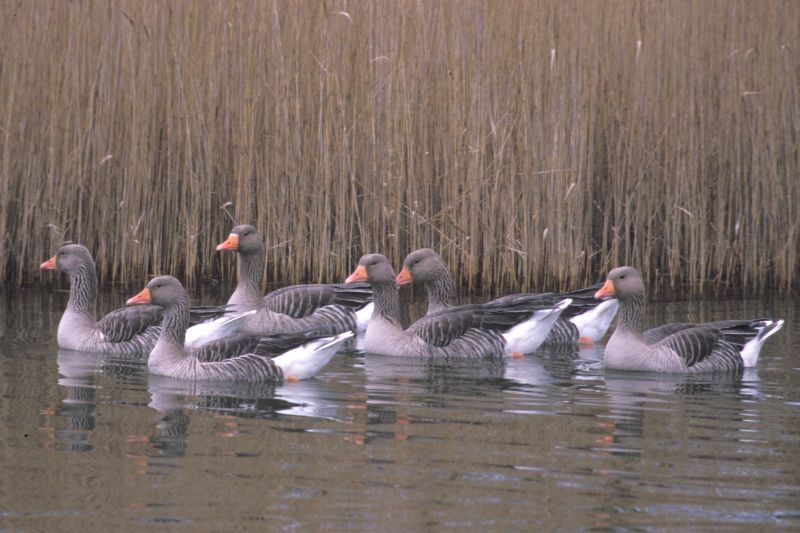
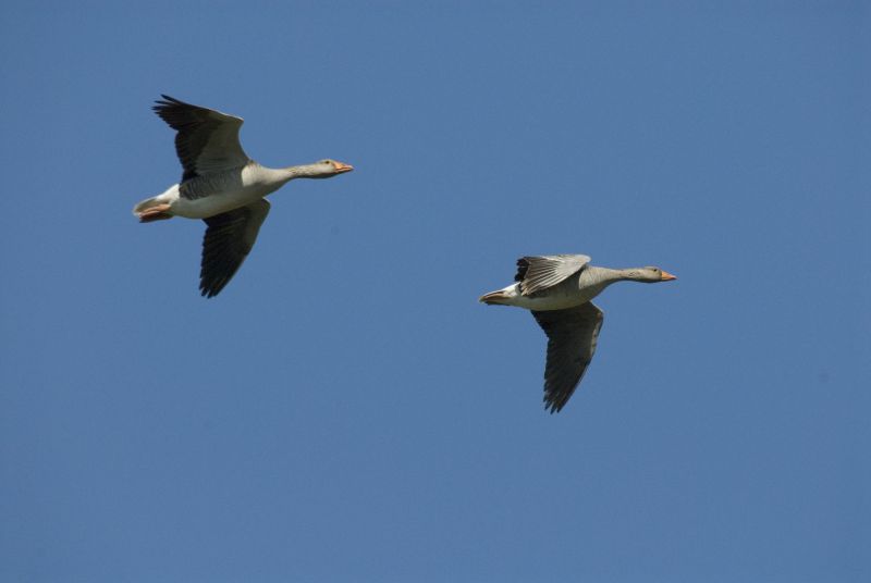
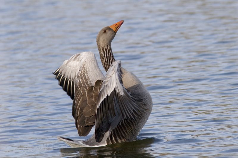
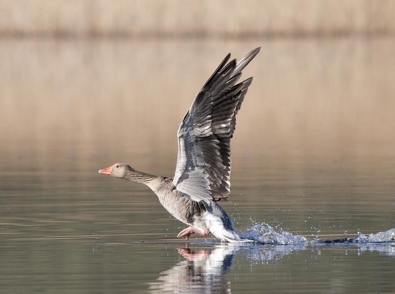
Greylag Goose - Anser anser (Linnaeus, 1758)

Images from the web

Quick facts

Threat status Europe Least Concern (IUCN)
EU Population status
Secure
Protected by EU Birds Directive and 3 other international agreements
Natura 2000 sites 844 are designated for this species
Breeding habitats
  • rivers and lakes
  • sparsely vegetated land
  • wetlands
Wintering habitats
  • cropland
  • grassland
  • marine inlets and transitional waters
  • rivers and lakes
Natura 2000 species code A043

Distribution

The distribution map is currently disabled. A new map solution will soon become available. In the meantime, please consult other species distribution map providers listed in the Other resources panel below.

Threat and EU population status

IUCN Red List status of threatened species

The IUCN Red List threat status assesses the risk of extinction.

EU population status

The status of the population at the EU level was evaluated at the species level; this was based on the reports delivered by Member States under Article 12 of the Birds Directive (see fact sheet below). The EU status assessment can cover several subspecies/subspecific population units. For more information, please consult the species fact sheet and link below.

IUCN Red List Category
Not Evaluated
Near Threatened
Regionally Extinct
Not Applicable
Vulnerable
Extinct in the Wild
Data Deficient
Endangered
Extinct
Least Concern
Critically Endangered
Population status categories for bird species under the Birds Directive
Secure
Near Threatened, declining or depleted
Threatened (i.e. vulnerable, endangered, critically endangered, regionally extinct)
Unknown or not evaluated

Natura 2000 sites

Protected in the following Natura 2000 sites

Sitecode Country Site name Action
BE2301336 Belgium Schorren en Polders van de Beneden-Schelde Map
BE2500831 Belgium Ijzervallei Map
CY6000002 Cyprus ALYKES LARNAKAS Map
CZ0311033 Czech Republic Třeboňsko Map
CZ0311035 Czech Republic Řežabinec Map
CZ0621028 Czech Republic Lednické rybníky Map
CZ0621030 Czech Republic Střední nádrž vodního díla Nové Mlýny Map
DE1727401 Germany Lanker See Map
DE2028401 Germany Wardersee Map
DE2121401 Germany Unterelbe Map
DE2210401 Germany Niedersächsisches Wattenmeer und angrenzendes Küstenmeer Map
DE2213401 Germany Wangerland Map
DE2408401 Germany Westermarsch Map
DE2508401 Germany Krummhörn Map
DE2509401 Germany Ostfriesische Meere Map
DE2526402 Germany Untere Seeve- und Untere Luhe-Ilmenau-Niederung Map
DE2609401 Germany Emsmarsch von Leer bis Emden Map
DE2617401 Germany Unterweser Map
DE2709401 Germany Rheiderland Map
DE2719401 Germany Hammeniederung Map
DE2723401 Germany Moore bei Sittensen Map
DE2746401 Germany Uckermärkische Seenlandschaft Map
DE2752302 Germany Salveytal Map
DE2816401 Germany Hunteniederung Map
DE2832401 Germany Niedersächsische Mittelelbe Map
DE2843401 Germany Stechlin Map
DE2909401 Germany Emstal von Lathen bis Papenburg Map
DE2935401 Germany Aland-Elbe-Niederung Map
DE2948401 Germany Schorfheide-Chorin Map
DE2951401 Germany Unteres Odertal Map
DE3032401 Germany Landgraben- und Dummeniederung Map
DE3036401 Germany Unteres Elbtal Map
DE3124401 Germany Truppenübungsplatz Bergen Map
DE3224401 Germany Ostenholzer Moor und Meißendorfer Teiche Map
DE3239401 Germany Untere Havel/Sachsen-Anhalt und Schollener See Map
DE3334401 Germany Milde-Niederung/Altmark Map
DE3339402 Germany Niederung der Unteren Havel Map
DE3341401 Germany U. Rhinluch/Dreetzer See, Havell. Luch und Belziger Landschaftsw. Map
DE3415401 Germany Dümmer Map
DE3418401 Germany Diepholzer Moorniederung Map
DE3420401 Germany Wesertalaue bei Landesbergen Map
DE3437401 Germany Elbaue Jerichow Map
DE3444401 Germany Döberitzer Heide Map
DE3450401 Germany Märkische Schweiz Map
DE3513401 Germany Alfsee Map
DE3521401 Germany Steinhuder Meer Map
DE3530401 Germany Barnbruch Map
DE3532401 Germany Vogelschutzgebiet Drömling Map
DE3540301 Germany Große Freiheit bei Plaue Map
DE3639401 Germany Vogelschutzgebiet Fiener Bruch Map
DE3642401 Germany Rietzer See Map
DE3727401 Germany Lengeder Teiche Map
DE3828401 Germany Heerter See Map
DE3938401 Germany Zerbster Land Map
DE4137401 Germany Wulfener Bruch und Teichgebiet Osternienburg Map
DE4139401 Germany Mittlere Elbe einschließlich Steckby-Lödderitzer Forst Map
DE4142401 Germany Mündungsgebiet der Schwarzen Elster Map
DE4225401 Germany Leinetal bei Salzderhelden Map
DE4531401 Germany Helmestausee Berga-Kelbra (Anteil Sachsen-Anhalt) Map
DE4531403 Germany Kyffhäuser - Badraer Schweiz - Helmestausee Map
DE4536401 Germany Salziger See und Salzatal Map
DE4638401 Germany Saale-Elster-Aue südlich Halle Map
DE4831401 Germany Gera-Unstrut-Niederung um Straußfurt Map
DE4921301 Germany Borkener See Map
DE5024301 Germany Forbachsee bei Bebra Map
DE5336401 Germany Plothener Teiche Map
DE5509401 Germany Laacher See Map
DE5511301 Germany NSG Urmitzer Werth Map
DE5511401 Germany Engerser Feld Map
DE5614301 Germany Eich von Niederbrechen Map
DE5723302 Germany Westerngrund von Neuengronau und Breunings Map
DE5818401 Germany Main bei Mühlheim und NSG 'Rumpenheimer und Bürgeler Kiesgruben' Map
DE5819308 Germany Erlensee bei Erlensee und Bulau bei Hanau Map
DE5820301 Germany Kinzigaue von Langenselbold Map
DE5912302 Germany Lorcher Werth Map
DE5920401 Germany Bong'sche Grube und Mainflinger Mainufer Map
DE6013401 Germany Rheinaue Bingen-Ingelheim Map
DE6013403 Germany NSG Hinter der Mortkaute Map
DE6014301 Germany Winkeler Aue Map
DE6014402 Germany Selztal zwischen Hahnheim und Ingelheim Map
DE6015301 Germany NSG Laubenheimer-Bodenheimer Ried Map
DE6018305 Germany Kranichsteiner Wald mit Hegbachaue,Mörsbacher Grund u. Silzwiesen Map
DE6116301 Germany Riedwiesen von Wächterstadt Map
DE6216401 Germany Eich-Gimbsheimer Altrhein Map
DE6316401 Germany Lampertheimer Altrhein Map
DE6317301 Germany Weschnitzinsel von Lorsch Map
DE6416401 Germany Bobenheimer und Roxheimer Altrhein mit Silbersee Map
DE6616401 Germany Otterstadter Altrhein und Angelhofer Altrhein inklusive Binsfeld Map
DE6716401 Germany NSG Mechtersheimer Tongruben Map
DE6716402 Germany Berghausener und Lingenfelder Altrhein mit Insel Flotzgrün Map
DE6716404 Germany Heiligensteiner Weiher Map
DE6816403 Germany Karlskopf und Leimersheimer Altrhein Map
DE6915403 Germany Goldgrund und Daxlander Au Map
DE7712401 Germany Rheinniederung Sasbach - Wittenweier Map
DK002X110 Denmark Saltholm og omliggende hav Map
DK004Y105 Denmark Roskilde Fjord, Kattinge Vig og Kattinge Sø Map
DK005X095 Denmark Skælskør Nor, Skælskør Fjord og Gammelsø Map
DK005X096 Denmark Farvandet mellem Skælskør Fjord og Glænø Map
DK005X099 Denmark Saltbæk Vig Map
DK005X100 Denmark Tissø, Åmose og Hallenslev Mose Map
DK005Y101 Denmark Søer ved Bregentved og Gisselfeld Map
DK006X081 Denmark Karrebæk, Dybsø og Avnø Fjorde Map
DK006X082 Denmark Bøtø Nor Map
DK006X083 Denmark Kyststrækningen v. Hyllekrog-Rødsand Map
DK006X085 Denmark Smålandshavet nord for Lolland Map
DK006X087 Denmark Maribosøerne Map
DK006X088 Denmark Nakskov Fjord og Inderfjord Map
DK006X089 Denmark Præstø Fjord, Ulvshale, Nyord og Jungshoved Nor Map
DK006Y091 Denmark Holmegårds Mose og Porsmose Map
DK008X074 Denmark Skove ved Brahetrolleborg Map
DK008X078 Denmark Arreskov Sø Map
DK009X060 Denmark Vidåen, Tøndermarsken og Saltvandssøen Map
DK00AX056 Denmark Fiilsø Map
DK00AY057 Denmark Vadehavet Map
DK00CX038 Denmark Nissum Fjord Map
DK00CX043 Denmark Ringkøbing Fjord Map
DK00CX161 Denmark Stadil Fjord og Vest Stadil Fjord Map
DK00EX017 Denmark Ålvand Klithede og Førby Sø Map
DK00EX020 Denmark Vestlige Vejler, Arup Holm og Hovsør Røn Map
DK00EX022 Denmark Hanstholm Reservatet Map
DK00EY013 Denmark Østlige Vejler Map
DK00FX001 Denmark Ulvedybet og Nibe Bredning Map
EE0040001 Estonia Väinamere Map
EE0040113 Estonia Vanamõisa Map
EE0040346 Estonia Pärnu lahe Map
EE0040351 Estonia Luitemaa Map
EE0040412 Estonia Kahtla-Kübassaare Map
EE0040418 Estonia Kasti lahe Map
EE0040432 Estonia Küdema lahe Map
EE0040434 Estonia Kura kurgu Map
EE0040441 Estonia Kaugatoma-Lõu Map
EE0040444 Estonia Mullutu-Loode Map
EE0040469 Estonia Siiksaare-Oessaare Map
EE0040472 Estonia Sutu lahe Map
EE0040476 Estonia Tagamõisa Map
EE0040496 Estonia Vilsandi Map
EE0060271 Estonia Toolse Map
ES0000004 Spain Lagunas de Villafáfila Map
ES0000011 Spain Monte de El Pardo Map
ES0000013 Spain Tablas de Daimiel Map
ES0000014 Spain Monfragüe y las Dehesas del Entorno Map
ES0000017 Spain CUENCA DE GALLOCANTA Map
ES0000019 Spain Aiguamolls de l'Alt Empordà Map
ES0000020 Spain Delta de l'Ebre Map
ES0000024 Spain Doñana Map
ES0000025 Spain Marismas del Odiel Map
ES0000027 Spain Laguna de Medina Map
ES0000030 Spain Complejo Endorreico de Puerto Real Map
ES0000033 Spain Laguna de Fuente de Piedra Map
ES0000037 Spain Es Trenc - Salobrar de Campos Map
ES0000038 Spain S'Albufera de Mallorca Map
ES0000068 Spain Embalse de Orellana y Sierra de Pela Map
ES0000069 Spain Embalse de Cornalvo y Sierra Bermeja Map
ES0000071 Spain Llanos de Cáceres y Sierra de Fuentes Map
ES0000084 Spain Ses Salines d'Eivissa i Formentera Map
ES0000133 Spain Laguna de Pitillas Map
ES0000134 Spain Embalse de las Cañas Map
ES0000135 Spain Estanca de los Dos Reinos Map
ES0000138 Spain GALACHOS DE LA ALFRANCA DE PASTRIZ, LA CARTUJA Y EL BURGO DE EBRO Map
ES0000142 Spain Cortados y cantiles de los ríos Jarama y Manzanares Map
ES0000143 Spain Marismas de Santoña, Victoria y Joyel y Ría de Ajo Map
ES0000144 Spain Urdaibaiko itsasadarra / Ría de Urdaibai Map
ES0000146 Spain Delta del Llobregat Map
ES0000161 Spain Laguna de El Hito Map
ES0000169 Spain Río Tajo en Castrejón, islas de Malpica de Tajo y Azután Map
ES0000184 Spain Valle del Tiétar - ZEPA Map
ES0000191 Spain Embalse del Ebro Map
ES0000204 Spain Tierra de Campiñas Map
ES0000211 Spain Desembocadura del riu Millars Map
ES0000216 Spain La Nava-Campos Sur Map
ES0000234 Spain S'Albufera des Grau Map
ES0000243 Spain Txingudi Map
ES0000252 Spain Embalse del Ebro Map
ES0000272 Spain Brazo del Este Map
ES0000289 Spain LAGUNAS Y CARRIZALES DE CINCO VILLAS Map
ES0000290 Spain LA SOTONERA Map
ES0000294 Spain LAGUNA DE SARIÑENA Y BALSA DE LA ESTACIÓN Map
ES0000296 Spain EMBALSE DEL PAS Y SANTA RITA Map
ES0000318 Spain Cabo Busto-Luanco Map
ES0000319 Spain Ría de Ribadesella-Ría de Tinamayor Map
ES0000320 Spain Embalses del centro (San Andrés, la Granda, Trasona y la Furta) Map
ES0000324 Spain Embalse de Arrocampo Map
ES0000325 Spain Campiña sur - Embalse de Arroyo Conejos Map
ES0000326 Spain Embalse de Borbollón Map
ES0000327 Spain Embalse de los Canchales Map
ES0000329 Spain Embalse de Valdecañas Map
ES0000330 Spain Embalse de Valuengo Map
ES0000333 Spain Llanos de Zorita y Embalse de Sierra Brava Map
ES0000334 Spain Sierras Centrales y Embalse de Alange Map
ES0000356 Spain Riberos del Almonte Map
ES0000359 Spain Campos de Alba Map
ES0000367 Spain La Serena y Sierras Periféricas Map
ES0000369 Spain Llanos de Alcantara y Brozas Map
ES0000393 Spain Azud de Badajoz Map
ES0000396 Spain Embalse de Horno-Tejero Map
ES0000397 Spain Embalse de la Serena Map
ES0000398 Spain Llanos y Complejo Lagunar de la Albuera Map
ES0000399 Spain Embalse del Zujar Map
ES0000400 Spain Arrozales de Palazuelo y Guadalperales Map
ES0000408 Spain Vegas del Ruecas, Cubilar y Moheda Alta Map
ES0000411 Spain Charca Dehesa Boyal Navalmoral Map
ES0000416 Spain Embalse de Aldea del Cano Map
ES0000418 Spain Embalse de Talaván Map
ES0000421 Spain Embalse Gabriel y Galán Map
ES0000427 Spain Río y Pinares del Tietar Map
ES0000434 Spain Canchos de Ramiro y Ladronera Map
ES1200008 Spain Redes Map
ES1300007 Spain Marismas de Santoña, Victoria y Joyel Map
ES2110011 Spain Zadorraren sistemako urtegiak / Embalses del sistema del Zadorra Map
ES2110014 Spain Salburua Map
ES2110019 Spain Izki Map
ES2120018 Spain Txingudi-Bidasoa Map
ES2130007 Spain Urdaibaiko itsasertzak eta padurak / Zonas litorales y marismas de Urdaibai Map
ES2200043 Spain Robledales de Ultzama y Basaburua Map
ES4140036 Spain La Nava-Campos Norte Map
ES4160048 Spain Lagunas de Cantalejo - ZEPA Map
ES4180017 Spain Riberas de Castronuño Map
ES4310004 Spain Dehesas de Jerez Map
ES4310009 Spain Puerto Peña - los Golondrinos Map
ES5110012 Spain Montserrat-Roques Blanques-riu Llobregat Map
ES6110001 Spain Albufera de Adra Map
ES6120002 Spain Cola del Embalse de Bornos Map
ES6120006 Spain Marismas del Río Palmones Map
ES6120014 Spain Laguna de Las Canteras y El Tejón Map
ES6150003 Spain Estero de Domingo Rubio Map
ES6160002 Spain Alto Guadalquivir Map
ES6180002 Spain Complejo Endorreico de La Lantejuela Map
FR1110025 France Etang de Saint Quentin Map
FR1110102 France Marais d'Itteville et de Fontenay-le-Vicomte Map
FR2110001 France Lacs de la forêt d'Orient Map
FR2110002 France Lac du Der Map
FR2110091 France Étang de la Horre Map
FR2112001 France Herbages et cultures des vallées de la Voire, de l'Héronne et de la Laines Map
FR2112002 France Herbages et cultures autour du lac du Der Map
FR2112003 France Étangs de Belval et d'Etoges Map
FR2112004 France Confluence des vallées de la Meuse et de la Chiers Map
FR2112005 France Vallée de l'Aisne en aval de Château Porcien Map
FR2112006 France Confluence des vallées de l'Aisne et de l'Aire Map
FR2112008 France Vallée de l'Aisne à Mouron Map
FR2210068 France Estuaires picards : Baie de Somme et d'Authie Map
FR2210104 France Moyenne vallée de l'Oise Map
FR2310044 France Estuaire et marais de la Basse Seine Map
FR2310045 France Littoral seino-marin Map
FR2410003 France Brenne Map
FR2510046 France Basses Vallées du Cotentin et Baie des Veys Map
FR2610004 France Vallées de la Loire et de l'Allier entre Cher et Nièvre Map
FR2612002 France Vallée de la Loire de Iguerande à Decize Map
FR3110085 France Cap Gris-Nez Map
FR4110007 France Lac de Madine et étangs de Pannes Map
FR4110060 France Etang de Lachaussée et zones voisines Map
FR4112001 France Forêts et zones humides du pays de Spincourt Map
FR4112002 France Complexe de l'étang de Lindre, forêt de Romersberg et zones voisines Map
FR4112004 France Forêt humide de la Reine et Caténa de Rangeval Map
FR4112005 France Vallée de la Meuse (secteur de Stenay) Map
FR4112008 France Vallée de la Meuse Map
FR4211810 France Vallée du Rhin de Strasbourg à Marckolsheim Map
FR4211811 France Vallée du Rhin de Lauterbourg à Strasbourg Map
FR4212813 France Ried de Colmar à Sélestat, Bas-Rhin Map
FR4213813 France Ried de Colmar à Sélestat, Haut-Rhin Map
FR5210008 France Lac de Grand Lieu Map
FR5210103 France Estuaire de la Loire Map
FR5310056 France Baie d'Audierne Map
FR5310086 France Golfe du Morbihan Map
FR5310093 France Baie de Quiberon Map
FR5310094 France Rade de Lorient Map
FR5410013 France Anse de Fouras, baie d'Yves, marais de Rochefort Map
FR5410028 France Marais de Brouage-Oléron Map
FR5410100 France Marais poitevin Map
FR5412006 France Vallée de la Charente en amont d'Angoulême Map
FR5412011 France Estuaire de la Gironde : marais de la rive nord Map
FR5412012 France Bonne Anse, marais de Bréjat et de Saint Augustin Map
FR5412016 France Plateau de Bellefonds Map
FR5412017 France Bois de l'Hospice, étang de Beaufour et environs Map
FR5412019 France Région de Pressac, étang de Combourg Map
FR5412023 France Plaines de Barbezières à Gourville Map
FR5412025 France Estuaire et basse vallée de la Charente Map
FR7210029 France Marais de Bruges Map
FR7210030 France Côte médocaine : dunes boisées et dépression humides Map
FR7210063 France Domaine d'Orx Map
FR7210065 France Marais du Nord Médoc Map
FR7210077 France Barthes de l'Adour Map
FR7210078 France Champ de tir du Poteau Map
FR7212001 France Site d'Arjuzanx Map
FR8310079 France Val d'Allier Bourbonnais Map
FR9110034 France Étang du Bagnas Map
FR9310019 France Camargue Map
FR9312001 France Marais entre Crau et Grand Rhône Map
FR9312003 France La Durance Map
FR9312005 France Salines de l'Étang de Berre Map
FR9312008 France Salins d'Hyères et des Pesquiers Map
HUBF30002 Hungary Balaton Map
HUBF30003 Hungary Kis-Balaton Map
HUBN10001 Hungary Bodrogzug–Kopasz-hegy–Taktaköz Map
HUBN10002 Hungary Borsodi-sík Map
HUBN10004 Hungary Hevesi-sík Map
HUBN10005 Hungary Kesznyéten Map
HUBN10007 Hungary Zempléni-hegység a Szerencsi-dombsággal és a Hernád-völggyel Map
HUDD10004 Hungary Béda-Karapancsa Map
HUDD10006 Hungary Pacsmagi-tavak Map
HUDD10012 Hungary Balatoni berkek Map
HUDI10004 Hungary Jászkarajenői puszták Map
HUDI10005 Hungary Sárvíz völgye Map
HUDI10006 Hungary Tatai Öreg-tó Map
HUDI10007 Hungary Velencei-tó és Dinnyési-Fertő Map
HUDI10008 Hungary Ipoly völgye Map
HUDI30002 Hungary Zámolyi-medence Map
HUFH10001 Hungary Fertő tó Map
HUFH10004 Hungary Mosoni-sík Map
HUFH30005 Hungary Hanság Map
HUHN10002 Hungary Hortobágy Map
HUHN10003 Hungary Bihar Map
HUKM10002 Hungary Kis-Sárrét Map
HUKM10003 Hungary Dévaványai-sík Map
HUKM10004 Hungary Hódmezővásárhely környéki és csanádi-háti puszták Map
HUKM10005 Hungary Cserebökényi-puszták Map
HUKN10001 Hungary Felső-kiskunsági szikes puszták és turjánvidék Map
HUKN10002 Hungary Kiskunsági szikes tavak és az őrjegi turjánvidék Map
HUKN10004 Hungary Alpár-bokrosi tisza-ártéri öblözet Map
HUKN10007 Hungary Alsó-Tisza-völgy Map
HUKN30001 Hungary Csongrád-bokrosi Sóstó Map
HUKN30002 Hungary Gátéri Fehér-tó Map
HUKN30003 Hungary Izsáki Kolon-tó Map
IE0000204 Ireland Lambay Island SAC Map
IE0000208 Ireland Rogerstown Estuary SAC Map
IE0000455 Ireland Dundalk Bay SAC Map
IE0002137 Ireland Lower River Suir SAC Map
IE0002165 Ireland Lower River Shannon SAC Map
IE0002249 Ireland The Murrough Wetlands SAC Map
IE0002287 Ireland Lough Swilly SAC Map
IE0002301 Ireland River Finn SAC Map
IE0004015 Ireland Rogerstown Estuary SPA Map
IE0004026 Ireland Dundalk Bay SPA Map
IE0004041 Ireland Ballyallia Lough SPA Map
IE0004063 Ireland Poulaphouca Reservoir SPA Map
IE0004069 Ireland Lambay Island SPA Map
IE0004075 Ireland Lough Swilly SPA Map
IE0004077 Ireland River Shannon and River Fergus Estuaries SPA Map
IE0004091 Ireland Stabannan-Braganstown SPA Map
IT1110079 Italy La Mandria Map
IT1120008 Italy Fontana Gigante (Tricerro) Map
IT1180002 Italy Torrente Orba Map
IT2020003 Italy Palude di Albate Map
IT2040022 Italy Lago di Mezzola e Pian di Spagna Map
IT2050005 Italy Boschi della Fagiana Map
IT2050006 Italy Bosco di Vanzago Map
IT2070020 Italy Torbiere d'Iseo Map
IT2080002 Italy Basso corso e sponde del Ticino Map
IT2080301 Italy Boschi del Ticino Map
IT2090001 Italy Monticchie Map
IT20B0006 Italy Isola Boscone Map
IT20B0009 Italy Valli del Mincio Map
IT20B0010 Italy Vallazza Map
IT3210003 Italy Laghetto del Frassino Map
IT3230047 Italy Lago di Santa Croce Map
IT3240023 Italy Grave del Piave Map
IT3250041 Italy Valle Vecchia - Zumelle - Valli di Bibione Map
IT3320037 Italy Laguna di Marano e Grado Map
IT3330005 Italy Foce dell'Isonzo - Isola della Cona Map
IT3330006 Italy Valle Cavanata e Banco Mula di Muggia Map
IT3330007 Italy Cavana di Monfalcone Map
IT4040014 Italy Valli Mirandolesi Map
IT4050019 Italy La Bora Map
IT4050022 Italy Biotopi e Ripristini ambientali di Medicina e Molinella Map
IT4050023 Italy Biotopi e Ripristini ambientali di Budrio e Minerbio Map
IT4050024 Italy Biotopi e Ripristini ambientali di Bentivoglio, S. Pietro in Casale, Malalbergo e Baricella Map
IT4050025 Italy Biotopi e Ripristini ambientali di Crevalcore Map
IT4050026 Italy Bacini ex-zuccherificio di Argelato e Golena del Fiume Reno Map
IT4060001 Italy Valli di Argenta Map
IT4060002 Italy Valli di Comacchio Map
IT4060003 Italy Vene di Bellocchio, Sacca di Bellocchio, Foce del Fiume Reno, Pineta di Bellocchio Map
IT4060004 Italy Valle Bertuzzi, Valle Porticino - Canneviè Map
IT4060008 Italy Valle del Mezzano Map
IT4060015 Italy Bosco della Mesola, Bosco Panfilia, Bosco di Santa Giustina, Valle Falce, La Goara Map
IT4070001 Italy Punte Alberete, Valle Mandriole Map
IT4070007 Italy Salina di Cervia Map
IT4070009 Italy Ortazzo, Ortazzino, Foce del Torrente Bevano Map
IT5120017 Italy Lago e Padule di Massacciuccoli Map
IT5140011 Italy Stagni della Piana Fiorentina e Pratese Map
IT5160001 Italy Padule di Suese e Biscottino Map
IT5160004 Italy Padule di Bolgheri Map
IT5160010 Italy Padule Orti - Bottagone Map
IT5170002 Italy Selva Pisana Map
IT5190008 Italy Lago di Montepulciano Map
IT51A0011 Italy Padule di Diaccia Botrona Map
IT51A0013 Italy Padule della Trappola, Bocca d'Ombrone Map
IT51A0026 Italy Laguna di Orbetello Map
IT51A0033 Italy Lago di Burano Map
IT51A0036 Italy Pianure del Parco della Maremma Map
IT5210070 Italy Lago Trasimeno Map
IT5210072 Italy Palude di Colfiorito Map
IT5220024 Italy Valle del Tevere: Laghi di Corbara - Alviano Map
IT5310025 Italy Calanchi e praterie aride della media Valle del Foglia Map
IT9140003 Italy Stagni e Saline di Punta della Contessa Map
ITA050001 Italy Biviere e Macconi di Gela Map
ITA070001 Italy Foce del Fiume Simeto e Lago Gornalunga Map
ITA090002 Italy Vendicari Map
ITA090006 Italy Saline di Siracusa e Fiume Ciane Map
LTSLUB001 Lithuania Nemuno delta Map
LV0303200 Latvia Svetes paliene Map
LV0303500 Latvia Pape Map
LV0525500 Latvia Satinu diki Map
LV0527300 Latvia Tasu ezers Map
NL1000007 Netherlands Ilperveld, Varkensland, Oostzanerveld & Twiske Map
NL1000015 Netherlands Haringvliet Map
NL1000021 Netherlands Krammer-Volkerak Map
NL2000001 Netherlands Deelen Map
NL2000006 Netherlands Duinen Goeree & Kwade Hoek Map
NL2000007 Netherlands Lepelaarplassen Map
NL2000012 Netherlands Naardermeer Map
NL3009001 Netherlands Alde Feanen Map
NL3009002 Netherlands Biesbosch Map
NL3009004 Netherlands De Wieden Map
NL3009013 Netherlands Ketelmeer & Vossemeer Map
NL3009015 Netherlands Markiezaat Map
NL3009016 Netherlands Oosterschelde Map
NL4000017 Netherlands Voordelta Map
NL4000021 Netherlands Grevelingen Map
NL9801001 Netherlands Waddenzee Map
NL9802012 Netherlands Lauwersmeer Map
NL9802019 Netherlands Hollands Diep Map
NL9802031 Netherlands Zwarte Meer Map
NL9802035 Netherlands Eemmeer & Gooimeer Zuidoever Map
NL9802054 Netherlands Oostvaardersplassen Map
NL9802060 Netherlands Oostelijke Vechtplassen Map
NL9803028 Netherlands IJsselmeer Map
NL9803029 Netherlands Markermeer & IJmeer Map
NL9902010 Netherlands Zoommeer Map
PLB020001 Poland Dolina Baryczy Map
PLB020003 Poland Stawy Przemkowskie Map
PLB040001 Poland Błota Rakutowskie Map
PLB040002 Poland Bagienna Dolina Drwęcy Map
PLB040003 Poland Dolina Dolnej Wisły Map
PLB040004 Poland Ostoja Nadgoplańska Map
PLB060004 Poland Dolina Tyśmienicy Map
PLB060005 Poland Lasy Janowskie Map
PLB060006 Poland Lasy Parczewskie Map
PLB100001 Poland Pradolina Warszawsko-Berlińska Map
PLB140002 Poland Dolina Liwca Map
PLB220001 Poland Wielki Sandr Brdy Map
PLB220005 Poland Zatoka Pucka Map
PLB240001 Poland Dolina Górnej Wisły Map
PLB260001 Poland Dolina Nidy Map
PLB280004 Poland Jezioro Oświn i okolice Map
PLB280010 Poland Zalew Wiślany Map
PLB300001 Poland Dolina Środkowej Noteci i Kanału Bydgoskiego Map
PLB300002 Poland Dolina Środkowej Warty Map
PLB300004 Poland Wielki Łęg Obrzański Map
PLB300005 Poland Zbiornik Wonieść Map
PLB320001 Poland Bagna Rozwarowskie Map
PLB320002 Poland Delta Świny Map
PLB320003 Poland Dolina Dolnej Odry Map
PLB320005 Poland Jezioro Miedwie i okolice Map
PLB320006 Poland Jezioro Świdwie Map
PLB320007 Poland Łąki Skoszewskie Map
PLB320008 Poland Ostoja Ińska Map
PLB320009 Poland Zalew Szczeciński Map
PLC140001 Poland Puszcza Kampinoska Map
PTZPE0010 Portugal Estuário do Tejo Map
PTZPE0011 Portugal Estuário do Sado Map
PTZPE0013 Portugal Lagoa de Santo André Map
PTZPE0018 Portugal Sapais de Castro Marim Map
SE0210278 Sweden Tämnaren öst Map
SE0230067 Sweden Tåkern Map
SE0230126 Sweden Svensksundsviken Map
SE0230389 Sweden Södra Bråviken Map
SE0410041 Sweden Torhamn-Hästholmen Map
SE0410042 Sweden Tromtö-Almö Map
SE0410044 Sweden Vållholmen Map
SE0410046 Sweden Bräkne-Hoby skärgård Map
SE0410047 Sweden Björkeskärven Map
SE0410048 Sweden Ronnekläppen Map
SE0410049 Sweden Björnön-Varö Map
SE0410050 Sweden Gräsör m fl öar Map
SE0410051 Sweden Abramsäng Map
SE0410052 Sweden Majö Map
SE0410053 Sweden Kristianopels skärgård Map
SE0430124 Sweden Krankesjön Map
SE0530028 Sweden Hullsjön Map
SE0610004 Sweden Inre Kilsviken Map
SE0610152 Sweden Brosjön Map
SE0610203 Sweden Ölmeviken Map
SE0630139 Sweden Långvind Map
SE0820042 Sweden Gammelstadsviken Map
SE0820108 Sweden Haparanda skärgård Map
SI5000011 Slovenia Drava Map
SKCHVU006 Slovakia Dubnicke strkovisko Map
SKCHVU016 Slovakia Zahorske Pomoravie Map
SKCHVU020 Slovakia Parizske mociare Map
SKCHVU029 Slovakia Syslovske polia Map
FR5212010 France Dunes, forêt et marais d'Olonne Map
DE4447421 Germany Niederlausitzer Heide Map
ES4250010 Spain Humedales de La Mancha Map
ES4310028 Spain Río Matachel Map
IT2040042 Italy Pian di Spagna e Lago di Mezzola Map
DE2331491 Germany Schaalsee-Gebiet Map
IT1324909 Italy Torrente Arroscia e Centa Map
PLB180005 Poland Puszcza Sandomierska Map
IT51A0006 Italy Padule di Scarlino Map
FR8312007 France Sologne bourbonnaise Map
FR5312003 France Baie de Goulven Map
FR9112016 France Étang de Capestang Map
IT7212126 Italy Pantano Zittola - Feudo Valcocchiara Map
BG0000270 Bulgaria Atanasovsko ezero Map
FR8312002 France Haut Val d'Allier Map
IT20A0401 Italy Riserva Regionale Bosco Ronchetti Map
PLB320018 Poland Jeziora Wełtyńskie Map
DE3453422 Germany Mittlere Oderniederung Map
DE3744421 Germany Nuthe-Nieplitz-Niederung Map
DE3432401 Germany Feldflur bei Kusey Map
ITA090029 Italy Pantani della Sicilia sud-orientale, Morghella, di Marzamemi, di Punta Pilieri e Vendicari Map
IT5220011 Italy Zona umida di Alviano Map
ES4310010 Spain La Serena Map
IT9110015 Italy Duna e Lago di Lesina - Foce del Fortore Map
IT9120011 Italy Valle Ofanto - Lago di Capaciotti Map
FR4312014 France Pelouses de la région vésulienne et vallée de la Colombine Map
IT9150022 Italy Palude dei Tamari Map
ES4250001 Spain Sierra de San Vicente y valles del Tiétar y Alberche Map
FR4112009 France Forêts et étangs d'Argonne et vallée de l'Ornain Map
PLB320011 Poland Zalew Kamieński i Dziwna Map
IT3341002 Italy Aree Carsiche della Venezia Giulia Map
FR2410016 France Lac de Rillé et forêts voisines d'Anjou et de Touraine Map
FR5212001 France Marais de Goulaine Map
ITA050012 Italy Torre Manfria, Biviere e Piana di Gela Map
IT20B0501 Italy Viadana, Portiolo, San Benedetto Po e Ostiglia Map
DE7744471 Germany Salzach und Inn Map
PLB300011 Poland Pojezierze Sławskie Map
PLB320017 Poland Ostoja Cedyńska Map
IT4060017 Italy Po di Primaro e Bacini di Traghetto Map
FR7212014 France Estuaire de la Gironde : marais du Blayais Map
BG0000241 Bulgaria Srebarna Map
DE5026402 Germany Rhäden von Obersuhl und Auen an der mittleren Werra Map
PLB320019 Poland Ostoja Drawska Map
BG0002091 Bulgaria Ostrov Lakat Map
BG0002046 Bulgaria Yatata Map
ES4320077 Spain Monfragüe Map
PTCON0011 Portugal Estuário do Sado Map
BG0002114 Bulgaria Ribarnitsi Chelopechene Map
FR2312003 France Terrasses alluviales de la Seine Map
DE5219401 Germany Amöneburger Becken Map
PLC080001 Poland Ujście Warty Map
FR5212002 France Vallée de la Loire de Nantes aux Ponts-de-Cé et ses annexes Map
PLB080005 Poland Jeziora Pszczewskie i Dolina Obry Map
FR3112002 France Les "Cinq Tailles" Map
DE6119401 Germany Untere Gersprenzaue Map
FR2112012 France Marigny, Superbe, vallée de l'Aube Map
DE5914350 Germany Mariannenaue Map
FR5212004 France Marais de l'Erdre Map
FR4312006 France Vallée de la Saône Map
IT3240030 Italy Grave del Piave - Fiume Soligo - Fosso di Negrisia Map
BG0002064 Bulgaria Garvansko blato Map
ES3110004 Spain Cuenca del río Manzanares Map
IT20B0401 Italy Parco Regionale Oglio Sud Map
PLB320014 Poland Ostoja Wkrzańska Map
BG0002022 Bulgaria Yazovir Rozov kladenets Map
BG0002028 Bulgaria Kompleks Straldzha Map
BG0002069 Bulgaria Ribarnitsi Zvanichevo Map
DE3640421 Germany Fiener Bruch Map
FR8312003 France Gorges de la Sioule Map
ES4220001 Spain Navas de Malagón Map
BG0002023 Bulgaria Yazovir Ovcharitsa Map
ES6150012 Spain Dehesa del Estero y Montes de Moguer Map
BG0002017 Bulgaria Kompleks Belenski ostrovi Map
ES3110006 Spain Vegas, cuestas y páramos del sureste de Madrid Map
FR8212020 France Lac Léman Map
DE6116450 Germany Hessisches Ried mit Kühkopf-Knoblochsaue Map
FR7412001 France Gorges de la Dordogne Map
FR8312013 France Val d'allier Saint Yorre-Joze Map
DE7427471 Germany Schwäbisches Donaumoos Map
IT4020024 Italy San Genesio Map
FR8312005 France Planèze de Saint Flour Map
IT9110001 Italy Isola e Lago di Varano Map
IT5210018 Italy Lago Trasimeno Map
ES4320013 Spain Granadilla Map
DE3242421 Germany Rhin-Havelluch Map
BG0002014 Bulgaria Madzharovo Map
BG0002067 Bulgaria Ostrov Golya Map
BG0002030 Bulgaria Kompleks Kalimok Map
ITA070029 Italy Biviere di Lentini, tratto mediano e foce del Fiume Simeto e area antistante la foce Map
FR8312010 France Gorges de la Truyère Map
BG0002029 Bulgaria Kotlenska planina Map
PLB080004 Poland Dolina Środkowej Odry Map
DE5914450 Germany Inselrhein Map
DE5238303 Germany Elstertal zwischen Greiz und Wünschendorf Map
BG0002018 Bulgaria Ostrov Vardim Map
BG0002006 Bulgaria Ribarnitsi Orsoya Map
DE5916402 Germany Untermainschleusen Map
IT9150011 Italy Alimini Map
BG0002048 Bulgaria Suha reka Map
IT20A0015 Italy Bosco Ronchetti Map
DE2649421 Germany Uckerniederung Map
DE5417401 Germany Lahnaue zwischen Atzbach und Gießen Map
DE5328305 Germany Werra bis Treffurt mit Zuflüssen Map
ES4240005 Spain Lagunas de Puebla de Beleña Map
PLB320016 Poland Lasy Puszczy nad Drawą Map
BG0002024 Bulgaria Ribarnitsi Mechka Map
FR5212003 France Vallée de la Loire des Ponts-de-Cé à Montsoreau Map
DE2738421 Germany Agrarlandschaft Prignitz-Stepenitz Map
FR4112000 France Plaine et étang du Bischwald Map
BG0000237 Bulgaria Ostrov Pozharevo Map
DE6217403 Germany Hessische Altneckarschlingen Map
BG0002040 Bulgaria Strandzha Map
BG0002094 Bulgaria Adata - Tundzha Map
DE4450421 Germany Lausitzer Bergbaufolgelandschaft Map
ES4220005 Spain Lagunas volcánicas del Campo de Calatrava Map
FR8212016 France La Dombes Map
ES6150014 Spain Marismas y Riberas del Tinto Map
FR7212013 France Estuaire de la Bidassoa et baie de Fontarabie Map
FR8312011 France Pays des Couzes Map
PTCON0009 Portugal Estuário do Tejo Map
DE2751421 Germany Randow-Welse-Bruch Map
BG0002106 Bulgaria Yazovir Ivaylovgrad Map
PLB140014 Poland Dolina Dolnej Narwi Map
IT3340006 Italy Carso Triestino e Goriziano Map
PLB320015 Poland Ostoja Witnicko-Dębniańska Map
DE1530491 Germany Östliche Kieler Bucht Map
BG0000273 Bulgaria Burgasko ezero Map
DE5519401 Germany Wetterau Map
FR7212011 France Col de Lizarrieta Map
FR5212009 France Marais Breton, baie de Bourgneuf, île de Noirmoutier et forêt de Monts Map
PLB140013 Poland Ostoja Kozienicka Map
DE7428471 Germany Donauauen Map
ES5130018 Spain Estany d'Ivars- Vilasana Map
IT20A0013 Italy Lanca di Gerole Map
PLB300006 Poland Dolina Małej Wełny pod Kiszkowem Map
DE5026350 Germany Rhäden bei Obersuhl und Bosserode Map
IT20B0017 Italy Ansa e Valli del Mincio Map
BG0002083 Bulgaria Svishtovsko-Belenska nizina Map
FR3112003 France Marais Audomarois Map
DE4722401 Germany Fuldaaue um Kassel Map
NL3011002 Netherlands Polder Zeevang Map
ES6150009 Spain Doñana Norte y Oeste Map
FR2612005 France Basse vallée du Doubs et étangs associés Map
BG0002013 Bulgaria Studen kladenets Map
DE4151421 Germany Spreewald und Lieberoser Endmoräne Map
ES6150019 Spain Bajo Guadalquivir Map
DE7932471 Germany Ammerseegebiet Map
IT20A0014 Italy Lancone di Gussola Map
DE4148421 Germany Luckauer Becken Map
PLB320010 Poland Wybrzeże Trzebiatowskie Map
FR8212026 France Gorges de la Loire aval Map
BG0002010 Bulgaria Yazovir Pyasachnik Map
FR8312009 France Gorges de la Loire Map
ES4320064 Spain Embalse de Lancho Map
DE6116350 Germany Kühkopf-Knoblochsaue Map
DE3542421 Germany Mittlere Havelniederung Map
IT1343502 Italy Parco della Magra - Vara Map
IT1345101 Italy Piana del Magra Map
FR7312004 France Puydarrieux Map
BG0002027 Bulgaria Yazovir Malko Sharkovo Map
PLB080002 Poland Dolina Dolnej Noteci Map
FR1112011 France Massif de Rambouillet et zones humides proches Map
BG0002095 Bulgaria Gorni Dabnik - Telish Map
DE6216450 Germany Rheinauen bei Biblis und Groß-Rohrheim Map
IT51A0031 Italy Lago di Burano Map
DE3145421 Germany Obere Havelniederung Map
IT20A0402 Italy Riserva Regionale Lanca di Gerole Map
BG0002052 Bulgaria Yazovir Zhrebchevo Map
FR5212008 France Grande Brière, marais de Donges et du Brivet Map
PLB280015 Poland Ostoja Warmińska Map
DE6013350 Germany Rüdesheimer Aue Map
FR8212024 France Plaine du Forez Map
DE4624303 Germany Freudenthal bei Witzenhausen Map
PLB300009 Poland Jezioro Zgierzynieckie Map
BG0000152 Bulgaria Pomoriysko ezero Map
ROSPA0016 Romania Câmpia Nirului - Valea Ierului Map
ROSPA0053 Romania Lacul Bugeac Map
ROSPA0022 Romania Comana Map
ROSPA0006 Romania Balta Tătaru Map
ROSPA0015 Romania Câmpia Crișului Alb și Crișului Negru Map
ROSPA0108 Romania Vedea - Dunăre Map
ROSPA0023 Romania Confluența Jiu - Dunăre Map
ROSPA0026 Romania Cursul Dunării - Baziaș - Porțile de Fier Map
ROSPA0058 Romania Lacul Stânca Costești Map
ROSPA0010 Romania Bistreț Map
ROSPA0059 Romania Lacul Strachina Map
ROSPA0072 Romania Lunca Siretului Mijlociu Map
ROSPA0004 Romania Balta Albă - Amara - Jirlău Map
ROSPA0056 Romania Lacul Oltina Map
ROSPA0051 Romania Iezerul Călărași Map
ROSPA0005 Romania Balta Mică a Brăilei Map
ROSPA0057 Romania Lacul Siutghiol Map
ROSPA0090 Romania Ostrovu Lung - Gostinu Map
ROSPA0094 Romania Pădurea Hagieni Map
ROSPA0097 Romania Pescăria Cefa - Pădurea Rădvani Map
ROSPA0062 Romania Lacurile de acumulare de pe Argeș Map
ROSPA0068 Romania Lunca inferioară a Turului Map
ROSPA0052 Romania Lacul Beibugeac Map
ROSPA0044 Romania Grădiștea - Căldărușani - Dridu Map
ROSPA0070 Romania Lunca Prutului - Vlădești - Frumușița Map
ROSPA0063 Romania Lacurile de acumulare Buhuși - Bacău - Berești Map
ROSPA0037 Romania Dumbrăvița - Rotbav - Măgura Codlei Map
ROSPA0031 Romania Delta Dunării și Complexul Razim - Sinoie Map
ROSPA0109 Romania Acumulările Belcești Map
ROSPA0102 Romania Suhaia Map
ROSPA0042 Romania Eleșteiele Jijiei și Miletinului Map
ROSPA0017 Romania Canaralele de la Hârșova Map
ROSPA0021 Romania Ciocănești - Dunăre Map
ROSPA0054 Romania Lacul Dunăreni Map
ROSPA0065 Romania Lacurile Fundata - Amara Map
ROSPA0071 Romania Lunca Siretului Inferior Map
ROSPA0061 Romania Lacul Techirghiol Map
ROSPA0007 Romania Balta Vederoasa Map
ROSPA0074 Romania Maglavit Map
DE4649451 Germany Teiche nordwestlich Kamenz Map
DE4639451 Germany Leipziger Auwald Map
DE4342452 Germany Elbaue und Teichgebiete bei Torgau Map
DE4440451 Germany Kämmereiforst und Leineaue Map
DE2339402 Germany Nossentiner/Schwinzer Heide Map
DE4754451 Germany Talsperre Quitzdorf Map
DE4545452 Germany Elbtal zwischen Schöna und Mühlberg Map
DE5438451 Germany Weidenteich und Syrau-Kauschwitzer Heide Map
DE4930420 Germany Ackerhügelland westlich Erfurt mit Fahnerscher Höhe Map
DE4747451 Germany Moritzburger Kleinkuppenlandschaft Map
DE1446401 Germany Binnenbodden von Rügen Map
DE2147401 Germany Peenetallandschaft Map
DE2235402 Germany Schweriner Seen Map
DE4642451 Germany Wermsdorfer Teich- und Waldgebiet Map
DE4752451 Germany Teiche zwischen Neschwitz und Lomske Map
DE4740451 Germany Rückhaltebecken Stöhna Map
DE2416431 Germany Butjadingen Map
DE4340451 Germany Vereinigte Mulde Map
DE1934401 Germany Wismarbucht und Salzhaff Map
DE4554451 Germany Teichgebiete Niederspree-Hammerstadt Map
DE4941451 Germany Eschefelder Teiche Map
DE2344401 Germany Kuppiges Tollensegebiet zwischen Rosenow und Penzlin Map
DE4840451 Germany Lobstädter Lachen Map
DE4840452 Germany Speicherbecken Borna und Teichgebiet Haselbach Map
DE1542401 Germany Vorpommersche Boddenlandschaft und nördlicher Strelasund Map
DE4739451 Germany Elsteraue bei Groitzsch Map
DE2514431 Germany Marschen am Jadebusen Map
DE5537451 Germany Vogtländische Pöhle und Täler Map
DE4752452 Germany Spreeniederung Malschwitz Map
DE2642401 Germany Müritz-Seenland und Neustrelitzer Kleinseenplatte Map
DE4651451 Germany Doberschützer Wasser Map
DE3729332 Germany Riddagshäuser Teiche Map
DE2645402 Germany Wald- und Seenlandschaft Lieps-Serrahn Map
DE4552451 Germany Biosphärenreservat Oberlausitzer Heide- und Teichlandschaft Map
DE4841451 Germany Bergbaufolgelandschaft Bockwitz Map
DE2450402 Germany Koblentzer See Map
DE4342451 Germany Dübener Heide Map
DE4439452 Germany Agrarraum und Bergbaufolgelandschaft bei Delitzsch Map
DE2309431 Germany Ostfriesische Seemarsch zwischen Norden und Esens Map
DE2640401 Germany Feldmark Massow-Wendisch Priborn-Satow Map
DE4648451 Germany Königsbrücker Heide Map
DE4654451 Germany Doras Ruh Map
DE4648452 Germany Teiche bei Zschorna Map
DE1747402 Germany Greifswalder Bodden und südlicher Strelasund Map
DE4753451 Germany Feldgebiete in der östlichen Oberlausitz Map
DE2741401 Germany Buchholzer-Krümmeler Heide Map
DE1743401 Germany Nordvorpommersche Waldlandschaft Map
DE2242401 Germany Mecklenburgische Schweiz und Kummerower See Map
DE4450451 Germany Bergbaufolgelandschaft bei Hoyerswerda Map
DE4650451 Germany Teichgebiet Biehla-Weißig Map
DE4940451 Germany Bergbaufolgelandschaft Haselbach Map
DE5145451 Germany Großhartmannsdorfer Großteich Map
DE4940420 Germany Nordöstliches Altenburger Land Map
DE4655451 Germany Teiche und Wälder um Mückenhain Map
DE4650452 Germany Jeßnitz und Thury Map
DE4633420 Germany Helme-Unstrut-Niederung Map
DE4647451 Germany Mittleres Rödertal Map
DE4546451 Germany Unteres Rödertal Map
DE2547471 Germany Feldberger Seenlandschaft und Teile des Woldegker Hügellands Map
DE4550451 Germany Dubringer Moor Map
DE2441401 Germany Klocksiner Seenkette, Kölpin- und Fleesensee Map
DE1941401 Germany Recknitz- und Trebeltal mit Seitentälern und Feldmark Map
BG0002051 Bulgaria Kaliakra Map
BG0002082 Bulgaria Batova Map
BG0002097 Bulgaria Belite skali Map
BG0002050 Bulgaria Durankulashko ezero Map
BG0002043 Bulgaria Emine Map
BG0000156 Bulgaria Shablenski ezeren kompleks Map
BG0000191 Bulgaria Varnensko-Beloslavsko ezero Map
BG0000271 Bulgaria Mandra - Poda Map
BG0002045 Bulgaria Kompleks Kamchia Map
BG0002021 Bulgaria Sakar Map
PLB280013 Poland Jezioro Drużno Map
PLB120005 Poland Dolina Dolnej Skawy Map
PLB100002 Poland Zbiornik Jeziorsko Map
PLB160003 Poland Zbiornik Otmuchowski Map
PLB120004 Poland Dolina Dolnej Soły Map
PLB220009 Poland Bory Tucholskie Map
FR5312010 France Dunes et côtes de Trévignon Map
ES0000451 Spain Montdúver-Marjal de la Safor Map
ES0000450 Spain Marjal i Estanys d'Almenara Map
ES0000470 Spain Marjal dels Moros (ZEPA) Map
ES0000471 Spain l'Albufera (ZEPA) Map
ES6130017 Spain Alto Guadiato Map
ES0000467 Spain Prat de Cabanes i Torreblanca (ZEPA) Map
ES6180017 Spain Campiñas de Sevilla Map
ES1200006 Spain Ría de Villaviciosa Map
ES4310003 Spain Complejo Lagunar de la Albuera Map
PTZPE0055 Portugal Évora Map
CZ0311037 Czech Republic Českobudějovické rybníky Map
CZ0311038 Czech Republic Dehtář Map
IE0004186 Ireland The Murrough SPA Map
NL2009162 Netherlands Abtskolk & De Putten Map
PLB200008 Poland Przełomowa Dolina Narwi Map
ROSPA0066 Romania Limanu - Herghelia Map
FR7212018 France Bassin d'Arcachon et banc d'Arguin Map
AT2111000 Austria Völkermarkter Stausee Map
AT1220V00 Austria Feuchte Ebene - Leithaauen Map
AT3228000 Austria Bürmooser Moor Map
AT2211000 Austria Hartberger-Gmoos Map
AT1204V00 Austria Donau-Auen östlich von Wien Map
AT3209022 Austria Salzachauen, Salzburg Map
AT3225000 Austria Weidmoos Map
AT1110137 Austria Neusiedler See - Nordöstliches Leithagebirge Map
AT1216V00 Austria Tullnerfelder Donau-Auen Map
AT3205021 Austria Obertauern-Hundsfeldmoor Map
AT1202V00 Austria March-Thaya-Auen Map
AT2104000 Austria Sablatnig Moor Map
AT3105000 Austria Unterer Inn Map
AT2113000 Austria Flachwasserbiotop Neudenstein Map
ROSPA0143 Romania Tisa Superioară Map
ROSPA0130 Romania Mața - Cârja - Rădeanu Map
ROSPA0136 Romania Oltenița - Ulmeni Map
ROSPA0112 Romania Câmpia Gherghiței Map
DE2417401 Germany Luneplate Map
ES1200055 Spain Cabo Busto-Luanco Map
ES0000487 Spain Marjal de Pego-Oliva (ZEPA) Map
ES0000486 Spain Salines de Santa Pola (ZEPA) Map
ES0000485 Spain Lagunas de la Mata y Torrevieja (ZEPA) Map
IT51A0039 Italy Padule della Trappola, Bocca d'Ombrone Map
ES5310125 Spain Albufera de Mallorca Map
HR1000016 Croatia Podunavlje i donje Podravlje Map
HR1000010 Croatia Poilovlje s ribnjacima Map
HR1000013 Croatia Dravske akumulacije Map
HR1000004 Croatia Donja Posavina Map
HR1000001 Croatia Pokupski bazen Map
HR1000009 Croatia Ribnjaci uz Česmu Map
HR1000005 Croatia Jelas polje Map
HR1000011 Croatia Ribnjaci Grudnjak i Našice Map
HR1000025 Croatia Vransko jezero i Jasen Map
IT4020027 Italy Cronovilla Map
IT4050031 Italy Cassa di espansione del Torrente Samoggia Map
PLB100003 Poland Doliny Przysowy i Słudwi Map
BG0002115 Bulgaria Bilo Map
NL2014038 Netherlands Rijntakken Map
NL9802026 Netherlands Westerschelde & Saeftinghe Map
IT5120105 Italy Bonifica della Gherardesca Map
PLC020002 Poland Łęgi Odrzańskie Map
ROSPA0157 Romania Mlaștina Iezerul Dorohoi Map
ROSPA0160 Romania Lunca Buzăului Map
DE2323402 Germany Unterelbe bis Wedel Map

Protected sites

Please note the site map takes a while to display.

Legal status

Legal text Annex Conditions More information
Directive 2009/147/EC of the European Parliament and of the Council, of 30 November 2009, on the conservation of wild birds (EU Birds Directive) http://ec.europa.eu/environm...rective/index_en.htm
Convention on the conservation of European wildlife and natural habitats (Bern Convention) (All species of Birds not included in Appendix II) http://www.coe.int/t/dg4/cul.../bern/default_en.asp
Convention on the Conservation of Migratory Species of Wild Animals. (Bonn Convention) (Migratory species of Anatidae) http://www.cms.int/
Agreement on the Conservation of African-Eurasian Migratory Waterbirds. Convention on Migratory Species of Wild Animals. (AEWA) http://www.migratoryspecies....ent/about-cms-family

http://www.unep-aewa.org/en/legalinstrument/aewa

Common names and synonyms

Common Name Language Reference
Ansar Común Spanish Hagemeijer, W.J.M. & Blair, M.J.
Ganso-comum Portuguese Hagemeijer, W.J.M. & Blair, M.J.
Grågås Swedish Hagemeijer, W.J.M. & Blair, M.J.
Graugans German Hagemeijer, W.J.M. & Blair, M.J.
Grauwe Gans Dutch Hagemeijer, W.J.M. & Blair, M.J.
Greylag Goose English Hagemeijer, W.J.M. & Blair, M.J.
Husa velká Czech Hagemeijer, W.J.M. & Blair, M.J.
Merihanhi Finnish Hagemeijer, W.J.M. & Blair, M.J.
Meza zoss Latvian Latvian NRC
Nyári lúd Hungarian Hagemeijer, W.J.M. & Blair, M.J.
Oca selvatica Italian Hagemeijer, W.J.M. & Blair, M.J.
Oie cendrée French Hagemeijer, W.J.M. & Blair, M.J.

Other resources

CoL (accepted name) Catalogue of Life
EBCC Atlas of breeding birds European Bird Census Council's Atlas of Breeding Birds
EURing code:01610 European bird-ringing
EoL Encyclopedia of Life
Fauna Europaea Fauna Europaea
GBIF Global Biodiversity Information Facility
ITIS (Valid name) Interagency Taxonomic Information System
NCBI search National Center for Biotechnology Information
NOBANIS: Anser anser European Network on Invasive Alien Species
PESI (Accepted) Pan-European Species directories Infrastructure
Wikipedia Wikipedia

External data

Population distribution from "Birds in Europe" editions 1 and 2

These publications present a thorough and detailed review of the conservation status of European birds. Based on detailed breeding and wintering population data collected in each country, the report provides a review of the population sizes and trends of Species of European Conservation Concern.

71 items found, displaying all items.1
Country Biogeographic region Min / Max (Units) Period Status Quality Source Published
Albania 0/0 (pairs) 1996-2002 Breeding Species generally well known, but only poor or incomplete quantitative data available Birds in Europe 2 (1990-2000) 2004-01-01
Albania 0/84 (individuals) 1995-2002 Wintering Species poorly known, with no quantitative data available Birds in Europe 2 (1990-2000) 2004-01-01
Armenia 250/999 (individuals) 1997-2002 Wintering Species generally well known, but only poor or incomplete quantitative data available Birds in Europe 2 (1990-2000) 2004-01-01
Armenia 50/249 (pairs) 1997-2002 Breeding Species generally well known, but only poor or incomplete quantitative data available Birds in Europe 2 (1990-2000) 2004-01-01
Austria 500/700 (pairs) 1998-2002 Breeding Species generally well known, but only poor or incomplete quantitative data available Birds in Europe 2 (1990-2000) 2004-01-01
Azerbaijan 200/2000 (pairs) 1996-2000 Breeding Reliable quantitative data (e.g. atlas survey or monitoring data, etc.) are available for the whole period and region in question Birds in Europe 2 (1990-2000) 2004-01-01
Azerbaijan 13000/28000 (individuals) 1996-2002 Wintering Species generally well known, but only poor or incomplete quantitative data available Birds in Europe 2 (1990-2000) 2004-01-01
Belarus 50/250 (pairs) 1997-2002 Breeding Species poorly known, with no quantitative data available Birds in Europe 2 (1990-2000) 2004-01-01
Belarus 0/49 (individuals) 1991-2000 Wintering Species poorly known, with no quantitative data available Birds in Europe 2 (1990-2000) 2004-01-01
Belgium 1151/1323 (pairs) 1995-2002 Breeding Species poorly known, with no quantitative data available Birds in Europe 2 (1990-2000) 2004-01-01
Belgium 7210/13530 (individuals) 1995-2000 Wintering Species poorly known, with no quantitative data available Birds in Europe 2 (1990-2000) 2004-01-01
Bulgaria 88/1378 (individuals) 1997-2001 Wintering Species poorly known, with no quantitative data available Birds in Europe 2 (1990-2000) 2004-01-01
Bulgaria 5/15 (pairs) 1996-2002 Breeding Species poorly known, with no quantitative data available Birds in Europe 2 (1990-2000) 2004-01-01
Croatia 3000/6000 (individuals) 2002 Wintering Species poorly known, with no quantitative data available Birds in Europe 2 (1990-2000) 2004-01-01
Croatia 50/150 (pairs) 2002 Breeding Species poorly known, with no quantitative data available Birds in Europe 2 (1990-2000) 2004-01-01
Cyprus 0/20 (individuals) 1994-2002 Wintering Species poorly known, with no quantitative data available Birds in Europe 2 (1990-2000) 2004-01-01
Czech Republic 400/1300 (individuals) 1990-2000 Wintering Species poorly known, with no quantitative data available Birds in Europe 2 (1990-2000) 2004-01-01
Czech Republic 620/650 (pairs) 2000 Breeding Species poorly known, with no quantitative data available Birds in Europe 2 (1990-2000) 2004-01-01
Denmark 16000/18000 (individuals) 1999-2000 Wintering Species poorly known, with no quantitative data available Birds in Europe 2 (1990-2000) 2004-01-01
Denmark 6000/10000 (pairs) 2000 Breeding Species generally well known, but only poor or incomplete quantitative data available Birds in Europe 2 (1990-2000) 2004-01-01
Estonia 0/50 (individuals) 1998 Wintering Species generally well known, but only poor or incomplete quantitative data available Birds in Europe 2 (1990-2000) 2004-01-01
Estonia 1000/1200 (pairs) 1998 Breeding Species generally well known, but only poor or incomplete quantitative data available Birds in Europe 2 (1990-2000) 2004-01-01
Finland 2500/3500 (pairs) 1999-2001 Breeding Species generally well known, but only poor or incomplete quantitative data available Birds in Europe 2 (1990-2000) 2004-01-01
France 73/74 (pairs) 2001 Breeding Species poorly known, with no quantitative data available Birds in Europe 2 (1990-2000) 2004-01-01
France 6000/13000 (individuals) 1998-2002 Wintering Species poorly known, with no quantitative data available Birds in Europe 2 (1990-2000) 2004-01-01
Georgia Present/Present (pairs) 2003 Breeding Reliable quantitative data (e.g. atlas survey or monitoring data, etc.) are available for the whole period and region in question Birds in Europe 2 (1990-2000) 2004-01-01
Germany 10000/26500 (individuals) 1994-1999 Wintering Species generally well known, but only poor or incomplete quantitative data available Birds in Europe 2 (1990-2000) 2004-01-01
Germany 10000/18000 (pairs) 1995-1999 Breeding Species generally well known, but only poor or incomplete quantitative data available Birds in Europe 2 (1990-2000) 2004-01-01
Greece 44/816 (individuals) 1995-1999 Wintering Species poorly known, with no quantitative data available Birds in Europe 2 (1990-2000) 2004-01-01
Greece 20/40 (pairs) 1995-2000 Breeding Species generally well known, but only poor or incomplete quantitative data available Birds in Europe 2 (1990-2000) 2004-01-01
Hungary 1100/1400 (pairs) 1995-2002 Breeding Species poorly known, with no quantitative data available Birds in Europe 2 (1990-2000) 2004-01-01
Hungary 5000/25000 (individuals) 1990-2000 Wintering Species poorly known, with no quantitative data available Birds in Europe 2 (1990-2000) 2004-01-01
Iceland 20000/30000 (pairs) 1990-2000 Breeding Species generally well known, but only poor or incomplete quantitative data available Birds in Europe 2 (1990-2000) 2004-01-01
Iceland 500/550 (individuals) 1978-1994 Wintering Species poorly known, with no quantitative data available Birds in Europe 2 (1990-2000) 2004-01-01
Ireland 250/999 (pairs) 1988-1991 Breeding Species generally well known, but only poor or incomplete quantitative data available Birds in Europe 2 (1990-2000) 2004-01-01
Ireland 4540/5916 (individuals) 1994-2000 Wintering Species poorly known, with no quantitative data available Birds in Europe 2 (1990-2000) 2004-01-01
Italy 150/200 (pairs) 2003 Breeding Species poorly known, with no quantitative data available Birds in Europe 2 (1990-2000) 2004-01-01
Italy 700/3500 (individuals) 2002 Wintering Species generally well known, but only poor or incomplete quantitative data available Birds in Europe 2 (1990-2000) 2004-01-01
Latvia 0/20 (individuals) 1990-1999 Wintering Species poorly known, with no quantitative data available Birds in Europe 2 (1990-2000) 2004-01-01
Latvia 30/80 (pairs) 1990-2000 Breeding Species generally well known, but only poor or incomplete quantitative data available Birds in Europe 2 (1990-2000) 2004-01-01
Lithuania 100/150 (pairs) 1999-2001 Breeding Species generally well known, but only poor or incomplete quantitative data available Birds in Europe 2 (1990-2000) 2004-01-01
Lithuania 0/5 (individuals) 1992-2002 Wintering Species generally well known, but only poor or incomplete quantitative data available Birds in Europe 2 (1990-2000) 2004-01-01
Macedonia (FYR) 10/32 (individuals) 1990-2000 Wintering Reliable quantitative data (e.g. atlas survey or monitoring data, etc.) are available for the whole period and region in question Birds in Europe 2 (1990-2000) 2004-01-01
Moldova, Republic of 0/5 (individuals) 1990-2000 Wintering Species generally well known, but only poor or incomplete quantitative data available Birds in Europe 2 (1990-2000) 2004-01-01
Moldova, Republic of 20/50 (pairs) 1990-2000 Breeding Species generally well known, but only poor or incomplete quantitative data available Birds in Europe 2 (1990-2000) 2004-01-01
Netherlands 8000/9000 (pairs) 1998-2000 Breeding Species poorly known, with no quantitative data available Birds in Europe 2 (1990-2000) 2004-01-01
Netherlands 130000/130000 (individuals) 1999-2001 Wintering Species poorly known, with no quantitative data available Birds in Europe 2 (1990-2000) 2004-01-01
Norway 400/500 (individuals) 1993-1996 Wintering Species poorly known, with no quantitative data available Birds in Europe 2 (1990-2000) 2004-01-01
Norway 10000/12000 (pairs) 2002 Breeding Species poorly known, with no quantitative data available Birds in Europe 2 (1990-2000) 2004-01-01
Poland 3200/3600 (pairs) 1990-1994 Breeding Species poorly known, with no quantitative data available Birds in Europe 2 (1990-2000) 2004-01-01
Poland 20/5000 (individuals) 1992-2001 Wintering Species poorly known, with no quantitative data available Birds in Europe 2 (1990-2000) 2004-01-01
Portugal 1500/4800 (individuals) 1996-2001 Wintering Species poorly known, with no quantitative data available Birds in Europe 2 (1990-2000) 2004-01-01
Romania 5000/26000 (individuals) 1990-2000 Wintering Species generally well known, but only poor or incomplete quantitative data available Birds in Europe 2 (1990-2000) 2004-01-01
Romania 1000/1300 (pairs) 1990-2002 Breeding Reliable quantitative data (e.g. atlas survey or monitoring data, etc.) are available for the whole period and region in question Birds in Europe 2 (1990-2000) 2004-01-01
Russian Federation 20000/45000 (pairs) 1990-2000 Breeding Species generally well known, but only poor or incomplete quantitative data available Birds in Europe 2 (1990-2000) 2004-01-01
Serbia and Montenegro 4000/15000 (individuals) 1990-2002 Wintering Species generally well known, but only poor or incomplete quantitative data available Birds in Europe 2 (1990-2000) 2004-01-01
Serbia and Montenegro 100/130 (pairs) 1995-2002 Breeding Species poorly known, with no quantitative data available Birds in Europe 2 (1990-2000) 2004-01-01
Slovakia 15/80 (pairs) 1980-1999 Breeding Species generally well known, but only poor or incomplete quantitative data available Birds in Europe 2 (1990-2000) 2004-01-01
Slovakia 2000/3000 (individuals) 1990-1999 Wintering Species generally well known, but only poor or incomplete quantitative data available Birds in Europe 2 (1990-2000) 2004-01-01
Slovenia 0/1000 (individuals) 1990-2000 Wintering Species generally well known, but only poor or incomplete quantitative data available Birds in Europe 2 (1990-2000) 2004-01-01
Spain 55155/105624 (individuals) 1990-2001 Wintering Species poorly known, with no quantitative data available Birds in Europe 2 (1990-2000) 2004-01-01
Sweden 15000/20000 (pairs) 1999-2000 Breeding Species poorly known, with no quantitative data available Birds in Europe 2 (1990-2000) 2004-01-01
Sweden 200/3600 (individuals) 1998-2001 Wintering Species poorly known, with no quantitative data available Birds in Europe 2 (1990-2000) 2004-01-01
Switzerland 226/546 (individuals) 1998-2002 Wintering Species poorly known, with no quantitative data available Birds in Europe 2 (1990-2000) 2004-01-01
Switzerland 6/12 (pairs) 1993-1996 Breeding Species poorly known, with no quantitative data available Birds in Europe 2 (1990-2000) 2004-01-01
Turkey 400/800 (pairs) 2001 Breeding Species generally well known, but only poor or incomplete quantitative data available Birds in Europe 2 (1990-2000) 2004-01-01
Turkey 1500/3000 (individuals) 1991-2001 Wintering Reliable quantitative data (e.g. atlas survey or monitoring data, etc.) are available for the whole period and region in question Birds in Europe 2 (1990-2000) 2004-01-01
Ukraine 10000/19999 (individuals) 1990-2000 Wintering Reliable quantitative data (e.g. atlas survey or monitoring data, etc.) are available for the whole period and region in question Birds in Europe 2 (1990-2000) 2004-01-01
Ukraine 5000/7100 (pairs) 1990-2000 Breeding Species generally well known, but only poor or incomplete quantitative data available Birds in Europe 2 (1990-2000) 2004-01-01
United Kingdom 110000/110000 (individuals) 1994-1999 Wintering Species generally well known, but only poor or incomplete quantitative data available Birds in Europe 2 (1990-2000) 2004-01-01
United Kingdom 15600/15800 (pairs) 2000 Breeding Species generally well known, but only poor or incomplete quantitative data available Birds in Europe 2 (1990-2000) 2004-01-01
Source: BirdLife International

Population trends from "Birds in Europe" editions 1 and 2

These publications present a thorough and detailed review of the conservation status of European birds. Based on detailed breeding and wintering population data collected in each country, the report provides a review of the population sizes and trends of Species of European Conservation Concern.

71 items found, displaying all items.1
Country Biogeographic region Period Status Trend Quality Source Published
Albania 1990-2000 Breeding Decreasing but no trend value given Species generally well known, but only poor or incomplete quantitative data available Birds in Europe 2 (1990-2000) 2004
Albania 1990-2000 Wintering Fluctuating Species poorly known, with no quantitative data available Birds in Europe 2 (1990-2000) 2004
Armenia 1990-2000 Wintering Unknown Species poorly known, with no quantitative data available Birds in Europe 2 (1990-2000) 2004
Armenia 1990-2000 Breeding Decreasing between 30% to 49% Species generally well known, but only poor or incomplete quantitative data available Birds in Europe 2 (1990-2000) 2004
Austria 1990-2000 Breeding Increasing between 50% to 79% Reliable quantitative data (e.g. atlas survey or monitoring data, etc.) are available for the whole period and region in question Birds in Europe 2 (1990-2000) 2004
Azerbaijan 1990-2000 Breeding Increasing : 80 % Species poorly known, with no quantitative data available Birds in Europe 2 (1990-2000) 2004
Azerbaijan 1990-2000 Wintering Stable between 0% to 19% Species generally well known, but only poor or incomplete quantitative data available Birds in Europe 2 (1990-2000) 2004
Belarus 1990-2000 Breeding Increasing between 50% to 79% Species generally well known, but only poor or incomplete quantitative data available Birds in Europe 2 (1990-2000) 2004
Belarus 1990-2000 Wintering Stable between 0% to 19% Reliable quantitative data (e.g. atlas survey or monitoring data, etc.) are available for the whole period and region in question Birds in Europe 2 (1990-2000) 2004
Belgium 1990-2000 Wintering Increasing : 80 % Reliable quantitative data (e.g. atlas survey or monitoring data, etc.) are available for the whole period and region in question Birds in Europe 2 (1990-2000) 2004
Belgium 1990-2000 Breeding Increasing between 50% to 79% Species generally well known, but only poor or incomplete quantitative data available Birds in Europe 2 (1990-2000) 2004
Bulgaria 1990-2000 Wintering Fluctuating : 80 % Reliable quantitative data (e.g. atlas survey or monitoring data, etc.) are available for the whole period and region in question Birds in Europe 2 (1990-2000) 2004
Bulgaria 1990-2000 Breeding Decreasing between 0% to 19% Reliable quantitative data (e.g. atlas survey or monitoring data, etc.) are available for the whole period and region in question Birds in Europe 2 (1990-2000) 2004
Croatia 1990-2000 Breeding Increasing between 20% to 29% Reliable quantitative data (e.g. atlas survey or monitoring data, etc.) are available for the whole period and region in question Birds in Europe 2 (1990-2000) 2004
Croatia 1990-2000 Wintering Increasing but of unknown magnitude Species poorly known, with no quantitative data available Birds in Europe 2 (1990-2000) 2004
Cyprus 1990-2000 Wintering Unknown Species poorly known, with no quantitative data available Birds in Europe 2 (1990-2000) 2004
Czech Republic 1990-2000 Wintering Increasing between 20% to 29% Reliable quantitative data (e.g. atlas survey or monitoring data, etc.) are available for the whole period and region in question Birds in Europe 2 (1990-2000) 2004
Czech Republic 1990-2000 Breeding Stable between 0% to 19% Reliable quantitative data (e.g. atlas survey or monitoring data, etc.) are available for the whole period and region in question Birds in Europe 2 (1990-2000) 2004
Denmark 1990-2000 Wintering Increasing : 80 % Reliable quantitative data (e.g. atlas survey or monitoring data, etc.) are available for the whole period and region in question Birds in Europe 2 (1990-2000) 2004
Denmark 1990-2000 Breeding Increasing between 50% to 79% Species generally well known, but only poor or incomplete quantitative data available Birds in Europe 2 (1990-2000) 2004
Estonia 1990-2000 Wintering Unknown Species poorly known, with no quantitative data available Birds in Europe 2 (1990-2000) 2004
Estonia 1990-2000 Breeding Decreasing between 20% to 29% Species generally well known, but only poor or incomplete quantitative data available Birds in Europe 2 (1990-2000) 2004
Finland 1990-2000 Breeding Increasing : 115 % Species generally well known, but only poor or incomplete quantitative data available Birds in Europe 2 (1990-2000) 2004
France 1990-2000 Breeding Increasing : 80 % Reliable quantitative data (e.g. atlas survey or monitoring data, etc.) are available for the whole period and region in question Birds in Europe 2 (1990-2000) 2004
France 1990-2000 Wintering Increasing between 50% to 79% Reliable quantitative data (e.g. atlas survey or monitoring data, etc.) are available for the whole period and region in question Birds in Europe 2 (1990-2000) 2004
Georgia 1990-2000 Breeding Unknown Species poorly known, with no quantitative data available Birds in Europe 2 (1990-2000) 2004
Germany 1990-2000 Wintering Increasing : 80 % Species generally well known, but only poor or incomplete quantitative data available Birds in Europe 2 (1990-2000) 2004
Germany 1990-2000 Breeding Increasing between 50% to 79% Species generally well known, but only poor or incomplete quantitative data available Birds in Europe 2 (1990-2000) 2004
Greece 1990-2000 Breeding Stable between 0% to 19% Species generally well known, but only poor or incomplete quantitative data available Birds in Europe 2 (1990-2000) 2004
Greece 1990-2000 Wintering Decreasing between 0% to 19% Reliable quantitative data (e.g. atlas survey or monitoring data, etc.) are available for the whole period and region in question Birds in Europe 2 (1990-2000) 2004
Hungary 1990-2000 Wintering Fluctuating : 80 % Species generally well known, but only poor or incomplete quantitative data available Birds in Europe 2 (1990-2000) 2004
Hungary 1990-2000 Breeding Increasing between 0% to 19% Reliable quantitative data (e.g. atlas survey or monitoring data, etc.) are available for the whole period and region in question Birds in Europe 2 (1990-2000) 2004
Iceland 1990-2000 Wintering Stable between 0% to 19% Reliable quantitative data (e.g. atlas survey or monitoring data, etc.) are available for the whole period and region in question Birds in Europe 2 (1990-2000) 2004
Iceland 1990-2000 Breeding Decreasing between 0% to 19% Species generally well known, but only poor or incomplete quantitative data available Birds in Europe 2 (1990-2000) 2004
Ireland 1990-2000 Breeding Increasing between 0% to 19% Species poorly known, with no quantitative data available Birds in Europe 2 (1990-2000) 2004
Ireland 1990-2000 Wintering Increasing between 0% to 19% Reliable quantitative data (e.g. atlas survey or monitoring data, etc.) are available for the whole period and region in question Birds in Europe 2 (1990-2000) 2004
Italy 1990-2000 Breeding Increasing between 30% to 49% Species generally well known, but only poor or incomplete quantitative data available Birds in Europe 2 (1990-2000) 2004
Italy 1990-2000 Wintering Stable between 0% to 19% Species generally well known, but only poor or incomplete quantitative data available Birds in Europe 2 (1990-2000) 2004
Latvia 1990-2000 Breeding Stable between 0% to 19% Species generally well known, but only poor or incomplete quantitative data available Birds in Europe 2 (1990-2000) 2004
Latvia 1990-2000 Wintering Stable between 0% to 19% Reliable quantitative data (e.g. atlas survey or monitoring data, etc.) are available for the whole period and region in question Birds in Europe 2 (1990-2000) 2004
Lithuania 1990-2000 Breeding Increasing between 0% to 19% Species poorly known, with no quantitative data available Birds in Europe 2 (1990-2000) 2004
Lithuania 1990-2000 Wintering Stable between 0% to 19% Species poorly known, with no quantitative data available Birds in Europe 2 (1990-2000) 2004
Macedonia (FYR) 1990-2000 Wintering Fluctuating between 20% to 29% Species poorly known, with no quantitative data available Birds in Europe 2 (1990-2000) 2004
Moldova, Republic of 1990-2000 Wintering Stable between 0% to 19% Species generally well known, but only poor or incomplete quantitative data available Birds in Europe 2 (1990-2000) 2004
Moldova, Republic of 1990-2000 Breeding Decreasing between 30% to 49% Species generally well known, but only poor or incomplete quantitative data available Birds in Europe 2 (1990-2000) 2004
Netherlands 1990-2000 Breeding Increasing : 624 % Reliable quantitative data (e.g. atlas survey or monitoring data, etc.) are available for the whole period and region in question Birds in Europe 2 (1990-2000) 2004
Netherlands 1990-2000 Wintering increasing : 140 % Reliable quantitative data (e.g. atlas survey or monitoring data, etc.) are available for the whole period and region in question Birds in Europe 2 (1990-2000) 2004
Norway 1990-2000 Breeding Increasing between 0% to 19% Reliable quantitative data (e.g. atlas survey or monitoring data, etc.) are available for the whole period and region in question Birds in Europe 2 (1990-2000) 2004
Norway 1990-2000 Wintering Stable between 0% to 19% Reliable quantitative data (e.g. atlas survey or monitoring data, etc.) are available for the whole period and region in question Birds in Europe 2 (1990-2000) 2004
Poland 1990-2000 Wintering Increasing between 0% to 19% Species generally well known, but only poor or incomplete quantitative data available Birds in Europe 2 (1990-2000) 2004
Poland 1990-2000 Breeding Increasing between 30% to 49% Species generally well known, but only poor or incomplete quantitative data available Birds in Europe 2 (1990-2000) 2004
Portugal 1990-2000 Wintering Increasing but of unknown magnitude Species poorly known, with no quantitative data available Birds in Europe 2 (1990-2000) 2004
Romania 1990-2000 Breeding Increasing between 0% to 19% Species poorly known, with no quantitative data available Birds in Europe 2 (1990-2000) 2004
Romania 1990-2000 Wintering Decreasing between 0% to 19% Species generally well known, but only poor or incomplete quantitative data available Birds in Europe 2 (1990-2000) 2004
Russian Federation 1990-2000 Breeding Decreasing between 20% to 29% Species generally well known, but only poor or incomplete quantitative data available Birds in Europe 2 (1990-2000) 2004
Serbia and Montenegro 1990-2000 Wintering Increasing between 10% to 19% Species generally well known, but only poor or incomplete quantitative data available Birds in Europe 2 (1990-2000) 2004
Serbia and Montenegro 1990-2000 Breeding Increasing between 50% to 69% Reliable quantitative data (e.g. atlas survey or monitoring data, etc.) are available for the whole period and region in question Birds in Europe 2 (1990-2000) 2004
Slovakia 1990-2000 Wintering Unknown Species poorly known, with no quantitative data available Birds in Europe 2 (1990-2000) 2004
Slovakia 1990-2000 Breeding Decreasing between 30% to 49% Species generally well known, but only poor or incomplete quantitative data available Birds in Europe 2 (1990-2000) 2004
Slovenia 1990-2000 Wintering Fluctuating between 0% to 100% Species generally well known, but only poor or incomplete quantitative data available Birds in Europe 2 (1990-2000) 2004
Spain 1990-2000 Wintering Increasing between 30% to 49% Reliable quantitative data (e.g. atlas survey or monitoring data, etc.) are available for the whole period and region in question Birds in Europe 2 (1990-2000) 2004
Sweden 1990-2000 Breeding Increasing : 80 % Reliable quantitative data (e.g. atlas survey or monitoring data, etc.) are available for the whole period and region in question Birds in Europe 2 (1990-2000) 2004
Sweden 1990-2000 Wintering Increasing : 80 % Reliable quantitative data (e.g. atlas survey or monitoring data, etc.) are available for the whole period and region in question Birds in Europe 2 (1990-2000) 2004
Switzerland 1990-2000 Breeding Increasing between 50% to 79% Reliable quantitative data (e.g. atlas survey or monitoring data, etc.) are available for the whole period and region in question Birds in Europe 2 (1990-2000) 2004
Switzerland 1990-2000 Wintering increasing between 77% to 166% Reliable quantitative data (e.g. atlas survey or monitoring data, etc.) are available for the whole period and region in question Birds in Europe 2 (1990-2000) 2004
Turkey 1990-2000 Wintering Decreasing between 20% to 29% Species poorly known, with no quantitative data available Birds in Europe 2 (1990-2000) 2004
Turkey 1990-2000 Breeding Decreasing between 30% to 49% Species generally well known, but only poor or incomplete quantitative data available Birds in Europe 2 (1990-2000) 2004
Ukraine 1990-2000 Wintering Increasing between 0% to 19% Species poorly known, with no quantitative data available Birds in Europe 2 (1990-2000) 2004
Ukraine 1990-2000 Breeding Increasing between 30% to 49% Species generally well known, but only poor or incomplete quantitative data available Birds in Europe 2 (1990-2000) 2004
United Kingdom 1990-2000 Breeding Increasing : 118 % Reliable quantitative data (e.g. atlas survey or monitoring data, etc.) are available for the whole period and region in question Birds in Europe 2 (1990-2000) 2004
United Kingdom 1990-2000 Wintering Increasing : 15 % Species generally well known, but only poor or incomplete quantitative data available Birds in Europe 2 (1990-2000) 2004
Source: BirdLife International
European Environment Agency (EEA)
Kongens Nytorv 6
1050 Copenhagen K
Denmark
Phone: +45 3336 7100