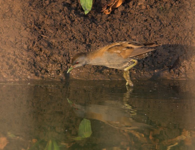
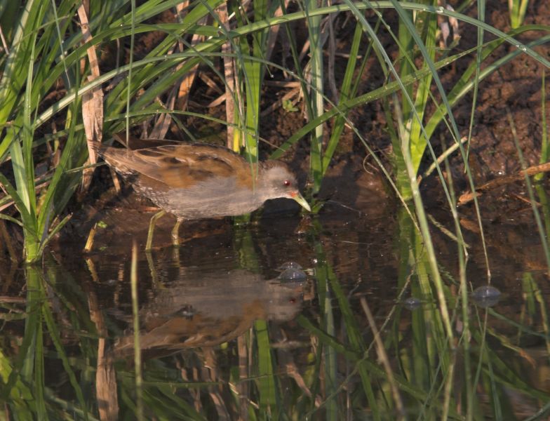
Kingdom: Animalia > Phylum: Chordata > Class: Aves > Order: Gruiformes > Family: Rallidae > Genus: Porzana > Species: Porzana parva > See subspecies
Scientific name Source
Porzana parva parva

Little Crake - Porzana parva (Scopoli, 1769)

Images from the web

Quick facts

Threat status Europe Least Concern (IUCN)
Protected by EU Birds Directive and 4 other international agreements
Natura 2000 sites 493 are designated for this species

Distribution

The distribution map is currently disabled. A new map solution will soon become available. In the meantime, please consult other species distribution map providers listed in the Other resources panel below.

Threat and conservation status

IUCN Red List status of threatened species

The IUCN Red List threat status assesses the risk of extinction.

IUCN Red List Category
Not Evaluated
Near Threatened
Regionally Extinct
Not Applicable
Vulnerable
Extinct in the Wild
Data Deficient
Endangered
Extinct
Least Concern
Critically Endangered

EU conservation status

The EU conservation status is assessed for species mentioned in the EU Habitats Directive annexes. The EU Habitats Directive does not cover this species.

Natura 2000 sites

Protected in the following Natura 2000 sites

Sitecode Country Site name Action
BE2500831 Belgium Ijzervallei Map
CY6000002 Cyprus ALYKES LARNAKAS Map
EE0040001 Estonia Väinamere Map
EE0040351 Estonia Luitemaa Map
EE0040469 Estonia Siiksaare-Oessaare Map
EE0080172 Estonia Endla Map
EE0080271 Estonia Räpina poldri Map
EE0080313 Estonia Ropka-Ihaste Map
EE0080571 Estonia Võrtsjärve Map
ES0000013 Spain Tablas de Daimiel Map
ES0000024 Spain Doñana Map
ES0000027 Spain Laguna de Medina Map
ES0000144 Spain Urdaibaiko itsasadarra / Ría de Urdaibai Map
ES0000146 Spain Delta del Llobregat Map
ES0000243 Spain Txingudi Map
ES0000272 Spain Brazo del Este Map
ES0000275 Spain Complejo Endorreico de Lebrija-Las Cabezas Map
ES0000375 Spain Esteiro do Miño Map
ES1140007 Spain Baixo Miño Map
ES2120018 Spain Txingudi-Bidasoa Map
ES2130007 Spain Urdaibaiko itsasertzak eta padurak / Zonas litorales y marismas de Urdaibai Map
ES6110001 Spain Albufera de Adra Map
ES6180002 Spain Complejo Endorreico de La Lantejuela Map
FI0100062 Finland Vanhankaupunginlahden lintuvesi Map
FI0200031 Finland Otajärvi Map
FI0301013 Finland Vähäpää Map
FI0403001 Finland Kirkkojärvi Map
FI0415001 Finland Siikalahti, Sammallampi, Rautalahti Map
FI0700007 Finland Jouhtenuslampi Map
FI0700009 Finland Peijonniemenlahti Map
FR2110091 France Étang de la Horre Map
FR2112002 France Herbages et cultures autour du lac du Der Map
FR2410003 France Brenne Map
FR4110007 France Lac de Madine et étangs de Pannes Map
FR4110060 France Etang de Lachaussée et zones voisines Map
FR4112001 France Forêts et zones humides du pays de Spincourt Map
FR4112002 France Complexe de l'étang de Lindre, forêt de Romersberg et zones voisines Map
FR4112004 France Forêt humide de la Reine et Caténa de Rangeval Map
FR4310027 France Vallons de la Drésine et de la Bonavette Map
FR5310056 France Baie d'Audierne Map
FR5410028 France Marais de Brouage-Oléron Map
FR7210030 France Côte médocaine : dunes boisées et dépression humides Map
FR9110108 France Basse plaine de l'Aude Map
FR9112001 France Camargue gardoise fluvio-lacustre Map
FR9310019 France Camargue Map
FR9312001 France Marais entre Crau et Grand Rhône Map
FR9312003 France La Durance Map
FR9312008 France Salins d'Hyères et des Pesquiers Map
FR9410097 France Iles Finocchiarola et Côte Nord Map
FR9410101 France Étang de Biguglia Map
HUBF30002 Hungary Balaton Map
HUBF30003 Hungary Kis-Balaton Map
HUBN10001 Hungary Bodrogzug–Kopasz-hegy–Taktaköz Map
HUBN10002 Hungary Borsodi-sík Map
HUBN10004 Hungary Hevesi-sík Map
HUBN10005 Hungary Kesznyéten Map
HUDD10002 Hungary Nyugat-Dráva Map
HUDD10003 Hungary Gemenc Map
HUDD10004 Hungary Béda-Karapancsa Map
HUDD10006 Hungary Pacsmagi-tavak Map
HUDD10008 Hungary Belső-Somogy Map
HUDD10012 Hungary Balatoni berkek Map
HUDI10004 Hungary Jászkarajenői puszták Map
HUDI10005 Hungary Sárvíz völgye Map
HUDI10008 Hungary Ipoly völgye Map
HUDI30002 Hungary Zámolyi-medence Map
HUFH10001 Hungary Fertő tó Map
HUFH30005 Hungary Hanság Map
HUHN10001 Hungary Szatmár-Bereg Map
HUHN10002 Hungary Hortobágy Map
HUHN10003 Hungary Bihar Map
HUKM10002 Hungary Kis-Sárrét Map
HUKN10001 Hungary Felső-kiskunsági szikes puszták és turjánvidék Map
HUKN10002 Hungary Kiskunsági szikes tavak és az őrjegi turjánvidék Map
HUKN10004 Hungary Alpár-bokrosi tisza-ártéri öblözet Map
HUKN10007 Hungary Alsó-Tisza-völgy Map
HUKN30001 Hungary Csongrád-bokrosi Sóstó Map
HUKN30003 Hungary Izsáki Kolon-tó Map
HUON10001 Hungary Őrség Map
IT1110051 Italy Peschiere e Laghi di Pralormo Map
IT1110081 Italy Monte Musiné e Laghi di Caselette Map
IT1120007 Italy Palude di S. Genuario Map
IT1120008 Italy Fontana Gigante (Tricerro) Map
IT1140001 Italy Fondo Toce Map
IT1180002 Italy Torrente Orba Map
IT1180005 Italy Ghiaia Grande (Fiume Po) Map
IT1180027 Italy Confluenza Po - Sesia - Tanaro Map
IT2010006 Italy Lago di Biandronno Map
IT2010007 Italy Palude Brabbia Map
IT2010015 Italy Palude Bruschera Map
IT2020003 Italy Palude di Albate Map
IT2020005 Italy Lago di Alserio Map
IT2030004 Italy Lago di Olginate Map
IT2030005 Italy Palude di Brivio Map
IT2040022 Italy Lago di Mezzola e Pian di Spagna Map
IT2070020 Italy Torbiere d'Iseo Map
IT2080001 Italy Garzaia di Celpenchio Map
IT2080003 Italy Garzaia della Verminesca Map
IT2080004 Italy Palude Loja Map
IT2080005 Italy Garzaia della Rinalda Map
IT2080006 Italy Garzaia di S. Alessandro Map
IT2080007 Italy Garzaia del Bosco Basso Map
IT2080009 Italy Garzaia della Cascina Notizia Map
IT2080010 Italy Garzaia di Sartirana Map
IT2080011 Italy Abbazia Acqualunga Map
IT2080014 Italy Boschi Siro Negri e Moriano Map
IT2080015 Italy San Massimo Map
IT2080016 Italy Boschi del Vignolo Map
IT2080019 Italy Boschi di Vaccarizza Map
IT2080301 Italy Boschi del Ticino Map
IT20A0001 Italy Morta di Pizzighettone Map
IT20A0002 Italy Naviglio di Melotta Map
IT20A0003 Italy Palata Menasciutto Map
IT20A0005 Italy Lanca di Gabbioneta Map
IT20B0005 Italy Torbiere di Marcaria Map
IT20B0008 Italy Paludi di Ostiglia Map
IT20B0009 Italy Valli del Mincio Map
IT20B0010 Italy Vallazza Map
IT3110034 Italy Biotopo Lago di Caldaro Map
IT3120059 Italy Palu' di Tuenno Map
IT3210003 Italy Laghetto del Frassino Map
IT3210013 Italy Palude del Busatello Map
IT3210016 Italy Palude del Brusà - Le Vallette Map
IT3220005 Italy Ex Cave di Casale - Vicenza Map
IT3220037 Italy Colli Berici Map
IT3230032 Italy Lago di Busche - Vincheto di Cellarda - Fontane Map
IT3230044 Italy Fontane di Nogare' Map
IT3240023 Italy Grave del Piave Map
IT3250016 Italy Cave di Gaggio Map
IT3250033 Italy Laguna di Caorle - Foce del Tagliamento Map
IT3250040 Italy Foce del Tagliamento Map
IT3250041 Italy Valle Vecchia - Zumelle - Valli di Bibione Map
IT3250042 Italy Valli Zignago - Perera - Franchetti - Nova Map
IT3310010 Italy Risorgive del Vinchiaruzzo Map
IT3320021 Italy Torbiera di Casasola e Andreuzza Map
IT3320026 Italy Risorgive dello Stella Map
IT3320031 Italy Paludi di Gonars Map
IT3320032 Italy Paludi di Porpetto Map
IT3320037 Italy Laguna di Marano e Grado Map
IT3330001 Italy Palude del Preval Map
IT3330005 Italy Foce dell'Isonzo - Isola della Cona Map
IT3330006 Italy Valle Cavanata e Banco Mula di Muggia Map
IT4020017 Italy Aree delle risorgive di Viarolo, Bacini di Torrile, Fascia golenale del Po Map
IT4020021 Italy Medio Taro Map
IT4030015 Italy Valli di Novellara Map
IT4040009 Italy Manzolino Map
IT4040014 Italy Valli Mirandolesi Map
IT4040015 Italy Valle di Gruppo Map
IT4050022 Italy Biotopi e Ripristini ambientali di Medicina e Molinella Map
IT4050023 Italy Biotopi e Ripristini ambientali di Budrio e Minerbio Map
IT4050024 Italy Biotopi e Ripristini ambientali di Bentivoglio, S. Pietro in Casale, Malalbergo e Baricella Map
IT4050025 Italy Biotopi e Ripristini ambientali di Crevalcore Map
IT4050026 Italy Bacini ex-zuccherificio di Argelato e Golena del Fiume Reno Map
IT4060001 Italy Valli di Argenta Map
IT4060002 Italy Valli di Comacchio Map
IT4060003 Italy Vene di Bellocchio, Sacca di Bellocchio, Foce del Fiume Reno, Pineta di Bellocchio Map
IT4060004 Italy Valle Bertuzzi, Valle Porticino - Canneviè Map
IT4060008 Italy Valle del Mezzano Map
IT4060015 Italy Bosco della Mesola, Bosco Panfilia, Bosco di Santa Giustina, Valle Falce, La Goara Map
IT4070001 Italy Punte Alberete, Valle Mandriole Map
IT4070002 Italy Bardello Map
IT4070004 Italy Pialasse Baiona, Risega e Pontazzo Map
IT4070009 Italy Ortazzo, Ortazzino, Foce del Torrente Bevano Map
IT4070021 Italy Biotopi di Alfonsine e Fiume Reno Map
IT4090002 Italy Torriana, Montebello, Fiume Marecchia Map
IT5120017 Italy Lago e Padule di Massacciuccoli Map
IT5140011 Italy Stagni della Piana Fiorentina e Pratese Map
IT5160004 Italy Padule di Bolgheri Map
IT5170002 Italy Selva Pisana Map
IT5190008 Italy Lago di Montepulciano Map
IT51A0013 Italy Padule della Trappola, Bocca d'Ombrone Map
IT51A0033 Italy Lago di Burano Map
IT5210072 Italy Palude di Colfiorito Map
IT5340001 Italy Litorale di Porto d'Ascoli Map
IT6020011 Italy Laghi Lungo e Ripasottile Map
IT6040015 Italy Parco Nazionale del Circeo Map
IT8030007 Italy Cratere di Astroni Map
IT9140003 Italy Stagni e Saline di Punta della Contessa Map
IT9140008 Italy Torre Guaceto Map
IT9150014 Italy Le Cesine Map
IT9150015 Italy Litorale di Gallipoli e Isola S. Andrea Map
ITA010001 Italy Isole dello Stagnone di Marsala Map
ITA010006 Italy Paludi di Capo Feto e Margi Spanò Map
ITA010007 Italy Saline di Trapani Map
ITA020010 Italy Isola di Ustica Map
ITA050001 Italy Biviere e Macconi di Gela Map
ITA070001 Italy Foce del Fiume Simeto e Lago Gornalunga Map
ITA090006 Italy Saline di Siracusa e Fiume Ciane Map
LTALYB001 Lithuania Metelių, Dusios ir Obelijos ežerai Map
LTALYB003 Lithuania Žuvinto, Žaltyčio ir Amalvo pelkės Map
LTKAUB008 Lithuania Kauno marios Map
LTKLAB002 Lithuania Tyrų pelkė Map
LTRADB005 Lithuania Tyrulių pelkė Map
LTROKB004 Lithuania Šaltojos ir Vyžuonos upių slėniai Map
LTSLUB001 Lithuania Nemuno delta Map
LTSVEB005 Lithuania Asvejos ežerynas Map
LTTELB001 Lithuania Biržulio ir Stervo pelkių kompleksas Map
LTVARB007 Lithuania Grybaulios žuvininkystės tvenkiniai Map
LTZARB003 Lithuania Drūkšių ežeras Map
LV0200200 Latvia Kemeru nacionalais parks Map
LV0301700 Latvia Piejura Map
LV0302800 Latvia Engures ezers Map
LV0302900 Latvia Dvietes paliene Map
LV0303200 Latvia Svetes paliene Map
LV0303500 Latvia Pape Map
LV0304200 Latvia Kuja Map
LV0504700 Latvia Viku purvs Map
LV0507800 Latvia Liepajas ezers Map
LV0509100 Latvia Randu plavas Map
LV0513100 Latvia Babites ezers Map
LV0523100 Latvia Lielupes palienes plavas Map
LV0525600 Latvia Zvarde Map
LV0526800 Latvia Sedas purvs Map
LV0527300 Latvia Tasu ezers Map
LV0528700 Latvia Melna ezera purvs Map
LV0532400 Latvia Asunes ezeri Map
LV0536000 Latvia Uzavas augstece Map
LV0600300 Latvia Augszeme Map
LV0600400 Latvia Augsdaugava Map
LV0600800 Latvia Adazi Map
MT0000006 Malta Is-Simar (limiti ta' San Pawl il-Baħar) Map
PLB020001 Poland Dolina Baryczy Map
PLB020002 Poland Grądy Odrzańskie Map
PLB020003 Poland Stawy Przemkowskie Map
PLB040001 Poland Błota Rakutowskie Map
PLB040002 Poland Bagienna Dolina Drwęcy Map
PLB040004 Poland Ostoja Nadgoplańska Map
PLB060001 Poland Bagno Bubnów Map
PLB060002 Poland Chełmskie Torfowiska Węglanowe Map
PLB060003 Poland Dolina Środkowego Bugu Map
PLB060004 Poland Dolina Tyśmienicy Map
PLB060005 Poland Lasy Janowskie Map
PLB060008 Poland Puszcza Solska Map
PLB080001 Poland Puszcza Barlinecka Map
PLB100001 Poland Pradolina Warszawsko-Berlińska Map
PLB140001 Poland Dolina Dolnego Bugu Map
PLB140002 Poland Dolina Liwca Map
PLB140003 Poland Dolina Pilicy Map
PLB140004 Poland Dolina Środkowej Wisły Map
PLB140005 Poland Doliny Omulwi i Płodownicy Map
PLB180001 Poland Pogórze Przemyskie Map
PLB200001 Poland Bagienna Dolina Narwi Map
PLB200002 Poland Puszcza Augustowska Map
PLB200003 Poland Puszcza Knyszyńska Map
PLB220004 Poland Ujście Wisły Map
PLB220005 Poland Zatoka Pucka Map
PLB240001 Poland Dolina Górnej Wisły Map
PLB260001 Poland Dolina Nidy Map
PLB280001 Poland Bagna Nietlickie Map
PLB280002 Poland Dolina Pasłęki Map
PLB280003 Poland Jezioro Łuknajno Map
PLB280004 Poland Jezioro Oświn i okolice Map
PLB280005 Poland Lasy Iławskie Map
PLB280006 Poland Puszcza Borecka Map
PLB280007 Poland Puszcza Napiwodzko-Ramucka Map
PLB280008 Poland Puszcza Piska Map
PLB280010 Poland Zalew Wiślany Map
PLB300001 Poland Dolina Środkowej Noteci i Kanału Bydgoskiego Map
PLB300002 Poland Dolina Środkowej Warty Map
PLB300003 Poland Nadnoteckie Łęgi Map
PLB300004 Poland Wielki Łęg Obrzański Map
PLB300005 Poland Zbiornik Wonieść Map
PLB320001 Poland Bagna Rozwarowskie Map
PLB320003 Poland Dolina Dolnej Odry Map
PLB320005 Poland Jezioro Miedwie i okolice Map
PLB320006 Poland Jezioro Świdwie Map
PLB320007 Poland Łąki Skoszewskie Map
PLC140001 Poland Puszcza Kampinoska Map
PLC200004 Poland Puszcza Białowieska Map
SI5000002 Slovenia Snežnik - Pivka Map
SI5000010 Slovenia Mura Map
SI5000011 Slovenia Drava Map
SI5000015 Slovenia Cerkniško jezero Map
SKCHVU008 Slovakia Horna Orava Map
SKCHVU015 Slovakia Medzibodrozie Map
SKCHVU020 Slovakia Parizske mociare Map
SKCHVU021 Slovakia Poiplie Map
ES4250010 Spain Humedales de La Mancha Map
ITA010028 Italy Stagnone di Marsala e Saline di Trapani - area marina e terrestre Map
IT2040042 Italy Pian di Spagna e Lago di Mezzola Map
PLB300015 Poland Puszcza Notecka Map
PLB180005 Poland Puszcza Sandomierska Map
IT2010022 Italy Alnete del Lago di Varese Map
IT9140005 Italy Torre Guaceto e Macchia S. Giovanni Map
FR9112016 France Étang de Capestang Map
IT7222248 Italy Lago di Occhito Map
IT7222267 Italy Località Fantina - Fiume Fortore Map
PLB060011 Poland Ostoja Tyszowiecka Map
BG0000270 Bulgaria Atanasovsko ezero Map
PLB320018 Poland Jeziora Wełtyńskie Map
IT9320095 Italy Foce Neto Map
ES5120008 Spain Estany de Banyoles Map
IT5220011 Italy Zona umida di Alviano Map
IT9110015 Italy Duna e Lago di Lesina - Foce del Fortore Map
IT9120011 Italy Valle Ofanto - Lago di Capaciotti Map
FR7412002 France Étang des Landes Map
FR4112009 France Forêts et étangs d'Argonne et vallée de l'Ornain Map
IT3341002 Italy Aree Carsiche della Venezia Giulia Map
IT20A0018 Italy Cave Danesi Map
ITA050012 Italy Torre Manfria, Biviere e Piana di Gela Map
IT20B0501 Italy Viadana, Portiolo, San Benedetto Po e Ostiglia Map
PLB300011 Poland Pojezierze Sławskie Map
LTRADB004 Lithuania Sulinkių durpynas Map
IT4020025 Italy Parma Morta Map
FR9312020 France Marais de Manteyer Map
BG0000241 Bulgaria Srebarna Map
IT6040012 Italy Laghi Fogliano, Monaci, Caprolace e Pantani dell'Inferno Map
PLB320019 Poland Ostoja Drawska Map
BG0002046 Bulgaria Yatata Map
IT1180028 Italy Fiume Po - tratto vercellese alessandrino Map
IT3250046 Italy Laguna di Venezia Map
BG0002114 Bulgaria Ribarnitsi Chelopechene Map
IT9220095 Italy Costa Ionica Foce Cavone Map
PLC080001 Poland Ujście Warty Map
PLB060019 Poland Polesie Map
BG0002086 Bulgaria Orizishta Tsalapitsa Map
IT3240030 Italy Grave del Piave - Fiume Soligo - Fosso di Negrisia Map
ES4250009 Spain Yesares del valle del Tajo Map
BG0002041 Bulgaria Kompleks Ropotamo Map
IT20B0401 Italy Parco Regionale Oglio Sud Map
BG0002028 Bulgaria Kompleks Straldzha Map
PLB020005 Poland Bory Dolnośląskie Map
LTSALB003 Lithuania Baltosios Vokės šlapžemės Map
IT7228221 Italy Foce Trigno - Marina di Petacciato Map
LTTAUB003 Lithuania Visbarų žuvininkystės tvenkiniai Map
ITA030036 Italy Riserva naturale del Fiume Alcantara Map
FR2212003 France Marais arrière-littoraux picards Map
PLB060012 Poland Roztocze Map
IT5210018 Italy Lago Trasimeno Map
LV0528400 Latvia Gipkas lankas Map
IT20A0020 Italy Gabbioneta Map
LV0524600 Latvia Jaunciems Map
IT4030023 Italy Fontanili di Gattatico e Fiume Enza Map
PLB280012 Poland Jezioro Dobskie Map
BG0002030 Bulgaria Kompleks Kalimok Map
PLB060013 Poland Dolina Górnej Łabuńki Map
ITA070029 Italy Biviere di Lentini, tratto mediano e foce del Fiume Simeto e area antistante la foce Map
IT20B0014 Italy Chiavica del Moro Map
PLB060014 Poland Uroczysko Mosty-Zahajki Map
BG0000242 Bulgaria Zaliv Chengene skele Map
ITA010018 Italy Foce del Torrente Calatubo e dune Map
BG0002006 Bulgaria Ribarnitsi Orsoya Map
PLB060020 Poland Ostoja Nieliska Map
IT9150011 Italy Alimini Map
BG0002048 Bulgaria Suha reka Map
IT1160059 Italy Zone umide di Fossano e Sant'Albano Stura Map
LTIGNB001 Lithuania Birvėtos šlapžemės Map
IT9320302 Italy Marchesato e Fiume Neto Map
LTROKB001 Lithuania Čedaso ežeras ir jo apyežerės Map
PLB060017 Poland Zlewnia Górnej Huczwy Map
PLB200007 Poland Dolina Górnej Narwi Map
PLB280014 Poland Ostoja Poligon Orzysz Map
PLB320016 Poland Lasy Puszczy nad Drawą Map
IT9150032 Italy Le Cesine Map
FR9312025 France Basse Vallée du Var Map
IT7228229 Italy Valle Biferno dalla diga a Guglionesi Map
BG0002040 Bulgaria Strandzha Map
IT7222247 Italy Valle Biferno da confluenza Torrente Quirino al Lago Guardalfiera - Torrente Rio Map
PLB060015 Poland Zbiornik Podedwórze Map
LTKLAB009 Lithuania Svencelės pievos Map
IT4020022 Italy Basso Taro Map
IT2080501 Italy Risaie della Lomellina Map
IT7212128 Italy Fiume Volturno dalle sorgenti al Fiume Cavaliere Map
PLB200006 Poland Ostoja Biebrzańska Map
PLB140014 Poland Dolina Dolnej Narwi Map
IT7222249 Italy Lago di Guardialfiera - M. Peloso Map
IT3340006 Italy Carso Triestino e Goriziano Map
FR9112006 France Étang de Lapalme Map
IT1332717 Italy Foce e medio corso del Fiume Entella Map
BG0000273 Bulgaria Burgasko ezero Map
PLB060018 Poland Dolina Szyszły Map
PLB140013 Poland Ostoja Kozienicka Map
IT3230088 Italy Fiume Piave dai Maserot alle grave di Pederobba Map
IT20A0013 Italy Lanca di Gerole Map
PLB300006 Poland Dolina Małej Wełny pod Kiszkowem Map
IT20B0017 Italy Ansa e Valli del Mincio Map
IT3311001 Italy Magredi di Pordenone Map
IT20B0016 Italy Ostiglia Map
BG0002001 Bulgaria Rayanovtsi Map
FR3112003 France Marais Audomarois Map
PLB060021 Poland Dolina Sołokiji Map
IT6030023 Italy Macchia Grande di Focene e Macchia dello Stagneto Map
PLB140008 Poland Doliny Wkry i Mławki Map
IT1120029 Italy Palude di San Genuario e San Silvestro Map
IT20A0014 Italy Lancone di Gussola Map
IT6040013 Italy Lago di Sabaudia Map
BG0000113 Bulgaria Vitosha Map
PLB300012 Poland Puszcza nad Gwdą Map
LV0530800 Latvia Lielupes grivas plavas Map
LTVLNB001 Lithuania Kazimieravo šlapžemės Map
IT1343502 Italy Parco della Magra - Vara Map
IT1345101 Italy Piana del Magra Map
CY4000007 Cyprus XEROS POTAMOS Map
PLB080002 Poland Dolina Dolnej Noteci Map
IT2090502 Italy Garzaie del Parco Adda Sud Map
IT7222216 Italy Foce Biferno - Litorale di Campomarino Map
IT20A0402 Italy Riserva Regionale Lanca di Gerole Map
LTMAZB001 Lithuania Plinkšių miškas Map
IT2010502 Italy Canneti del Lago Maggiore Map
BG0002096 Bulgaria Obnova Map
PLB140009 Poland Dolina Kostrzynia Map
PLB280015 Poland Ostoja Warmińska Map
IT1160054 Italy Fiume Tanaro e Stagni di Neive Map
FR8212024 France Plaine du Forez Map
BG0000152 Bulgaria Pomoriysko ezero Map
ROSPA0049 Romania Iazurile de pe valea Ibănesei - Bașeului - Podrigăi Map
ROSPA0053 Romania Lacul Bugeac Map
ROSPA0022 Romania Comana Map
ROSPA0041 Romania Eleșteiele Iernut - Cipău Map
ROSPA0015 Romania Câmpia Crișului Alb și Crișului Negru Map
ROSPA0011 Romania Blahnița Map
ROSPA0010 Romania Bistreț Map
ROSPA0059 Romania Lacul Strachina Map
ROSPA0050 Romania Iazurile Miheșu de Câmpie - Tăureni Map
ROSPA0014 Romania Câmpia Cermeiului Map
ROSPA0004 Romania Balta Albă - Amara - Jirlău Map
ROSPA0040 Romania Dunărea Veche - Brațul Măcin Map
ROSPA0104 Romania Bazinul Fizeșului Map
ROSPA0044 Romania Grădiștea - Căldărușani - Dridu Map
ROSPA0039 Romania Dunăre - Ostroave Map
ROSPA0037 Romania Dumbrăvița - Rotbav - Măgura Codlei Map
ROSPA0031 Romania Delta Dunării și Complexul Razim - Sinoie Map
ROSPA0099 Romania Podișul Hârtibaciului Map
ROSPA0012 Romania Brațul Borcea Map
ROSPA0077 Romania Măxineni Map
ROSPA0027 Romania Dealurile Homoroadelor Map
ROSPA0007 Romania Balta Vederoasa Map
BG0002051 Bulgaria Kaliakra Map
BG0002050 Bulgaria Durankulashko ezero Map
BG0000156 Bulgaria Shablenski ezeren kompleks Map
BG0000191 Bulgaria Varnensko-Beloslavsko ezero Map
BG0002077 Bulgaria Bakarlaka Map
BG0000271 Bulgaria Mandra - Poda Map
BG0002045 Bulgaria Kompleks Kamchia Map
LV0536600 Latvia Lubana mitrajs Map
PLB160004 Poland Zbiornik Turawa Map
PLB280013 Poland Jezioro Drużno Map
PLB100002 Poland Zbiornik Jeziorsko Map
PLB060016 Poland Staw Boćków Map
PLB160003 Poland Zbiornik Otmuchowski Map
PLB140011 Poland Bagno Całowanie Map
PLB240003 Poland Stawy Wielikąt i Las Tworkowski Map
PLB200005 Poland Bagno Wizna Map
ES6180017 Spain Campiñas de Sevilla Map
ES1200006 Spain Ría de Villaviciosa Map
CY3000008 Cyprus LIMNI PARALIMNIOU Map
CY3000007 Cyprus FRAGMA ACHNAS Map
LTZARB005 Lithuania Sartų regioninis parkas Map
LTKALB001 Lithuania Kalvarijos apylinkės Map
PLB200008 Poland Przełomowa Dolina Narwi Map
AT2111000 Austria Völkermarkter Stausee Map
AT2124000 Austria Untere Lavant Map
AT1123323 Austria Mattersburger Hügelland Map
AT2114000 Austria Obere Drau Map
AT3113000 Austria Untere Traun Map
AT2117000 Austria Turner See Map
AT1204V00 Austria Donau-Auen östlich von Wien Map
AT2205000 Austria Pürgschachen-Moos und ennsnahe Bereiche zwischen Selzthal und dem Gesäuseeingang Map
AT1301000 Austria Nationalpark Donau-Auen (Wiener Teil) Map
AT2116000 Austria Görtschacher Moos - Obermoos im Gailtal Map
AT2126000 Austria Tiebelmündung - Bleistätter Moor Map
AT2103000 Austria Hörfeld Moor - Kärntner Anteil Map
AT1110137 Austria Neusiedler See - Nordöstliches Leithagebirge Map
AT1216V00 Austria Tullnerfelder Donau-Auen Map
AT2212000 Austria Wörschacher Moos und ennsnahe Bereiche Map
AT1202V00 Austria March-Thaya-Auen Map
AT2104000 Austria Sablatnig Moor Map
AT2229002 Austria Ennstal zwischen Liezen und Niederstuttern Map
AT3402000 Austria Rheindelta Map
AT2113000 Austria Flachwasserbiotop Neudenstein Map
ROSPA0143 Romania Tisa Superioară Map
ROSPA0140 Romania Scroviștea Map
IT2030008 Italy Il Toffo Map
IT51A0039 Italy Padule della Trappola, Bocca d'Ombrone Map
HR1000016 Croatia Podunavlje i donje Podravlje Map
HR1000010 Croatia Poilovlje s ribnjacima Map
HR1000033 Croatia Kvarnerski otoci Map
HR1000026 Croatia Krka i okolni plato Map
HR1000004 Croatia Donja Posavina Map
HR1000001 Croatia Pokupski bazen Map
HR1000009 Croatia Ribnjaci uz Česmu Map
HR1000023 Croatia SZ Dalmacija i Pag Map
HR1000005 Croatia Jelas polje Map
HR1000031 Croatia Delta Neretve Map
HR1000011 Croatia Ribnjaci Grudnjak i Našice Map
HR1000025 Croatia Vransko jezero i Jasen Map
IT4020027 Italy Cronovilla Map
PLB100003 Poland Doliny Przysowy i Słudwi Map
SI5000027 Slovenia Črete Map
ROSPA0164 Romania Pescăria Nădlac Map
ROSPA0161 Romania Lunca Mijlocie a Argeșului Map
CY4000025 Cyprus ZONI EIDIKIS PROSTASIAS XEROY POTAMOU Map
IT5180019 Italy Vasche dell'ex-zuccherificio di Castiglion Fiorentino e Colmata di Brolio Map

Protected sites

Please note the site map takes a while to display.

Legal status

Legal text Annex Conditions More information
Directive 2009/147/EC of the European Parliament and of the Council, of 30 November 2009, on the conservation of wild birds (EU Birds Directive) http://ec.europa.eu/environm...rective/index_en.htm
Convention on the conservation of European wildlife and natural habitats (Bern Convention) http://www.coe.int/t/dg4/cul.../bern/default_en.asp
https://wcd.coe.int/ViewDoc....ckColorLogged=FDC864

Resolution No. 6 (1998) of the Bern Convention lists the species requiring specific habitat conservation measures [and the designation of Areas of Special Conservation Interest (ASCIs) forming for the Emerald network]
Convention on the Conservation of Migratory Species of Wild Animals. (Bonn Convention) (Porzana parva parva) http://www.cms.int/
Agreement on the Conservation of African-Eurasian Migratory Waterbirds. Convention on Migratory Species of Wild Animals. (AEWA) http://www.migratoryspecies....ent/about-cms-family

http://www.unep-aewa.org/en/legalinstrument/aewa

Common names and synonyms

Common Name Language Reference
Franga-d'água-bastarda Portuguese Hagemeijer, W.J.M. & Blair, M.J.
Kis vízicsibe Hungarian Hagemeijer, W.J.M. & Blair, M.J.
Klein Waterhoen Dutch Hagemeijer, W.J.M. & Blair, M.J.
Kleines Sumpfhuhn German Hagemeijer, W.J.M. & Blair, M.J.
Lille rørvagtel Danish EC-DGXI.d2, ETC/NC
Little Crake English Hagemeijer, W.J.M. & Blair, M.J.
Marouette poussin French Hagemeijer, W.J.M. & Blair, M.J.
Mazais ormanitis Latvian Latvian NRC
Mindre sumphöna Swedish Hagemeijer, W.J.M. & Blair, M.J.
Pikkuhuitti Finnish Hagemeijer, W.J.M. & Blair, M.J.
Polluela Bastarda Spanish Hagemeijer, W.J.M. & Blair, M.J.
Schiribilla Italian Hagemeijer, W.J.M. & Blair, M.J.
Zielonka Polish Hagemeijer, W.J.M. & Blair, M.J.
Synonym Author
Zapornia parva (Scopoli, 1769)
Porzana parva parva

Other resources

CoL (accepted name) Catalogue of Life
EBCC Atlas of breeding birds European Bird Census Council's Atlas of Breeding Birds
EURing code:04100 European bird-ringing
EoL Encyclopedia of Life
Fauna Europaea Fauna Europaea
GBIF Global Biodiversity Information Facility
ITIS (Valid name) Interagency Taxonomic Information System
NCBI search National Center for Biotechnology Information
PESI (Accepted) Pan-European Species directories Infrastructure
Wikipedia Wikipedia

External data

Population distribution from "Birds in Europe" editions 1 and 2

These publications present a thorough and detailed review of the conservation status of European birds. Based on detailed breeding and wintering population data collected in each country, the report provides a review of the population sizes and trends of Species of European Conservation Concern.

47 items found, displaying all items.1
Country Biogeographic region Min / Max (Units) Period Status Quality Source Published
Austria 12000/22000 (pairs) 1998-2002 Breeding Species generally well known, but only poor or incomplete quantitative data available Birds in Europe 2 (1990-2000) 2004-01-01
Austria 4000/6000 (pairs) - Breeding Species generally well known, but only poor or incomplete quantitative data available Birds in Europe 1 (1970-1990) 1994-01-01
Azerbaijan 50/500 (pairs) 1996-2000 Breeding Reliable quantitative data (e.g. atlas survey or monitoring data, etc.) are available for the whole period and region in question Birds in Europe 2 (1990-2000) 2004-01-01
Belarus 2000/3000 (pairs) 1997-2002 Breeding Species generally well known, but only poor or incomplete quantitative data available Birds in Europe 2 (1990-2000) 2004-01-01
Belarus 2000/3000 (pairs) 1990 Breeding Species poorly known, with no quantitative data available Birds in Europe 1 (1970-1990) 1994-01-01
Bulgaria 100/300 (pairs) 1996-2002 Breeding Species generally well known, but only poor or incomplete quantitative data available Birds in Europe 2 (1990-2000) 2004-01-01
Croatia 100/500 (pairs) 2002 Breeding Reliable quantitative data (e.g. atlas survey or monitoring data, etc.) are available for the whole period and region in question Birds in Europe 2 (1990-2000) 2004-01-01
Croatia 100/150 (pairs) - Breeding No qualification Birds in Europe 1 (1970-1990) 1994-01-01
Czech Republic 15/30 (pairs) 2000 Breeding Species poorly known, with no quantitative data available Birds in Europe 2 (1990-2000) 2004-01-01
Czech Republic Continental 4/8 (pairs) - Breeding Species generally well known, but only poor or incomplete quantitative data available Birds in Europe 1 (1970-1990) 1994-01-01
Estonia 20/50 (pairs) 1998 Breeding Reliable quantitative data (e.g. atlas survey or monitoring data, etc.) are available for the whole period and region in question Birds in Europe 2 (1990-2000) 2004-01-01
Estonia Boreal 10/20 (pairs) - Breeding Species generally well known, but only poor or incomplete quantitative data available Birds in Europe 1 (1970-1990) 1994-01-01
Finland 1/10 (pairs) 1998-2002 Breeding Species generally well known, but only poor or incomplete quantitative data available Birds in Europe 2 (1990-2000) 2004-01-01
France 3/10 (pairs) 1998-2000 Breeding Species generally well known, but only poor or incomplete quantitative data available Birds in Europe 2 (1990-2000) 2004-01-01
France 10/100 (pairs) 1976 Breeding Species generally well known, but only poor or incomplete quantitative data available Birds in Europe 1 (1970-1990) 1994-01-01
Georgia Present/Present (pairs) 2003 Breeding Reliable quantitative data (e.g. atlas survey or monitoring data, etc.) are available for the whole period and region in question Birds in Europe 2 (1990-2000) 2004-01-01
Germany 50/100 (pairs) 1995-1999 Breeding Species generally well known, but only poor or incomplete quantitative data available Birds in Europe 2 (1990-2000) 2004-01-01
Greece 10/50 (pairs) 1995-2000 Breeding Reliable quantitative data (e.g. atlas survey or monitoring data, etc.) are available for the whole period and region in question Birds in Europe 2 (1990-2000) 2004-01-01
Greece 100/500 (individuals) 1995-2000 Wintering Reliable quantitative data (e.g. atlas survey or monitoring data, etc.) are available for the whole period and region in question Birds in Europe 2 (1990-2000) 2004-01-01
Greece Mediterranean 10/50 (pairs) - Breeding Species poorly known, with no quantitative data available Birds in Europe 1 (1970-1990) 1994-01-01
Hungary 0/49 (individuals) 1990-2000 Wintering Reliable quantitative data (e.g. atlas survey or monitoring data, etc.) are available for the whole period and region in question Birds in Europe 2 (1990-2000) 2004-01-01
Hungary 3000/5000 (pairs) 1990-1993 Breeding Reliable quantitative data (e.g. atlas survey or monitoring data, etc.) are available for the whole period and region in question Birds in Europe 2 (1990-2000) 2004-01-01
Italy 20/60 (pairs) 2003 Breeding Reliable quantitative data (e.g. atlas survey or monitoring data, etc.) are available for the whole period and region in question Birds in Europe 2 (1990-2000) 2004-01-01
Italy 20/50 (pairs) - Breeding Species poorly known, with no quantitative data available Birds in Europe 1 (1970-1990) 1994-01-01
Latvia 50/200 (pairs) 1990-2000 Breeding Reliable quantitative data (e.g. atlas survey or monitoring data, etc.) are available for the whole period and region in question Birds in Europe 2 (1990-2000) 2004-01-01
Latvia Boreal 50/100 (pairs) - Breeding Species generally well known, but only poor or incomplete quantitative data available Birds in Europe 1 (1970-1990) 1994-01-01
Lithuania 250/400 (pairs) 1999-2001 Breeding Species generally well known, but only poor or incomplete quantitative data available Birds in Europe 2 (1990-2000) 2004-01-01
Macedonia (FYR) 0/49 (pairs) 1990-2000 Breeding Reliable quantitative data (e.g. atlas survey or monitoring data, etc.) are available for the whole period and region in question Birds in Europe 2 (1990-2000) 2004-01-01
Moldova, Republic of 0/10 (individuals) 1990-2000 Wintering Species poorly known, with no quantitative data available Birds in Europe 2 (1990-2000) 2004-01-01
Moldova, Republic of 150/200 (pairs) 1990-2000 Breeding Species generally well known, but only poor or incomplete quantitative data available Birds in Europe 2 (1990-2000) 2004-01-01
Moldova, Republic of 150/250 (pairs) 1988 Breeding Species generally well known, but only poor or incomplete quantitative data available Birds in Europe 1 (1970-1990) 1994-01-01
Poland 1200/1800 (pairs) 1995-2000 Breeding Species generally well known, but only poor or incomplete quantitative data available Birds in Europe 2 (1990-2000) 2004-01-01
Romania 5000/8000 (pairs) 1990-2002 Breeding Reliable quantitative data (e.g. atlas survey or monitoring data, etc.) are available for the whole period and region in question Birds in Europe 2 (1990-2000) 2004-01-01
Romania 3000/6000 (pairs) - Breeding Species poorly known, with no quantitative data available Birds in Europe 1 (1970-1990) 1994-01-01
Russian Federation 10000/50000 (pairs) 1990-2000 Breeding Reliable quantitative data (e.g. atlas survey or monitoring data, etc.) are available for the whole period and region in question Birds in Europe 2 (1990-2000) 2004-01-01
Russian Federation 10000/100000 (pairs) - Breeding Species poorly known, with no quantitative data available Birds in Europe 1 (1970-1990) 1994-01-01
Serbia and Montenegro 400/600 (pairs) 1990-2002 Breeding Reliable quantitative data (e.g. atlas survey or monitoring data, etc.) are available for the whole period and region in question Birds in Europe 2 (1990-2000) 2004-01-01
Slovakia 70/150 (pairs) 1980-1999 Breeding Species generally well known, but only poor or incomplete quantitative data available Birds in Europe 2 (1990-2000) 2004-01-01
Slovakia 70/150 (pairs) - Breeding Species poorly known, with no quantitative data available Birds in Europe 1 (1970-1990) 1994-01-01
Slovenia 10/20 (pairs) 1990-2000 Breeding Species generally well known, but only poor or incomplete quantitative data available Birds in Europe 2 (1990-2000) 2004-01-01
Slovenia 1/5 (pairs) - Breeding Species poorly known, with no quantitative data available Birds in Europe 1 (1970-1990) 1994-01-01
Sweden 1/10 (pairs) - Breeding Species generally well known, but only poor or incomplete quantitative data available Birds in Europe 1 (1970-1990) 1994-01-01
Switzerland 0/10 (pairs) 1993-1996 Breeding Species poorly known, with no quantitative data available Birds in Europe 2 (1990-2000) 2004-01-01
Turkey 10/100 (pairs) 2001 Breeding Reliable quantitative data (e.g. atlas survey or monitoring data, etc.) are available for the whole period and region in question Birds in Europe 2 (1990-2000) 2004-01-01
Ukraine 26000/43000 (pairs) 1990-2000 Breeding Species generally well known, but only poor or incomplete quantitative data available Birds in Europe 2 (1990-2000) 2004-01-01
Ukraine 0/49 (individuals) 1990-2000 Wintering Reliable quantitative data (e.g. atlas survey or monitoring data, etc.) are available for the whole period and region in question Birds in Europe 2 (1990-2000) 2004-01-01
Ukraine 3500/4000 (pairs) 1988 Breeding Species poorly known, with no quantitative data available Birds in Europe 1 (1970-1990) 1994-01-01
Source: BirdLife International

Population trends from "Birds in Europe" editions 1 and 2

These publications present a thorough and detailed review of the conservation status of European birds. Based on detailed breeding and wintering population data collected in each country, the report provides a review of the population sizes and trends of Species of European Conservation Concern.

47 items found, displaying all items.1
Country Biogeographic region Period Status Trend Quality Source Published
Austria 1990-2000 Breeding Stable between 0% to 19% Species poorly known, with no quantitative data available Birds in Europe 2 (1990-2000) 2004
Austria 1970-1990 Breeding Stable, or change of less than 20% Species generally well known, but only poor or incomplete quantitative data available Birds in Europe 1 (1970-1990) 1994
Azerbaijan 1990-2000 Breeding Unknown Species poorly known, with no quantitative data available Birds in Europe 2 (1990-2000) 2004
Belarus 1990-2000 Breeding Stable between 0% to 19% Species generally well known, but only poor or incomplete quantitative data available Birds in Europe 2 (1990-2000) 2004
Belarus 1970-1990 Breeding Fluctuating with changes of at least 20%, but no clear trend Species poorly known, with no quantitative data available Birds in Europe 1 (1970-1990) 1994
Bulgaria 1990-2000 Breeding Stable between 0% to 19% Species poorly known, with no quantitative data available Birds in Europe 2 (1990-2000) 2004
Croatia 1990-2000 Breeding Stable between 0% to 19% Species poorly known, with no quantitative data available Birds in Europe 2 (1990-2000) 2004
Croatia 1970-1990 Breeding Small decrease of 20-49% No qualification Birds in Europe 1 (1970-1990) 1994
Czech Republic 1990-2000 Breeding Increasing : 80 % Reliable quantitative data (e.g. atlas survey or monitoring data, etc.) are available for the whole period and region in question Birds in Europe 2 (1990-2000) 2004
Czech Republic Continental 1970-1990 Breeding Small decrease of 20-49% Species generally well known, but only poor or incomplete quantitative data available Birds in Europe 1 (1970-1990) 1994
Estonia 1990-2000 Breeding Unknown Species poorly known, with no quantitative data available Birds in Europe 2 (1990-2000) 2004
Estonia Boreal 1970-1990 Breeding Large decrease of at least 50% Species poorly known, with no quantitative data available Birds in Europe 1 (1970-1990) 1994
Finland 1990-2000 Breeding Fluctuating : 80 % Species generally well known, but only poor or incomplete quantitative data available Birds in Europe 2 (1990-2000) 2004
France 1990-2000 Breeding Stable between 0% to 19% Species poorly known, with no quantitative data available Birds in Europe 2 (1990-2000) 2004
France 1970-1990 Breeding Large decrease of at least 50% Species generally well known, but only poor or incomplete quantitative data available Birds in Europe 1 (1970-1990) 1994
Georgia 1990-2000 Breeding Unknown Species poorly known, with no quantitative data available Birds in Europe 2 (1990-2000) 2004
Germany 1990-2000 Breeding Decreasing between 20% to 29% Species generally well known, but only poor or incomplete quantitative data available Birds in Europe 2 (1990-2000) 2004
Greece 1990-2000 Breeding Stable between 0% to 19% Species poorly known, with no quantitative data available Birds in Europe 2 (1990-2000) 2004
Greece 1990-2000 Wintering Stable between 0% to 19% Species poorly known, with no quantitative data available Birds in Europe 2 (1990-2000) 2004
Greece Mediterranean 1970-1990 Breeding Stable, or change of less than 20% Species poorly known, with no quantitative data available Birds in Europe 1 (1970-1990) 1994
Hungary 1990-2000 Wintering Fluctuating : 80 % Species generally well known, but only poor or incomplete quantitative data available Birds in Europe 2 (1990-2000) 2004
Hungary 1990-2000 Breeding Stable between 0% to 19% Species poorly known, with no quantitative data available Birds in Europe 2 (1990-2000) 2004
Italy 1990-2000 Breeding Unknown Species poorly known, with no quantitative data available Birds in Europe 2 (1990-2000) 2004
Italy 1970-1990 Breeding Small decrease of 20-49% Species poorly known, with no quantitative data available Birds in Europe 1 (1970-1990) 1994
Latvia 1990-2000 Breeding Stable between 0% to 19% Species poorly known, with no quantitative data available Birds in Europe 2 (1990-2000) 2004
Latvia Boreal 1970-1990 Breeding Small decrease of 20-49% Species generally well known, but only poor or incomplete quantitative data available Birds in Europe 1 (1970-1990) 1994
Lithuania 1990-2000 Breeding Increasing between 20% to 29% Species poorly known, with no quantitative data available Birds in Europe 2 (1990-2000) 2004
Macedonia (FYR) 1990-2000 Breeding Stable between 0% to 19% Species poorly known, with no quantitative data available Birds in Europe 2 (1990-2000) 2004
Moldova, Republic of 1990-2000 Wintering Increasing between 0% to 19% Reliable quantitative data (e.g. atlas survey or monitoring data, etc.) are available for the whole period and region in question Birds in Europe 2 (1990-2000) 2004
Moldova, Republic of 1990-2000 Breeding Increasing between 0% to 19% Species poorly known, with no quantitative data available Birds in Europe 2 (1990-2000) 2004
Moldova, Republic of 1970-1990 Breeding Small decrease of 20-49% Species generally well known, but only poor or incomplete quantitative data available Birds in Europe 1 (1970-1990) 1994
Poland 1990-2000 Breeding Stable between 0% to 19% Species poorly known, with no quantitative data available Birds in Europe 2 (1990-2000) 2004
Romania 1990-2000 Breeding Stable between 0% to 19% Species poorly known, with no quantitative data available Birds in Europe 2 (1990-2000) 2004
Romania 1970-1990 Breeding Small decrease of 20-49% Species poorly known, with no quantitative data available Birds in Europe 1 (1970-1990) 1994
Russian Federation 1990-2000 Breeding Unknown Species poorly known, with no quantitative data available Birds in Europe 2 (1990-2000) 2004
Russian Federation 1970-1990 Breeding Small increase of 20-49% Species poorly known, with no quantitative data available Birds in Europe 1 (1970-1990) 1994
Serbia and Montenegro 1990-2000 Breeding Stable between 0% to 19% Species poorly known, with no quantitative data available Birds in Europe 2 (1990-2000) 2004
Slovakia 1990-2000 Breeding Decreasing between 30% to 49% Species generally well known, but only poor or incomplete quantitative data available Birds in Europe 2 (1990-2000) 2004
Slovakia 1970-1990 Breeding Small decrease of 20-49% Species poorly known, with no quantitative data available Birds in Europe 1 (1970-1990) 1994
Slovenia 1990-2000 Breeding Fluctuating : 80 % Species generally well known, but only poor or incomplete quantitative data available Birds in Europe 2 (1990-2000) 2004
Slovenia 1970-1990 Breeding Large decrease of at least 50% Species poorly known, with no quantitative data available Birds in Europe 1 (1970-1990) 1994
Sweden 1970-1990 Breeding Small decrease of 20-49% Reliable quantitative data (e.g. atlas survey or monitoring data, etc.) are available for the whole period and region in question Birds in Europe 1 (1970-1990) 1994
Switzerland 1990-2000 Breeding Stable between 0% to 19% Species poorly known, with no quantitative data available Birds in Europe 2 (1990-2000) 2004
Turkey 1990-2000 Breeding Decreasing Species poorly known, with no quantitative data available Birds in Europe 2 (1990-2000) 2004
Ukraine 1990-2000 Wintering Stable between 0% to 19% Species poorly known, with no quantitative data available Birds in Europe 2 (1990-2000) 2004
Ukraine 1990-2000 Breeding Decreasing between 0% to 19% Species generally well known, but only poor or incomplete quantitative data available Birds in Europe 2 (1990-2000) 2004
Ukraine 1970-1990 Breeding Large decrease of at least 50% Reliable quantitative data (e.g. atlas survey or monitoring data, etc.) are available for the whole period and region in question Birds in Europe 1 (1970-1990) 1994
Source: BirdLife International
European Environment Agency (EEA)
Kongens Nytorv 6
1050 Copenhagen K
Denmark
Phone: +45 3336 7100