Natura 2000 related content is now shown on the Biodiversity Information System for Europe, BISE. Please go to BISE or use the Natura 2000 map viewer for the latest information.
Kingdom: Animalia > Phylum: Chordata > Class: Aves > Order: Charadriiformes > Family: Sternidae > Genus: Chlidonias > Species: Chlidonias niger > See subspecies
Scientific name Source
Chlidonias niger niger Linnaeus, 1758

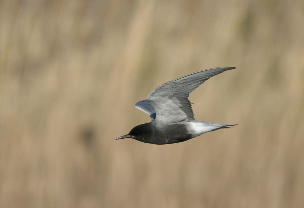
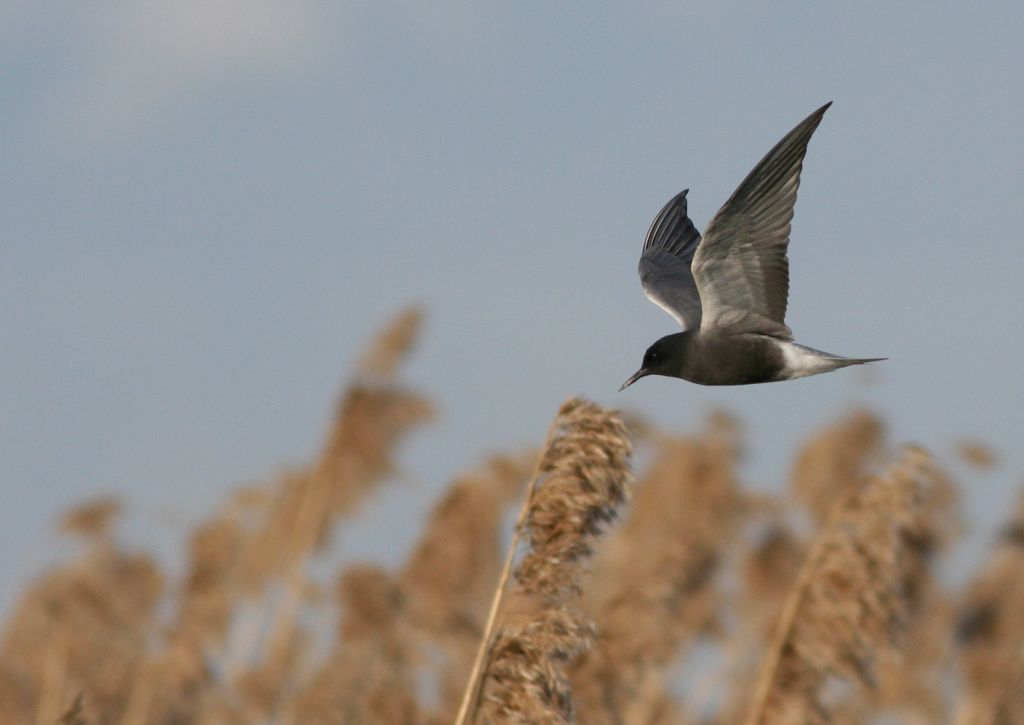
Black Tern - Chlidonias niger (Linnaeus, 1758)

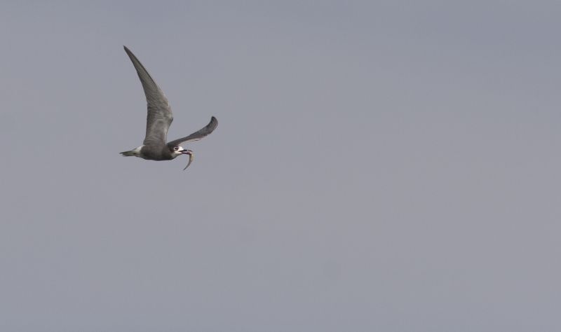
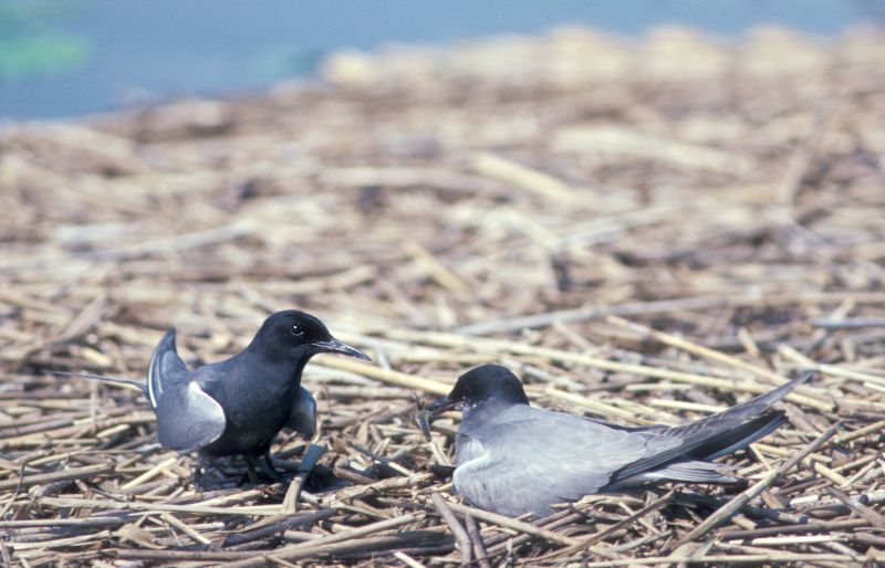
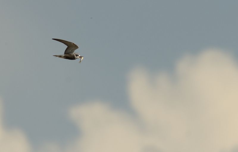
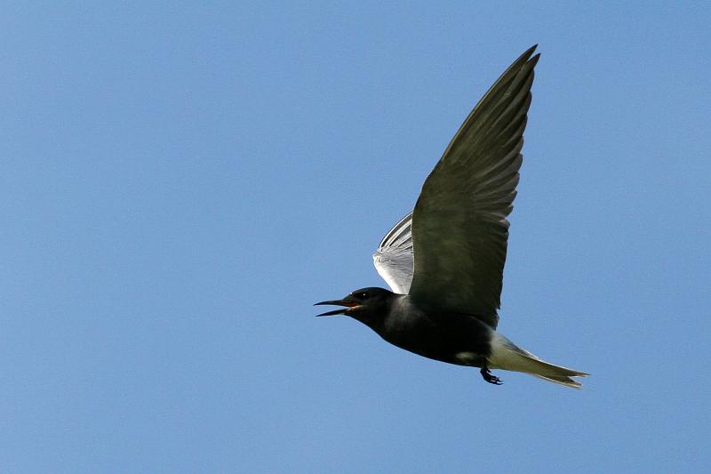
Images from the web

Quick facts

Threat status Europe Least Concern (IUCN)
EU Population status
Depleted
Protected by EU Birds Directive and 4 other international agreements
Natura 2000 sites 1237 are designated for this species
Breeding habitats
  • rivers and lakes
  • wetlands
Natura 2000 species code A197

Distribution

The distribution map is currently disabled. A new map solution will soon become available. In the meantime, please consult other species distribution map providers listed in the Other resources panel below.

Threat and EU population status

IUCN Red List status of threatened species

The IUCN Red List threat status assesses the risk of extinction.

EU population status

The status of the population at the EU level was evaluated at the species level; this was based on the reports delivered by Member States under Article 12 of the Birds Directive (see fact sheet below). The EU status assessment can cover several subspecies/subspecific population units. For more information, please consult the species fact sheet and link below.

IUCN Red List Category
Not Evaluated
Near Threatened
Regionally Extinct
Not Applicable
Vulnerable
Extinct in the Wild
Data Deficient
Endangered
Extinct
Least Concern
Critically Endangered
Population status categories for bird species under the Birds Directive
Secure
Near Threatened, declining or depleted
Threatened (i.e. vulnerable, endangered, critically endangered, regionally extinct)
Unknown or not evaluated

Natura 2000 sites

Protected in the following Natura 2000 sites

Sitecode Country Site name Action
BE2101639 Belgium Ronde Put Map
BE2500831 Belgium Ijzervallei Map
BE33064C0 Belgium Vallée de l'Ulf Map
BE35007C0 Belgium Forêts et lac de Bambois Map
DE2021401 Germany NSG Kudensee Map
DE2121401 Germany Unterelbe Map
DE2210401 Germany Niedersächsisches Wattenmeer und angrenzendes Küstenmeer Map
DE2410401 Germany Ewiges Meer Map
DE2424401 Germany Mühlenberger Loch Map
DE2508401 Germany Krummhörn Map
DE2617401 Germany Unterweser Map
DE2719401 Germany Hammeniederung Map
DE2752302 Germany Salveytal Map
DE2832401 Germany Niedersächsische Mittelelbe Map
DE2935401 Germany Aland-Elbe-Niederung Map
DE2948401 Germany Schorfheide-Chorin Map
DE2951401 Germany Unteres Odertal Map
DE3036401 Germany Unteres Elbtal Map
DE3239401 Germany Untere Havel/Sachsen-Anhalt und Schollener See Map
DE3339402 Germany Niederung der Unteren Havel Map
DE3341401 Germany U. Rhinluch/Dreetzer See, Havell. Luch und Belziger Landschaftsw. Map
DE3415401 Germany Dümmer Map
DE3418401 Germany Diepholzer Moorniederung Map
DE3437401 Germany Elbaue Jerichow Map
DE3450401 Germany Märkische Schweiz Map
DE3513401 Germany Alfsee Map
DE3519401 Germany Vogelschutzgebiet 'Weseraue' Map
DE3521401 Germany Steinhuder Meer Map
DE3532401 Germany Vogelschutzgebiet Drömling Map
DE3618401 Germany Vogelschutzgebiet 'Bastauniederung' Map
DE3642401 Germany Rietzer See Map
DE3807401 Germany Vogelschutzgebiet 'Moore und Heiden des westlichen Münsterlandes' Map
DE3828401 Germany Heerter See Map
DE3911401 Germany Vogelschutzgebiet 'Rieselfelder Münster' Map
DE4108401 Germany VSG 'Heubachniederung, Lavesumer Bruch und Borkenberge' Map
DE4116401 Germany VSG 'Rietberger Emsniederung mit Steinhorster Becken' Map
DE4137401 Germany Wulfener Bruch und Teichgebiet Osternienburg Map
DE4139401 Germany Mittlere Elbe einschließlich Steckby-Lödderitzer Forst Map
DE4142401 Germany Mündungsgebiet der Schwarzen Elster Map
DE4203401 Germany Vogelschutzgebiet 'Unterer Niederrhein' Map
DE4225401 Germany Leinetal bei Salzderhelden Map
DE4531401 Germany Helmestausee Berga-Kelbra (Anteil Sachsen-Anhalt) Map
DE4531403 Germany Kyffhäuser - Badraer Schweiz - Helmestausee Map
DE4536401 Germany Salziger See und Salzatal Map
DE4603401 Germany Vogelschutzgebiet 'Schwalm-Nette-Platte mit Grenzwald u. Meinweg' Map
DE4638401 Germany Saale-Elster-Aue südlich Halle Map
DE4819303 Germany Ederseeufer bei Herzhausen Map
DE4831401 Germany Gera-Unstrut-Niederung um Straußfurt Map
DE4921301 Germany Borkener See Map
DE5024301 Germany Forbachsee bei Bebra Map
DE5227304 Germany NSG Breitunger Seen Map
DE5314303 Germany NSG Krombachtalsperre Map
DE5336401 Germany Plothener Teiche Map
DE5412401 Germany Westerwälder Seenplatte Map
DE5509401 Germany Laacher See Map
DE5511401 Germany Engerser Feld Map
DE5707401 Germany Jungferweiher Map
DE5807401 Germany NSG Sangweiher und Erweiterung Map
DE5818401 Germany Main bei Mühlheim und NSG 'Rumpenheimer und Bürgeler Kiesgruben' Map
DE5820301 Germany Kinzigaue von Langenselbold Map
DE5920401 Germany Bong'sche Grube und Mainflinger Mainufer Map
DE6013401 Germany Rheinaue Bingen-Ingelheim Map
DE6013403 Germany NSG Hinter der Mortkaute Map
DE6019303 Germany Untere Gersprenz Map
DE6315401 Germany Klärteiche Offstein Map
DE6316401 Germany Lampertheimer Altrhein Map
DE6416401 Germany Bobenheimer und Roxheimer Altrhein mit Silbersee Map
DE6716401 Germany NSG Mechtersheimer Tongruben Map
DE6716402 Germany Berghausener und Lingenfelder Altrhein mit Insel Flotzgrün Map
DE6717401 Germany Wagbachniederung Map
DE6816403 Germany Karlskopf und Leimersheimer Altrhein Map
DE6915402 Germany Wörther Altrhein und Wörther Rheinhafen Map
DE6915403 Germany Goldgrund und Daxlander Au Map
DE7921401 Germany Baggerseen Krauchenwies/Zielfingen Map
DE8220401 Germany Untersee des Bodensees Map
DE8220404 Germany Überlinger See des Bodensees Map
DE8321401 Germany Konstanzer Bucht des Bodensees Map
DE8323401 Germany Eriskircher Ried Map
DK004X103 Denmark Gammel Havdrup Mose Map
DK004X104 Denmark Ramsø Mose Map
DK008X072 Denmark Marstal Bugt og den sydlige del af Langeland Map
DK009X060 Denmark Vidåen, Tøndermarsken og Saltvandssøen Map
DK009X061 Denmark Kongens Mose og Draved Skov Map
DK009X063 Denmark Sønder Ådal Map
DK009X069 Denmark Kogsbøl og Skast Mose Map
DK00CX161 Denmark Stadil Fjord og Vest Stadil Fjord Map
DK00EX020 Denmark Vestlige Vejler, Arup Holm og Hovsør Røn Map
DK00EY013 Denmark Østlige Vejler Map
EE0010173 Estonia Lahemaa Map
EE0040001 Estonia Väinamere Map
EE0040444 Estonia Mullutu-Loode Map
EE0040469 Estonia Siiksaare-Oessaare Map
EE0080171 Estonia Vooremaa Map
EE0080172 Estonia Endla Map
EE0080271 Estonia Räpina poldri Map
EE0080313 Estonia Ropka-Ihaste Map
EE0080372 Estonia Lahepera järve Map
EE0080374 Estonia Alam-Pedja Map
EE0080571 Estonia Võrtsjärve Map
ES0000004 Spain Lagunas de Villafáfila Map
ES0000011 Spain Monte de El Pardo Map
ES0000013 Spain Tablas de Daimiel Map
ES0000017 Spain CUENCA DE GALLOCANTA Map
ES0000019 Spain Aiguamolls de l'Alt Empordà Map
ES0000020 Spain Delta de l'Ebre Map
ES0000024 Spain Doñana Map
ES0000025 Spain Marismas del Odiel Map
ES0000027 Spain Laguna de Medina Map
ES0000030 Spain Complejo Endorreico de Puerto Real Map
ES0000033 Spain Laguna de Fuente de Piedra Map
ES0000034 Spain Lagunas del Sur de Córdoba Map
ES0000037 Spain Es Trenc - Salobrar de Campos Map
ES0000046 Spain Cabo de Gata-Níjar Map
ES0000048 Spain Punta Entinas-Sabinar Map
ES0000068 Spain Embalse de Orellana y Sierra de Pela Map
ES0000071 Spain Llanos de Cáceres y Sierra de Fuentes Map
ES0000084 Spain Ses Salines d'Eivissa i Formentera Map
ES0000085 Spain Ribadeo Map
ES0000086 Spain Ría de Ortigueira e Ladrido Map
ES0000087 Spain Complexo intermareal Umia - O Grove, A Lanzada, punta Carreirón e lagoa Bodeira Map
ES0000119 Spain Carrizales y sotos de Aranjuez Map
ES0000138 Spain GALACHOS DE LA ALFRANCA DE PASTRIZ, LA CARTUJA Y EL BURGO DE EBRO Map
ES0000140 Spain Bahía de Cádiz Map
ES0000142 Spain Cortados y cantiles de los ríos Jarama y Manzanares Map
ES0000144 Spain Urdaibaiko itsasadarra / Ría de Urdaibai Map
ES0000146 Spain Delta del Llobregat Map
ES0000161 Spain Laguna de El Hito Map
ES0000175 Spain Salinas y Arenales de San Pedro del Pinatar Map
ES0000176 Spain Costa da Morte (Norte) Map
ES0000184 Spain Valle del Tiétar - ZEPA Map
ES0000188 Spain Valles del Voltoya y el Zorita - ZEPA Map
ES0000189 Spain Campo Azálvaro - Pinares de Peguerinos - ZEPA Map
ES0000190 Spain Encinares de los ríos Adaja y Voltoya - ZEPA Map
ES0000191 Spain Embalse del Ebro Map
ES0000194 Spain Oteros-Campos Map
ES0000197 Spain Acantilados del Monte Hacho Map
ES0000200 Spain Isla Grosa Map
ES0000201 Spain Camino de Santiago Map
ES0000202 Spain Campo de Azaba - ZEPA Map
ES0000204 Spain Tierra de Campiñas Map
ES0000205 Spain Lagunas del Canal de Castilla Map
ES0000206 Spain Cañones del Duero - ZEPA Map
ES0000211 Spain Desembocadura del riu Millars Map
ES0000215 Spain Oteros-Cea Map
ES0000216 Spain La Nava-Campos Sur Map
ES0000220 Spain Riberas del Pisuerga Map
ES0000258 Spain Costa de Ferrolterra - Valdoviño Map
ES0000260 Spain Mar Menor Map
ES0000272 Spain Brazo del Este Map
ES0000273 Spain Embalse de Cordobilla Map
ES0000274 Spain Embalse de Malpasillo Map
ES0000275 Spain Complejo Endorreico de Lebrija-Las Cabezas Map
ES0000289 Spain LAGUNAS Y CARRIZALES DE CINCO VILLAS Map
ES0000290 Spain LA SOTONERA Map
ES0000294 Spain LAGUNA DE SARIÑENA Y BALSA DE LA ESTACIÓN Map
ES0000296 Spain EMBALSE DEL PAS Y SANTA RITA Map
ES0000298 Spain MATARRAÑA - AIGUABARREIX Map
ES0000317 Spain Penarronda-Barayo Map
ES0000318 Spain Cabo Busto-Luanco Map
ES0000319 Spain Ría de Ribadesella-Ría de Tinamayor Map
ES0000320 Spain Embalses del centro (San Andrés, la Granda, Trasona y la Furta) Map
ES0000324 Spain Embalse de Arrocampo Map
ES0000325 Spain Campiña sur - Embalse de Arroyo Conejos Map
ES0000326 Spain Embalse de Borbollón Map
ES0000327 Spain Embalse de los Canchales Map
ES0000328 Spain Embalse de Montijo Map
ES0000329 Spain Embalse de Valdecañas Map
ES0000333 Spain Llanos de Zorita y Embalse de Sierra Brava Map
ES0000334 Spain Sierras Centrales y Embalse de Alange Map
ES0000359 Spain Campos de Alba Map
ES0000363 Spain Monteagudo de las Vicarías Map
ES0000373 Spain Ría de Foz Map
ES0000375 Spain Esteiro do Miño Map
ES0000393 Spain Azud de Badajoz Map
ES0000397 Spain Embalse de la Serena Map
ES0000398 Spain Llanos y Complejo Lagunar de la Albuera Map
ES0000399 Spain Embalse del Zujar Map
ES0000400 Spain Arrozales de Palazuelo y Guadalperales Map
ES0000408 Spain Vegas del Ruecas, Cubilar y Moheda Alta Map
ES0000416 Spain Embalse de Aldea del Cano Map
ES0000418 Spain Embalse de Talaván Map
ES0000421 Spain Embalse Gabriel y Galán Map
ES0000434 Spain Canchos de Ramiro y Ladronera Map
ES1110001 Spain Ortigueira - Mera Map
ES1110002 Spain Costa Ártabra Map
ES1110004 Spain Encoro de Abegondo - Cecebre Map
ES1110005 Spain Costa da Morte Map
ES1110007 Spain Betanzos - Mandeo Map
ES1110008 Spain Carnota - Monte Pindo Map
ES1110011 Spain Esteiro do Tambre Map
ES1110012 Spain Monte e lagoa de Louro Map
ES1120002 Spain Río Eo Map
ES1120003 Spain Parga - Ladra - Támoga Map
ES1120011 Spain Ría de Foz - Masma Map
ES1130006 Spain Veiga de Ponteliñares Map
ES1140004 Spain Complexo Ons - O Grove Map
ES1140007 Spain Baixo Miño Map
ES1140011 Spain Gándaras de Budiño Map
ES1140012 Spain Illas Estelas Map
ES1140016 Spain Enseada de San Simón Map
ES2110011 Spain Zadorraren sistemako urtegiak / Embalses del sistema del Zadorra Map
ES2110014 Spain Salburua Map
ES2130005 Spain Gaztelugatxeko Doniene / San Juan de Gaztelugatxe Map
ES2130007 Spain Urdaibaiko itsasertzak eta padurak / Zonas litorales y marismas de Urdaibai Map
ES4140036 Spain La Nava-Campos Norte Map
ES4160008 Spain Hoces del Río Riaza - ZEPA Map
ES4160048 Spain Lagunas de Cantalejo - ZEPA Map
ES4180017 Spain Riberas de Castronuño Map
ES6110001 Spain Albufera de Adra Map
ES6120002 Spain Cola del Embalse de Bornos Map
ES6120014 Spain Laguna de Las Canteras y El Tejón Map
ES6150003 Spain Estero de Domingo Rubio Map
ES6150005 Spain Marismas de Isla Cristina Map
ES6150006 Spain Marismas del Río Piedras y Flecha del Rompido Map
ES6170001 Spain Laguna de La Ratosa Map
ES6170015 Spain Lagunas de Campillos Map
ES6180001 Spain Complejo Endorreico de Utrera Map
ES6180002 Spain Complejo Endorreico de La Lantejuela Map
ES6180003 Spain Laguna del Gosque Map
FI0100028 Finland Laajalahden lintuvesi Map
FI0100062 Finland Vanhankaupunginlahden lintuvesi Map
FI0100072 Finland Kanteleenjärven lintuvesi Map
FI0100103 Finland VANJÄRVI-LAUKKAMÄKI Map
FI0200027 Finland Viurilanlahti Map
FI0200029 Finland Suomijärvi Map
FI0200030 Finland Omenajärvi Map
FI0200035 Finland Inhottujärvi Map
FI0200036 Finland Paimionlahti Map
FI0200039 Finland Niemijärvi - Itäjärvi Map
FI0200041 Finland Kulju Map
FI0200076 Finland Pooskerin saaristo Map
FI0200079 Finland Kokemäenjoen suisto Map
FI0200089 Finland Mietoistenlahti Map
FI0200149 Finland Puurijärvi - Isosuo Map
FI0200152 Finland Seksmiilarin saaristo Map
FI0306006 Finland Kutajärven alue Map
FI0310007 Finland Hattelmalanjärvi Map
FI0316005 Finland Kirkkojärven alue Map
FI0401003 Finland Muhjärvi Map
FI0411002 Finland Haapajärvi Map
FI0411003 Finland Kaislanen Map
FI0415001 Finland Siikalahti, Sammallampi, Rautalahti Map
FI0425001 Finland Lupinlahti Map
FI0426001 Finland Kirkon-Vilkkiläntura Map
FI0500038 Finland Putkilahti - Ruskeaperä Map
FI0600051 Finland Maaningan lintujärvet Map
FI0600053 Finland Ruokojärvi ja Mula Map
FI0600074 Finland Luupuveden lintujärvet Map
FI0700001 Finland Sysmäjärvi Map
FI0700003 Finland Päätyeenlahti Map
FI0700005 Finland Joki-Hautalampi Map
FI0700007 Finland Jouhtenuslampi Map
FI0700008 Finland Hovinlampi-Ylälampi Map
FI0700009 Finland Peijonniemenlahti Map
FI0700030 Finland Särkijärvi Map
FI0800056 Finland Vassorfjärden Map
FI0800057 Finland Södra Stadsfjärden-Söderfjärden-Öjen Map
FI0800062 Finland Kodesjärvi Map
FI0800112 Finland Lapväärtin kosteikot Map
FI0900103 Finland Lapinjärvi-Teerikangas Map
FI1000004 Finland Laajalahti Map
FI1000016 Finland Jokisuunlahti ja Valmosanneva Map
FI1102200 Finland Liminganlahti Map
FR1110025 France Etang de Saint Quentin Map
FR2110001 France Lacs de la forêt d'Orient Map
FR2110002 France Lac du Der Map
FR2110091 France Étang de la Horre Map
FR2112001 France Herbages et cultures des vallées de la Voire, de l'Héronne et de la Laines Map
FR2112002 France Herbages et cultures autour du lac du Der Map
FR2112003 France Étangs de Belval et d'Etoges Map
FR2112004 France Confluence des vallées de la Meuse et de la Chiers Map
FR2112005 France Vallée de l'Aisne en aval de Château Porcien Map
FR2112006 France Confluence des vallées de l'Aisne et de l'Aire Map
FR2112009 France Étangs d'Argonne Map
FR2210026 France Marais d'Isle Map
FR2210104 France Moyenne vallée de l'Oise Map
FR2310044 France Estuaire et marais de la Basse Seine Map
FR2410003 France Brenne Map
FR2410017 France Vallée de la Loire du Loiret Map
FR2410018 France Forêt d'Orléans Map
FR2510046 France Basses Vallées du Cotentin et Baie des Veys Map
FR2510047 France Baie de Seine occidentale Map
FR2510059 France Estuaire de l'Orne Map
FR2512001 France Littoral augeron Map
FR2610004 France Vallées de la Loire et de l'Allier entre Cher et Nièvre Map
FR2612002 France Vallée de la Loire de Iguerande à Decize Map
FR3110038 France Estuaire de la Canche Map
FR3110039 France Platier d'Oye Map
FR3110085 France Cap Gris-Nez Map
FR4110007 France Lac de Madine et étangs de Pannes Map
FR4110060 France Etang de Lachaussée et zones voisines Map
FR4112001 France Forêts et zones humides du pays de Spincourt Map
FR4112002 France Complexe de l'étang de Lindre, forêt de Romersberg et zones voisines Map
FR4112004 France Forêt humide de la Reine et Caténa de Rangeval Map
FR4112005 France Vallée de la Meuse (secteur de Stenay) Map
FR4211810 France Vallée du Rhin de Strasbourg à Marckolsheim Map
FR4211811 France Vallée du Rhin de Lauterbourg à Strasbourg Map
FR4211812 France Vallée du Rhin d'Artzenheim à Village-Neuf Map
FR4213813 France Ried de Colmar à Sélestat, Haut-Rhin Map
FR4310027 France Vallons de la Drésine et de la Bonavette Map
FR5210008 France Lac de Grand Lieu Map
FR5210090 France Marais salants de Guérande, traicts du Croisic, dunes de Pen Bron Map
FR5210103 France Estuaire de la Loire Map
FR5210115 France Basses vallées angevines et prairies de la Baumette Map
FR5310056 France Baie d'Audierne Map
FR5310057 France Archipel de Glenan Map
FR5310086 France Golfe du Morbihan Map
FR5310092 France Rivière de Pénerf Map
FR5310094 France Rade de Lorient Map
FR5410012 France Fier d'Ars et fosse de Loix Map
FR5410013 France Anse de Fouras, baie d'Yves, marais de Rochefort Map
FR5410028 France Marais de Brouage-Oléron Map
FR5410100 France Marais poitevin Map
FR5412006 France Vallée de la Charente en amont d'Angoulême Map
FR5412012 France Bonne Anse, marais de Bréjat et de Saint Augustin Map
FR5412015 France Camp de Montmorillon, Landes de Sainte-Marie Map
FR5412017 France Bois de l'Hospice, étang de Beaufour et environs Map
FR5412019 France Région de Pressac, étang de Combourg Map
FR5412020 France Marais et estuaire de la Seudre, île d'Oléron Map
FR5412025 France Estuaire et basse vallée de la Charente Map
FR7210029 France Marais de Bruges Map
FR7210030 France Côte médocaine : dunes boisées et dépression humides Map
FR7210031 France Courant d'Huchet Map
FR7210063 France Domaine d'Orx Map
FR7210077 France Barthes de l'Adour Map
FR7212001 France Site d'Arjuzanx Map
FR8210018 France Delta de la Dranse Map
FR8212002 France Écozone du Forez Map
FR8212010 France Printegarde Map
FR8310079 France Val d'Allier Bourbonnais Map
FR9110042 France Étangs palavasiens et étang de l'Estagnol Map
FR9110080 France Montagne de la Clape Map
FR9110108 France Basse plaine de l'Aude Map
FR9112001 France Camargue gardoise fluvio-lacustre Map
FR9112002 France Le Salagou Map
FR9310019 France Camargue Map
FR9312001 France Marais entre Crau et Grand Rhône Map
FR9312003 France La Durance Map
FR9312005 France Salines de l'Étang de Berre Map
FR9312008 France Salins d'Hyères et des Pesquiers Map
HUBF30002 Hungary Balaton Map
HUBF30003 Hungary Kis-Balaton Map
HUBN10001 Hungary Bodrogzug–Kopasz-hegy–Taktaköz Map
HUBN10002 Hungary Borsodi-sík Map
HUBN10005 Hungary Kesznyéten Map
HUDD10002 Hungary Nyugat-Dráva Map
HUDD10003 Hungary Gemenc Map
HUDD10006 Hungary Pacsmagi-tavak Map
HUDD10008 Hungary Belső-Somogy Map
HUDD10012 Hungary Balatoni berkek Map
HUDI10002 Hungary Börzsöny és Visegrádi-hegység Map
HUDI10005 Hungary Sárvíz völgye Map
HUDI10006 Hungary Tatai Öreg-tó Map
HUDI10008 Hungary Ipoly völgye Map
HUDI30002 Hungary Zámolyi-medence Map
HUHN10002 Hungary Hortobágy Map
HUKM10001 Hungary Kígyósi-puszta Map
HUKM10002 Hungary Kis-Sárrét Map
HUKM10003 Hungary Dévaványai-sík Map
HUKM10005 Hungary Cserebökényi-puszták Map
HUKN10001 Hungary Felső-kiskunsági szikes puszták és turjánvidék Map
HUKN10002 Hungary Kiskunsági szikes tavak és az őrjegi turjánvidék Map
IT1110007 Italy Laghi di Avigliana Map
IT1110019 Italy Baraccone (confluenza Po - Dora Baltea) Map
IT1110024 Italy Lanca di San Michele Map
IT1110025 Italy Po morto di Carignano Map
IT1110036 Italy Lago di Candia Map
IT1110051 Italy Peschiere e Laghi di Pralormo Map
IT1110070 Italy Meisino (confluenza Po - Stura) Map
IT1110079 Italy La Mandria Map
IT1110081 Italy Monte Musiné e Laghi di Caselette Map
IT1120002 Italy Bosco della Partecipanza di Trino Map
IT1120007 Italy Palude di S. Genuario Map
IT1120010 Italy Lame del Sesia e Isolone di Oldenico Map
IT1120023 Italy Isola di Santa Maria Map
IT1140006 Italy Greto Torrente Toce tra Domodossola e Villadossola Map
IT1150001 Italy Valle del Ticino Map
IT1160003 Italy Oasi di Crava Morozzo Map
IT1160013 Italy Confluenza Po - Varaita Map
IT1180004 Italy Greto dello Scrivia Map
IT1180027 Italy Confluenza Po - Sesia - Tanaro Map
IT1205070 Italy Zona Umida di Les Iles di Saint - Marcel Map
IT2010006 Italy Lago di Biandronno Map
IT2010007 Italy Palude Brabbia Map
IT2010017 Italy Palude Bozza - Monvallina Map
IT2020001 Italy Lago di Piano Map
IT2020005 Italy Lago di Alserio Map
IT2020006 Italy Lago di Pusiano Map
IT2030004 Italy Lago di Olginate Map
IT2040022 Italy Lago di Mezzola e Pian di Spagna Map
IT2070020 Italy Torbiere d'Iseo Map
IT2080002 Italy Basso corso e sponde del Ticino Map
IT2080010 Italy Garzaia di Sartirana Map
IT2080014 Italy Boschi Siro Negri e Moriano Map
IT2080019 Italy Boschi di Vaccarizza Map
IT2080301 Italy Boschi del Ticino Map
IT20B0006 Italy Isola Boscone Map
IT20B0008 Italy Paludi di Ostiglia Map
IT20B0009 Italy Valli del Mincio Map
IT20B0010 Italy Vallazza Map
IT3120042 Italy Canneti di San Cristoforo Map
IT3120055 Italy Lago di Toblino Map
IT3120082 Italy Taio di Nomi Map
IT3220037 Italy Colli Berici Map
IT3230032 Italy Lago di Busche - Vincheto di Cellarda - Fontane Map
IT3240011 Italy Sile: sorgenti, paludi di Morgano e S. Cristina Map
IT3240013 Italy Ambito Fluviale del Livenza Map
IT3240019 Italy Fiume Sile: Sile Morto e ansa a S. Michele Vecchio Map
IT3240023 Italy Grave del Piave Map
IT3250013 Italy Laguna del Mort e Pinete di Eraclea Map
IT3250016 Italy Cave di Gaggio Map
IT3250030 Italy Laguna medio-inferiore di Venezia Map
IT3250031 Italy Laguna superiore di Venezia Map
IT3250033 Italy Laguna di Caorle - Foce del Tagliamento Map
IT3250040 Italy Foce del Tagliamento Map
IT3250041 Italy Valle Vecchia - Zumelle - Valli di Bibione Map
IT3250042 Italy Valli Zignago - Perera - Franchetti - Nova Map
IT3260018 Italy Grave e Zone umide della Brenta Map
IT3260020 Italy Le Vallette Map
IT3270017 Italy Delta del Po: tratto terminale e delta veneto Map
IT3310009 Italy Magredi del Cellina Map
IT3320026 Italy Risorgive dello Stella Map
IT3320028 Italy Palude Selvote Map
IT3320037 Italy Laguna di Marano e Grado Map
IT3330005 Italy Foce dell'Isonzo - Isola della Cona Map
IT3330006 Italy Valle Cavanata e Banco Mula di Muggia Map
IT4010018 Italy Fiume Po da Rio Boriacco a Bosco Ospizio Map
IT4020017 Italy Aree delle risorgive di Viarolo, Bacini di Torrile, Fascia golenale del Po Map
IT4020018 Italy Prati e Ripristini ambientali di Frescarolo e Samboseto Map
IT4020019 Italy Golena del Po presso Zibello Map
IT4020021 Italy Medio Taro Map
IT4030011 Italy Casse di espansione del Secchia Map
IT4030015 Italy Valli di Novellara Map
IT4030019 Italy Cassa di espansione del Tresinaro Map
IT4030020 Italy Golena del Po di Gualtieri, Guastalla e Luzzara Map
IT4040009 Italy Manzolino Map
IT4040011 Italy Cassa di espansione del Fiume Panaro Map
IT4040014 Italy Valli Mirandolesi Map
IT4040015 Italy Valle di Gruppo Map
IT4040017 Italy Valle delle Bruciate e Tresinaro Map
IT4040018 Italy Le Meleghine Map
IT4050022 Italy Biotopi e Ripristini ambientali di Medicina e Molinella Map
IT4050023 Italy Biotopi e Ripristini ambientali di Budrio e Minerbio Map
IT4050024 Italy Biotopi e Ripristini ambientali di Bentivoglio, S. Pietro in Casale, Malalbergo e Baricella Map
IT4050025 Italy Biotopi e Ripristini ambientali di Crevalcore Map
IT4050026 Italy Bacini ex-zuccherificio di Argelato e Golena del Fiume Reno Map
IT4060001 Italy Valli di Argenta Map
IT4060002 Italy Valli di Comacchio Map
IT4060003 Italy Vene di Bellocchio, Sacca di Bellocchio, Foce del Fiume Reno, Pineta di Bellocchio Map
IT4060004 Italy Valle Bertuzzi, Valle Porticino - Canneviè Map
IT4060005 Italy Sacca di Goro, Po di Goro, Valle Dindona, Foce del Po di Volano Map
IT4060008 Italy Valle del Mezzano Map
IT4060014 Italy Bacini di Jolanda di Savoia Map
IT4060015 Italy Bosco della Mesola, Bosco Panfilia, Bosco di Santa Giustina, Valle Falce, La Goara Map
IT4060016 Italy Fiume Po da Stellata a Mesola e Cavo Napoleonico Map
IT4070001 Italy Punte Alberete, Valle Mandriole Map
IT4070002 Italy Bardello Map
IT4070004 Italy Pialasse Baiona, Risega e Pontazzo Map
IT4070005 Italy Pineta di Casalborsetti, Pineta Staggioni, Duna di Porto Corsini Map
IT4070007 Italy Salina di Cervia Map
IT4070009 Italy Ortazzo, Ortazzino, Foce del Torrente Bevano Map
IT4070019 Italy Bacini di Conselice Map
IT4070020 Italy Bacini ex - zuccherificio di Mezzano Map
IT4070021 Italy Biotopi di Alfonsine e Fiume Reno Map
IT4070022 Italy Bacini di Russi e Fiume Lamone Map
IT4070023 Italy Bacini di Massa Lombarda Map
IT4090002 Italy Torriana, Montebello, Fiume Marecchia Map
IT5120017 Italy Lago e Padule di Massacciuccoli Map
IT5130007 Italy Padule di Fucecchio Map
IT5140010 Italy Bosco di Chiusi e Paduletta di Ramone Map
IT5140011 Italy Stagni della Piana Fiorentina e Pratese Map
IT5160004 Italy Padule di Bolgheri Map
IT5170002 Italy Selva Pisana Map
IT5180013 Italy Ponte a Buriano e Penna Map
IT5190008 Italy Lago di Montepulciano Map
IT51A0013 Italy Padule della Trappola, Bocca d'Ombrone Map
IT51A0026 Italy Laguna di Orbetello Map
IT51A0033 Italy Lago di Burano Map
IT5210070 Italy Lago Trasimeno Map
IT5210072 Italy Palude di Colfiorito Map
IT6010026 Italy Saline di Tarquinia Map
IT6010055 Italy Lago di Bolsena, Isole Bisentina e Martana Map
IT6020011 Italy Laghi Lungo e Ripasottile Map
IT6030010 Italy Lago di Bracciano Map
IT6030012 Italy Riserva naturale Tevere Farfa Map
IT6040015 Italy Parco Nazionale del Circeo Map
IT8010018 Italy Variconi Map
IT8030010 Italy Fondali marini di Ischia, Procida e Vivara Map
IT8030011 Italy Fondali marini di Punta Campanella e Capri Map
IT8030012 Italy Isola di Vivara Map
IT8030014 Italy Lago d'Averno Map
IT8030038 Italy Corpo centrale e rupi costiere occidentali dell'Isola di Capri Map
IT8030039 Italy Settore e rupi costiere orientali dell'Isola di Capri Map
IT8050036 Italy Parco marino di S. Maria di Castellabate Map
IT8050037 Italy Parco marino di Punta degli Infreschi Map
IT8050048 Italy Costa tra Punta Tresino e le Ripe Rosse Map
IT9140003 Italy Stagni e Saline di Punta della Contessa Map
IT9150014 Italy Le Cesine Map
IT9150015 Italy Litorale di Gallipoli e Isola S. Andrea Map
IT9220144 Italy Lago S. Giuliano e Timmari Map
ITA010001 Italy Isole dello Stagnone di Marsala Map
ITA010006 Italy Paludi di Capo Feto e Margi Spanò Map
ITA010007 Italy Saline di Trapani Map
ITA010021 Italy Saline di Marsala Map
ITA020010 Italy Isola di Ustica Map
ITA030008 Italy Capo Peloro - Laghi di Ganzirri Map
ITA050001 Italy Biviere e Macconi di Gela Map
ITA060002 Italy Lago di Pergusa Map
ITA070001 Italy Foce del Fiume Simeto e Lago Gornalunga Map
ITA070003 Italy La Gurna Map
ITA090002 Italy Vendicari Map
ITA090003 Italy Pantani della Sicilia sud orientale Map
ITA090004 Italy Pantano Morghella Map
ITA090006 Italy Saline di Siracusa e Fiume Ciane Map
ITA090013 Italy Saline di Priolo Map
ITA090014 Italy Saline di Augusta Map
ITB034001 Italy Stagno di S'Ena Arrubia Map
ITB034005 Italy Stagno di Pauli Majori Map
ITB034006 Italy Stagno di Mistras Map
ITB044002 Italy Saline di Molentargius Map
ITB044003 Italy Stagno di Cagliari Map
LTALYB001 Lithuania Metelių, Dusios ir Obelijos ežerai Map
LTALYB003 Lithuania Žuvinto, Žaltyčio ir Amalvo pelkės Map
LTIGNB003 Lithuania Vakarinė Aukštaitijos nacionalinio parko dalis Map
LTSLUB001 Lithuania Nemuno delta Map
LTSVEB003 Lithuania Kretuono ežeras Map
LTTELB001 Lithuania Biržulio ir Stervo pelkių kompleksas Map
LTZARB002 Lithuania Smalvos šlapžemių kompleksas Map
LTZARB003 Lithuania Drūkšių ežeras Map
LU0001017 Luxembourg Vallée de la Sûre inférieure Map
LU0001029 Luxembourg Région de la Moselle supérieure Map
LU0002007 Luxembourg Vallée supérieure de l'Alzette Map
LU0002012 Luxembourg Haff Réimech Map
LV0100500 Latvia Teicu dabas rezervats Map
LV0200200 Latvia Kemeru nacionalais parks Map
LV0301300 Latvia Istras pauguraine Map
LV0302800 Latvia Engures ezers Map
LV0302900 Latvia Dvietes paliene Map
LV0303200 Latvia Svetes paliene Map
LV0303400 Latvia Raznas nacionalais parks Map
LV0303500 Latvia Pape Map
LV0502200 Latvia Orlovas (Erglu) purvs Map
LV0504700 Latvia Viku purvs Map
LV0507800 Latvia Liepajas ezers Map
LV0510600 Latvia Pildas ezers Map
LV0513100 Latvia Babites ezers Map
LV0523100 Latvia Lielupes palienes plavas Map
LV0525500 Latvia Satinu diki Map
LV0526800 Latvia Sedas purvs Map
LV0527200 Latvia Daugava pie Kaibalas Map
LV0527300 Latvia Tasu ezers Map
LV0527500 Latvia Silabebru ezers Map
LV0532400 Latvia Asunes ezeri Map
LV0534300 Latvia Lubasts Map
LV0535600 Latvia Skrundas zivju diki Map
LV0600100 Latvia Vecpiebalga Map
LV0600300 Latvia Augszeme Map
LV0600400 Latvia Augsdaugava Map
NL2000001 Netherlands Deelen Map
NL2000012 Netherlands Naardermeer Map
NL2000013 Netherlands Weerribben Map
NL3009001 Netherlands Alde Feanen Map
NL3009004 Netherlands De Wieden Map
NL9801001 Netherlands Waddenzee Map
NL9801063 Netherlands Nieuwkoopse Plassen & De Haeck Map
NL9802031 Netherlands Zwarte Meer Map
NL9802060 Netherlands Oostelijke Vechtplassen Map
NL9802065 Netherlands Zouweboezem Map
NL9802099 Netherlands Boezems Kinderdijk Map
NL9803028 Netherlands IJsselmeer Map
NL9803029 Netherlands Markermeer & IJmeer Map
NL9902003 Netherlands Uiterwaarden Zwarte Water en Vecht Map
PLB020001 Poland Dolina Baryczy Map
PLB040001 Poland Błota Rakutowskie Map
PLB040002 Poland Bagienna Dolina Drwęcy Map
PLB040003 Poland Dolina Dolnej Wisły Map
PLB060003 Poland Dolina Środkowego Bugu Map
PLB060004 Poland Dolina Tyśmienicy Map
PLB100001 Poland Pradolina Warszawsko-Berlińska Map
PLB140001 Poland Dolina Dolnego Bugu Map
PLB140002 Poland Dolina Liwca Map
PLB140003 Poland Dolina Pilicy Map
PLB140004 Poland Dolina Środkowej Wisły Map
PLB140005 Poland Doliny Omulwi i Płodownicy Map
PLB200001 Poland Bagienna Dolina Narwi Map
PLB200002 Poland Puszcza Augustowska Map
PLB220001 Poland Wielki Sandr Brdy Map
PLB220004 Poland Ujście Wisły Map
PLB220005 Poland Zatoka Pucka Map
PLB240001 Poland Dolina Górnej Wisły Map
PLB260001 Poland Dolina Nidy Map
PLB280001 Poland Bagna Nietlickie Map
PLB280002 Poland Dolina Pasłęki Map
PLB280003 Poland Jezioro Łuknajno Map
PLB280004 Poland Jezioro Oświn i okolice Map
PLB280005 Poland Lasy Iławskie Map
PLB280006 Poland Puszcza Borecka Map
PLB280007 Poland Puszcza Napiwodzko-Ramucka Map
PLB280008 Poland Puszcza Piska Map
PLB280010 Poland Zalew Wiślany Map
PLB300001 Poland Dolina Środkowej Noteci i Kanału Bydgoskiego Map
PLB300002 Poland Dolina Środkowej Warty Map
PLB300003 Poland Nadnoteckie Łęgi Map
PLB300005 Poland Zbiornik Wonieść Map
PLB320001 Poland Bagna Rozwarowskie Map
PLB320003 Poland Dolina Dolnej Odry Map
PLB320005 Poland Jezioro Miedwie i okolice Map
PLB320006 Poland Jezioro Świdwie Map
PLB320007 Poland Łąki Skoszewskie Map
PLB320008 Poland Ostoja Ińska Map
PLB320009 Poland Zalew Szczeciński Map
PLC140001 Poland Puszcza Kampinoska Map
PLC200004 Poland Puszcza Białowieska Map
PTZPE0008 Portugal Paul do Boquilobo Map
PTZPE0010 Portugal Estuário do Tejo Map
PTZPE0017 Portugal Ria Formosa Map
PTZPE0018 Portugal Sapais de Castro Marim Map
PTZPE0049 Portugal Lagoa Pequena Map
SE0210278 Sweden Tämnaren öst Map
SE0230067 Sweden Tåkern Map
SE0230125 Sweden Svartåmynningen Map
SE0240058 Sweden Kvismarens naturreservat Map
SE0240156 Sweden Tysslingen Map
SE0250005 Sweden Strömsholm Map
SE0250095 Sweden Askö-Tidö Map
SE0250096 Sweden Gnien Map
SE0250148 Sweden Gussjön Map
SE0250153 Sweden Fläcksjön Map
SE0250154 Sweden Rörbosjön Map
SE0310575 Sweden Erstad kärr Map
SE0330054 Sweden Beijershamn och Svansholmarna Map
SE0330059 Sweden Petgärde träsk Map
SE0330060 Sweden Djurstadträsk Map
SE0330062 Sweden Knisa mosse Map
SE0330063 Sweden Horns Kungsgård Map
SE0330083 Sweden Ottenby Map
SE0330084 Sweden Södviken Map
SE0330109 Sweden Eckelsudde Map
SE0330146 Sweden Husvalla sjömarker Map
SE0330176 Sweden Stora Alvaret Map
SE0420145 Sweden Hammarsjöområdet Map
SE0420146 Sweden Araslövssjöområdet Map
SE0430090 Sweden Fulltofta-Ringsjön Map
SE0430091 Sweden Löddeåns mynning Map
SE0430124 Sweden Krankesjön Map
SE0430172 Sweden Sövdesjön Map
SE0430173 Sweden Lommaområdet Map
SE0510049 Sweden Getteröns fågelreservat Map
SE0540084 Sweden Hornborgasjön Map
SE0540120 Sweden Åråsviken-Vallholmen Map
SE0820042 Sweden Gammelstadsviken Map
SE0820738 Sweden Persöfjärden Map
SE0820739 Sweden Möröfjärden Map
SI5000011 Slovenia Drava Map
SI5000015 Slovenia Cerkniško jezero Map
SKCHVU015 Slovakia Medzibodrozie Map
IT8050010 Italy Fasce litoranee a destra e a sinistra del Fiume Sele Map
FR5212010 France Dunes, forêt et marais d'Olonne Map
ES4250010 Spain Humedales de La Mancha Map
ITA010028 Italy Stagnone di Marsala e Saline di Trapani - area marina e terrestre Map
IT9150006 Italy Rauccio Map
ES6150018 Spain Río Guadiana y Ribera de Chanza Map
IT2040042 Italy Pian di Spagna e Lago di Mezzola Map
ES6120009 Spain Fondos Marinos de Bahía de Cádiz Map
ES6200006 Spain Espacios Abiertos e Islas del Mar Menor Map
ITB030033 Italy Stagno di Pauli Maiori di Oristano Map
ITB010003 Italy Stagno e ginepreto di Platamona Map
LV0304100 Latvia Bauska Map
PLB300015 Poland Puszcza Notecka Map
PLB180005 Poland Puszcza Sandomierska Map
IT2010022 Italy Alnete del Lago di Varese Map
FR8312007 France Sologne bourbonnaise Map
PLB300013 Poland Dolina Samicy Map
ES5310082 Spain S'Estaca - Punta de Deià Map
FR9112016 France Étang de Capestang Map
FR9112010 France Piège et collines du Lauragais Map
PLB020004 Poland Zbiornik Mietkowski Map
PTCON0058 Portugal Ria de Alvor Map
FR2612006 France Prairies alluviales et milieux associés de Saône-et-Loire Map
BG0000270 Bulgaria Atanasovsko ezero Map
DE3442304 Germany Beetzsee-Rinne und Niederungen Map
IT20A0401 Italy Riserva Regionale Bosco Ronchetti Map
PLB320018 Poland Jeziora Wełtyńskie Map
DE3453422 Germany Mittlere Oderniederung Map
DE3744421 Germany Nuthe-Nieplitz-Niederung Map
IT9320095 Italy Foce Neto Map
ES5120008 Spain Estany de Banyoles Map
ITA090029 Italy Pantani della Sicilia sud-orientale, Morghella, di Marzamemi, di Punta Pilieri e Vendicari Map
IT9110015 Italy Duna e Lago di Lesina - Foce del Fortore Map
IT8020001 Italy Alta Valle del Fiume Tammaro Map
ES4250001 Spain Sierra de San Vicente y valles del Tiétar y Alberche Map
FR7412002 France Étang des Landes Map
FR4112009 France Forêts et étangs d'Argonne et vallée de l'Ornain Map
FR9312015 France Étangs entre Istres et Fos Map
PLB320011 Poland Zalew Kamieński i Dziwna Map
IT3341002 Italy Aree Carsiche della Venezia Giulia Map
IT20A0018 Italy Cave Danesi Map
FR2410016 France Lac de Rillé et forêts voisines d'Anjou et de Touraine Map
FR5212001 France Marais de Goulaine Map
ITA050012 Italy Torre Manfria, Biviere e Piana di Gela Map
IT20B0501 Italy Viadana, Portiolo, San Benedetto Po e Ostiglia Map
IT3240029 Italy Ambito fluviale del Livenza e corso inferiore del Monticano Map
DE3548341 Germany SPA Müggelspree Map
DE7744471 Germany Salzach und Inn Map
PLB300011 Poland Pojezierze Sławskie Map
ES5310095 Spain Can Picafort Map
IT4020025 Italy Parma Morta Map
PLB320017 Poland Ostoja Cedyńska Map
IT4060017 Italy Po di Primaro e Bacini di Traghetto Map
FR9312020 France Marais de Manteyer Map
DE8334471 Germany Loisach-Kochelsee-Moore Map
ES6150001 Spain Laguna de El Portil Map
FR7212014 France Estuaire de la Gironde : marais du Blayais Map
BG0000241 Bulgaria Srebarna Map
DE5026402 Germany Rhäden von Obersuhl und Auen an der mittleren Werra Map
IT6040012 Italy Laghi Fogliano, Monaci, Caprolace e Pantani dell'Inferno Map
PLB320019 Poland Ostoja Drawska Map
ES6310002 Spain Zona marítimo-terrestre del Monte Hacho Map
IT9340086 Italy Lago dell'Angitola Map
BG0002046 Bulgaria Yatata Map
IT1180028 Italy Fiume Po - tratto vercellese alessandrino Map
IT9310055 Italy Lago di Tarsia Map
IT8010020 Italy Pineta di Castelvolturno Map
FR2612008 France Étang de Galetas Map
FR2512002 France Landes et dunes de la Hague Map
IT3250046 Italy Laguna di Venezia Map
ES6200030 Spain Mar Menor Map
BG0002114 Bulgaria Ribarnitsi Chelopechene Map
FR2312003 France Terrasses alluviales de la Seine Map
DE5219401 Germany Amöneburger Becken Map
IT7222217 Italy Foce Saccione - Bonifica Ramitelli Map
DE5314450 Germany Hoher Westerwald Map
PLC080001 Poland Ujście Warty Map
ES4210004 Spain Lagunas saladas de Pétrola y Salobrejo y complejo lagunar de Corral Rubio Map
FR5212002 France Vallée de la Loire de Nantes aux Ponts-de-Cé et ses annexes Map
IT9150025 Italy Torre Veneri Map
PLB080005 Poland Jeziora Pszczewskie i Dolina Obry Map
ES5310075 Spain Arenal de Son Saura Map
IT9330087 Italy Lago La Vota Map
IT8030016 Italy Lago di Lucrino Map
FR3112002 France Les "Cinq Tailles" Map
DE6119401 Germany Untere Gersprenzaue Map
FR2112012 France Marigny, Superbe, vallée de l'Aube Map
FR5212004 France Marais de l'Erdre Map
PLB060019 Poland Polesie Map
IT3240030 Italy Grave del Piave - Fiume Soligo - Fosso di Negrisia Map
FR9112013 France Petite Camargue laguno-marine Map
ITA070019 Italy Lago Gurrida e Sciare di S. Venera Map
IT8030018 Italy Lago di Patria Map
IT8010028 Italy Foce Volturno - Variconi Map
ES6120033 Spain Fondos Marinos Marismas del Río Palmones Map
ES4250009 Spain Yesares del valle del Tajo Map
IT2010021 Italy Sabbie d'Oro Map
ES3110004 Spain Cuenca del río Manzanares Map
BG0002041 Bulgaria Kompleks Ropotamo Map
IT9110037 Italy Laghi di Lesina e Varano Map
PLB320014 Poland Ostoja Wkrzańska Map
BG0002028 Bulgaria Kompleks Straldzha Map
ITB042223 Italy Stagno di Santa Caterina Map
IT9110005 Italy Zone umide della Capitanata Map
FR1112012 France Boucles de Moisson, de Guernes et de Rosny Map
PLB300017 Poland Ostoja Rogalińska Map
LV0505400 Latvia Aizdumbles purvs Map
IT8030015 Italy Lago del Fusaro Map
IT1120021 Italy Risaie vercellesi Map
LTSALB003 Lithuania Baltosios Vokės šlapžemės Map
FR8312003 France Gorges de la Sioule Map
ES5310096 Spain Punta de n'Amer Map
IT7228221 Italy Foce Trigno - Marina di Petacciato Map
LTTAUB003 Lithuania Visbarų žuvininkystės tvenkiniai Map
BG0000240 Bulgaria Studenets Map
FR1112003 France Boucles de la Marne Map
DE6728471 Germany Altmühltal mit Brunst-Schwaigau und Altmühlsee Map
FR3112001 France Forêt, bocage, étangs de Thiérache Map
FR7412003 France Plateau de Millevaches Map
BG0002017 Bulgaria Kompleks Belenski ostrovi Map
ES3110006 Spain Vegas, cuestas y páramos del sureste de Madrid Map
FR8212020 France Lac Léman Map
DE5218401 Germany Lahntal zwischen Marburg und Gießen Map
ITA070025 Italy Tratto di Pietralunga del Fiume Simeto Map
DE6116450 Germany Hessisches Ried mit Kühkopf-Knoblochsaue Map
FR8312013 France Val d'allier Saint Yorre-Joze Map
IT4020024 Italy San Genesio Map
ES6120011 Spain Laguna de Los Tollos Map
IT9150003 Italy Aquatina di Frigole Map
FR8312005 France Planèze de Saint Flour Map
IT9110001 Italy Isola e Lago di Varano Map
PLB060012 Poland Roztocze Map
ES6150017 Spain Marisma de Las Carboneras Map
IT5210018 Italy Lago Trasimeno Map
FR9112005 France Complexe lagunaire de Salses-Leucate Map
ES5310074 Spain De cala Llucalari a Cales Coves Map
IT1160060 Italy Altopiano di Bainale Map
ES5310069 Spain Cala d'Algairens Map
ES5310084 Spain Torre Picada Map
FR2410001 France Vallée de la Loire du Loir-et-Cher Map
DE8140471 Germany Chiemseegebiet mit Alz Map
LV0524600 Latvia Jaunciems Map
DE3242421 Germany Rhin-Havelluch Map
ITA010031 Italy Laghetti di Preola e Gorghi Tondi, Sciare di Mazara e Pantano Leone Map
IT9120006 Italy Laghi di Conversano Map
IT4030023 Italy Fontanili di Gattatico e Fiume Enza Map
DE5421401 Germany Vogelsberg Map
BG0002030 Bulgaria Kompleks Kalimok Map
PLB060013 Poland Dolina Górnej Łabuńki Map
IT8010029 Italy Fiume Garigliano Map
ITA070029 Italy Biviere di Lentini, tratto mediano e foce del Fiume Simeto e area antistante la foce Map
IT20B0014 Italy Chiavica del Moro Map
DE0916491 Germany Ramsar-Gebiet S-H Wattenmeer und angrenzende Küstengebiete Map
IT8030026 Italy Rupi costiere dell'Isola di Ischia Map
PLB060014 Poland Uroczysko Mosty-Zahajki Map
BG0000242 Bulgaria Zaliv Chengene skele Map
FR2410013 France Étangs de Sologne Map
ITA030042 Italy Monti Peloritani, Dorsale Curcuraci, Antennamare e area marina dello stretto di Messina Map
IT20A0016 Italy Spiaggioni di Spinadesco Map
PLB080004 Poland Dolina Środkowej Odry Map
DE5914450 Germany Inselrhein Map
EE0080323 Estonia Peipsiveere Map
IT6040011 Italy Lago Lungo Map
IT9130004 Italy Mar Piccolo Map
BG0002006 Bulgaria Ribarnitsi Orsoya Map
ES6110015 Spain Alborán Map
PLB060020 Poland Ostoja Nieliska Map
ES6150021 Spain Corredor Ecológico del Río Tinto Map
ES6130015 Spain Río Guadalquivir -Tramo Medio Map
IT9150011 Italy Alimini Map
BG0002048 Bulgaria Suha reka Map
ES6140013 Spain Acantilados y Fondos Marinos Tesorillo-Salobreña Map
ES6150015 Spain Isla de San Bruno Map
IT1160059 Italy Zone umide di Fossano e Sant'Albano Stura Map
LTIGNB001 Lithuania Birvėtos šlapžemės Map
ITA010005 Italy Laghetti di Preola e Gorghi Tondi e Sciare di Mazara Map
IT9320302 Italy Marchesato e Fiume Neto Map
IT20A0015 Italy Bosco Ronchetti Map
DE2649421 Germany Uckerniederung Map
DE4314401 Germany VSG Lippeaue zwischen Hamm und Lippstadt mit Ahsewiesen Map
DE5417401 Germany Lahnaue zwischen Atzbach und Gießen Map
ES4210017 Spain Lagunas de Ruidera Map
FR7212010 France Barrage d'Artix et saligue du Gave de Pau Map
IT8030009 Italy Foce di Licola Map
IT8030017 Italy Lago di Miseno Map
ES4240005 Spain Lagunas de Puebla de Beleña Map
LTROKB001 Lithuania Čedaso ežeras ir jo apyežerės Map
PLB060017 Poland Zlewnia Górnej Huczwy Map
PLB200007 Poland Dolina Górnej Narwi Map
ES5310070 Spain Punta Redona - Arenal d'en Castell Map
PLB320016 Poland Lasy Puszczy nad Drawą Map
IT6030085 Italy Comprensorio Bracciano-Martignano Map
FR8212012 France Île de la Platière Map
BG0002024 Bulgaria Ribarnitsi Mechka Map
FR5212003 France Vallée de la Loire des Ponts-de-Cé à Montsoreau Map
FR9112022 France Est et sud de Béziers Map
FR4312015 France Vallée de la Lanterne Map
DE2738421 Germany Agrarlandschaft Prignitz-Stepenitz Map
FR5212007 France Marais du Mès, baie et dunes de Pont-Mahé, étang du Pont de Fer Map
FR4112000 France Plaine et étang du Bischwald Map
IT8030013 Italy Isolotto di S. Martino e dintorni Map
IT9150032 Italy Le Cesine Map
FR9312025 France Basse Vallée du Var Map
DE6217403 Germany Hessische Altneckarschlingen Map
ES5310005 Spain Badies de Pollença i Alcúdia Map
BG0002040 Bulgaria Strandzha Map
ITA050011 Italy Torre Manfria Map
IT3240031 Italy Fiume Sile da Treviso Est a San Michele Vecchio Map
PLB060015 Poland Zbiornik Podedwórze Map
IT7130214 Italy Lago di Penne Map
DE7736471 Germany Ismaninger Speichersee und Fischteiche Map
ITB030016 Italy Stagno di S'Ena Arrubia e territori limitrofi Map
IT2010501 Italy Lago di Varese Map
ES6150014 Spain Marismas y Riberas del Tinto Map
FR7212013 France Estuaire de la Bidassoa et baie de Fontarabie Map
IT9220090 Italy Costa Ionica Foce Bradano Map
PTCON0009 Portugal Estuário do Tejo Map
DE6741471 Germany Regentalaue und Chambtal mit Rötelseeweihergebiet Map
IT4020022 Italy Basso Taro Map
IT7222237 Italy Fiume Biferno (confluenza Cigno - alla foce esclusa) Map
DE2751421 Germany Randow-Welse-Bruch Map
PTCON0008 Portugal Sintra / Cascais Map
FR2612009 France Bocage, forêts et milieux humides des Amognes et du bassin de la Machine Map
IT2080501 Italy Risaie della Lomellina Map
BG0002106 Bulgaria Yazovir Ivaylovgrad Map
PLB200006 Poland Ostoja Biebrzańska Map
ES6150028 Spain Estuario del Río Piedras Map
PLB140014 Poland Dolina Dolnej Narwi Map
PLB320012 Poland Puszcza Goleniowska Map
DE1719391 Germany Untereider Map
IT3340006 Italy Carso Triestino e Goriziano Map
FR9112006 France Étang de Lapalme Map
PLB320015 Poland Ostoja Witnicko-Dębniańska Map
DE1530491 Germany Östliche Kieler Bucht Map
IT1332717 Italy Foce e medio corso del Fiume Entella Map
ES4240023 Spain Lagunas y parameras del Señorío de Molina Map
BG0000273 Bulgaria Burgasko ezero Map
PLB060018 Poland Dolina Szyszły Map
DE5519401 Germany Wetterau Map
ITB040023 Italy Stagno di Cagliari, Saline di Macchiareddu, Laguna di Santa Gilla Map
FR5212009 France Marais Breton, baie de Bourgneuf, île de Noirmoutier et forêt de Monts Map
PLB140013 Poland Ostoja Kozienicka Map
ITB040028 Italy Punta S'Aliga Map
ITB011155 Italy Lago di Baratz - Porto Ferro Map
ITB040022 Italy Stagno di Molentargius e territori limitrofi Map
IT20A0013 Italy Lanca di Gerole Map
ITB030034 Italy Stagno di Mistras di Oristano Map
PLB300006 Poland Dolina Małej Wełny pod Kiszkowem Map
DE5026350 Germany Rhäden bei Obersuhl und Bosserode Map
DE5316401 Germany Wiesentäler um Hohenahr und die Aartalsperre Map
FR9112007 France Étangs du Narbonnais Map
IT20B0017 Italy Ansa e Valli del Mincio Map
IT3311001 Italy Magredi di Pordenone Map
IT20B0016 Italy Ostiglia Map
FR9112017 France Étang de Mauguio Map
FR2410012 France Vallée de la Loire d'Indre-et-Loire Map
FR3112003 France Marais Audomarois Map
IT9110038 Italy Paludi presso il Golfo di Manfredonia Map
DE4722401 Germany Fuldaaue um Kassel Map
ES5310081 Spain Port des Canonge Map
PLB060021 Poland Dolina Sołokiji Map
FR2612005 France Basse vallée du Doubs et étangs associés Map
BG0002013 Bulgaria Studen kladenets Map
IT6030023 Italy Macchia Grande di Focene e Macchia dello Stagneto Map
DE6027471 Germany Maintal zwischen Schweinfurt und Dettelbach Map
DE4151421 Germany Spreewald und Lieberoser Endmoräne Map
PLB140008 Poland Doliny Wkry i Mławki Map
ES6150019 Spain Bajo Guadalquivir Map
LV0303000 Latvia Numernes valnis Map
DE7932471 Germany Ammerseegebiet Map
IT1120029 Italy Palude di San Genuario e San Silvestro Map
IT20A0014 Italy Lancone di Gussola Map
DE4148421 Germany Luckauer Becken Map
IT6040013 Italy Lago di Sabaudia Map
LV0520900 Latvia Tosmare Map
PLB320010 Poland Wybrzeże Trzebiatowskie Map
FR2512003 France Havre de la Sienne Map
IT9140002 Italy Litorale Brindisino Map
IT3270023 Italy Delta del Po Map
IT9310052 Italy Casoni di Sibari Map
BG0002010 Bulgaria Yazovir Pyasachnik Map
FR9312006 France Marais de l'Ile Vieille et alentour Map
BG0002070 Bulgaria Ribarnitsi Hadzhi Dimitrovo Map
FI0700025 Finland Värtsilän laakso (SPA) Map
FR8312009 France Gorges de la Loire Map
ES6200007 Spain Islas e Islotes del Litoral Mediterráneo Map
ES5310068 Spain Cap Negre Map
DE3542421 Germany Mittlere Havelniederung Map
ES6180005 Spain Corredor Ecológico del Río Guadiamar Map
LTVLNB001 Lithuania Kazimieravo šlapžemės Map
IT1343502 Italy Parco della Magra - Vara Map
IT1345101 Italy Piana del Magra Map
PLB080002 Poland Dolina Dolnej Noteci Map
IT8030002 Italy Capo Miseno Map
IT1140017 Italy Fiume Toce Map
FR1112011 France Massif de Rambouillet et zones humides proches Map
BG0002095 Bulgaria Gorni Dabnik - Telish Map
IT7222216 Italy Foce Biferno - Litorale di Campomarino Map
LTSLUB002 Lithuania Senrusnės ir Sennemunės ežerai Map
FR9112025 France Complexe lagunaire de Canet-Saint Nazaire Map
DE3145421 Germany Obere Havelniederung Map
PTCON0013 Portugal Ria Formosa / Castro Marim Map
DE5929471 Germany Mainaue zwischen Eltmann und Haßfurt Map
IT20A0402 Italy Riserva Regionale Lanca di Gerole Map
ITB010008 Italy Arcipelago La Maddalena Map
DE6404303 Germany Moselaue bei Nennig Map
LTMAZB001 Lithuania Plinkšių miškas Map
ES6150004 Spain Lagunas de Palos y Las Madres Map
IT2010502 Italy Canneti del Lago Maggiore Map
IT20A0501 Italy Spinadesco Map
BG0002096 Bulgaria Obnova Map
PLB140009 Poland Dolina Kostrzynia Map
FR5212008 France Grande Brière, marais de Donges et du Brivet Map
PLB280015 Poland Ostoja Warmińska Map
IT3240028 Italy Fiume Sile dalle sorgenti a Treviso Ovest Map
IT1160054 Italy Fiume Tanaro e Stagni di Neive Map
BG0002074 Bulgaria Nikopolsko plato Map
FR8212024 France Plaine du Forez Map
BG0000152 Bulgaria Pomoriysko ezero Map
ROSPA0049 Romania Iazurile de pe valea Ibănesei - Bașeului - Podrigăi Map
ROSPA0076 Romania Marea Neagră Map
ROSPA0053 Romania Lacul Bugeac Map
ROSPA0022 Romania Comana Map
ROSPA0048 Romania Ianca - Plopu - Sărat Map
ROSPA0079 Romania Mlaștinile Murani Map
ROSPA0041 Romania Eleșteiele Iernut - Cipău Map
ROSPA0015 Romania Câmpia Crișului Alb și Crișului Negru Map
ROSPA0023 Romania Confluența Jiu - Dunăre Map
ROSPA0060 Romania Lacurile Tașaul - Corbu Map
ROSPA0024 Romania Confluența Olt - Dunăre Map
ROSPA0058 Romania Lacul Stânca Costești Map
ROSPA0010 Romania Bistreț Map
ROSPA0050 Romania Iazurile Miheșu de Câmpie - Tăureni Map
ROSPA0110 Romania Acumulările Rogojești - Bucecea Map
ROSPA0046 Romania Gruia - Gârla Mare Map
ROSPA0004 Romania Balta Albă - Amara - Jirlău Map
ROSPA0056 Romania Lacul Oltina Map
ROSPA0051 Romania Iezerul Călărași Map
ROSPA0002 Romania Allah Bair - Capidava Map
ROSPA0057 Romania Lacul Siutghiol Map
ROSPA0038 Romania Dunăre - Oltenița Map
ROSPA0094 Romania Pădurea Hagieni Map
ROSPA0097 Romania Pescăria Cefa - Pădurea Rădvani Map
ROSPA0062 Romania Lacurile de acumulare de pe Argeș Map
ROSPA0104 Romania Bazinul Fizeșului Map
ROSPA0052 Romania Lacul Beibugeac Map
ROSPA0044 Romania Grădiștea - Căldărușani - Dridu Map
ROSPA0039 Romania Dunăre - Ostroave Map
ROSPA0063 Romania Lacurile de acumulare Buhuși - Bacău - Berești Map
ROSPA0037 Romania Dumbrăvița - Rotbav - Măgura Codlei Map
ROSPA0031 Romania Delta Dunării și Complexul Razim - Sinoie Map
ROSPA0012 Romania Brațul Borcea Map
ROSPA0029 Romania Defileul Mureșului Inferior - Dealurile Lipovei Map
ROSPA0078 Romania Mlaștina Satchinez Map
ROSPA0102 Romania Suhaia Map
ROSPA0055 Romania Lacul Gălățui Map
ROSPA0042 Romania Eleșteiele Jijiei și Miletinului Map
ROSPA0064 Romania Lacurile Fălticeni Map
ROSPA0021 Romania Ciocănești - Dunăre Map
ROSPA0054 Romania Lacul Dunăreni Map
ROSPA0013 Romania Calafat - Ciuperceni - Dunăre Map
ROSPA0065 Romania Lacurile Fundata - Amara Map
ROSPA0071 Romania Lunca Siretului Inferior Map
ROSPA0061 Romania Lacul Techirghiol Map
ROSPA0007 Romania Balta Vederoasa Map
ROSPA0074 Romania Maglavit Map
DE4649451 Germany Teiche nordwestlich Kamenz Map
DE1618404 Germany Eiderstedt Map
DE4639451 Germany Leipziger Auwald Map
DE4342452 Germany Elbaue und Teichgebiete bei Torgau Map
DE4754451 Germany Talsperre Quitzdorf Map
DE4545452 Germany Elbtal zwischen Schöna und Mühlberg Map
DE5438451 Germany Weidenteich und Syrau-Kauschwitzer Heide Map
DE4930420 Germany Ackerhügelland westlich Erfurt mit Fahnerscher Höhe Map
DE4747451 Germany Moritzburger Kleinkuppenlandschaft Map
DE1446401 Germany Binnenbodden von Rügen Map
DE2147401 Germany Peenetallandschaft Map
DE4642451 Germany Wermsdorfer Teich- und Waldgebiet Map
DE4739452 Germany Bergbaufolgelandschaft Werben Map
DE4752451 Germany Teiche zwischen Neschwitz und Lomske Map
DE4641451 Germany Laubwaldgebiete östlich Leipzig Map
DE4740451 Germany Rückhaltebecken Stöhna Map
DE2416431 Germany Butjadingen Map
DE4340451 Germany Vereinigte Mulde Map
DE6606310 Germany Rastgebiete im mittleren Saartal Map
DE4554451 Germany Teichgebiete Niederspree-Hammerstadt Map
DE4941451 Germany Eschefelder Teiche Map
DE6505307 Germany Saaraue bei Schwemlingen Map
DE2344401 Germany Kuppiges Tollensegebiet zwischen Rosenow und Penzlin Map
DE4840451 Germany Lobstädter Lachen Map
DE4840452 Germany Speicherbecken Borna und Teichgebiet Haselbach Map
DE4439451 Germany Goitzsche und Paupitzscher See Map
DE1542401 Germany Vorpommersche Boddenlandschaft und nördlicher Strelasund Map
DE2514431 Germany Marschen am Jadebusen Map
DE5537451 Germany Vogtländische Pöhle und Täler Map
DE4752452 Germany Spreeniederung Malschwitz Map
DE2642401 Germany Müritz-Seenland und Neustrelitzer Kleinseenplatte Map
DE5142451 Germany Limbacher Teiche Map
DE4651451 Germany Doberschützer Wasser Map
DE1622493 Germany Eider-Treene-Sorge-Niederung Map
DE2645402 Germany Wald- und Seenlandschaft Lieps-Serrahn Map
DE2142401 Germany Kämmericher Senke Map
DE4552451 Germany Biosphärenreservat Oberlausitzer Heide- und Teichlandschaft Map
DE4841451 Germany Bergbaufolgelandschaft Bockwitz Map
DE4439452 Germany Agrarraum und Bergbaufolgelandschaft bei Delitzsch Map
DE4454451 Germany Neißetal Map
DE2640401 Germany Feldmark Massow-Wendisch Priborn-Satow Map
DE1940401 Germany Teufelsmoor bei Horst Map
DE4648451 Germany Königsbrücker Heide Map
DE2250471 Germany Kleines Haff, Neuwarper See und Riether Werder Map
DE4648452 Germany Teiche bei Zschorna Map
DE1747402 Germany Greifswalder Bodden und südlicher Strelasund Map
DE4753451 Germany Feldgebiete in der östlichen Oberlausitz Map
DE2741401 Germany Buchholzer-Krümmeler Heide Map
DE2448401 Germany Brohmer Berge Map
DE1743401 Germany Nordvorpommersche Waldlandschaft Map
DE2242401 Germany Mecklenburgische Schweiz und Kummerower See Map
DE4450451 Germany Bergbaufolgelandschaft bei Hoyerswerda Map
DE4650451 Germany Teichgebiet Biehla-Weißig Map
DE4940451 Germany Bergbaufolgelandschaft Haselbach Map
DE5145451 Germany Großhartmannsdorfer Großteich Map
DE4940420 Germany Nordöstliches Altenburger Land Map
DE4655451 Germany Teiche und Wälder um Mückenhain Map
DE4633420 Germany Helme-Unstrut-Niederung Map
DE4647451 Germany Mittleres Rödertal Map
DE4546451 Germany Unteres Rödertal Map
DE5237420 Germany Auma-Aue mit Wolcheteiche und Struthbach-Niederung Map
DE2547471 Germany Feldberger Seenlandschaft und Teile des Woldegker Hügellands Map
DE4550451 Germany Dubringer Moor Map
DE2441401 Germany Klocksiner Seenkette, Kölpin- und Fleesensee Map
DE1941401 Germany Recknitz- und Trebeltal mit Seitentälern und Feldmark Map
BG0002051 Bulgaria Kaliakra Map
BG0002050 Bulgaria Durankulashko ezero Map
BG0002043 Bulgaria Emine Map
BG0000156 Bulgaria Shablenski ezeren kompleks Map
BG0000191 Bulgaria Varnensko-Beloslavsko ezero Map
BG0000271 Bulgaria Mandra - Poda Map
BG0002045 Bulgaria Kompleks Kamchia Map
BG0002060 Bulgaria Galata Map
BG0002021 Bulgaria Sakar Map
LV0536600 Latvia Lubana mitrajs Map
PLB160004 Poland Zbiornik Turawa Map
PLB280013 Poland Jezioro Drużno Map
PLB100002 Poland Zbiornik Jeziorsko Map
PLB060016 Poland Staw Boćków Map
PLB160003 Poland Zbiornik Otmuchowski Map
PLB120004 Poland Dolina Dolnej Soły Map
PLB220009 Poland Bory Tucholskie Map
PLB120009 Poland Stawy w Brzeszczach Map
PLB200005 Poland Bagno Wizna Map
SE0210361 Sweden Tämnaren väst Map
FR5312010 France Dunes et côtes de Trévignon Map
FR5212014 France Estuaire de la Loire - Baie de Bourgneuf Map
FR7212016 France Panache de la Gironde Map
FR5212015 France Secteur marin de l'île d'Yeu jusqu'au continent Map
FR5212013 France Mor Braz Map
ES0000451 Spain Montdúver-Marjal de la Safor Map
ES0000450 Spain Marjal i Estanys d'Almenara Map
ES90ATL01 Spain El Cachucho Map
ES0000470 Spain Marjal dels Moros (ZEPA) Map
ES0000471 Spain l'Albufera (ZEPA) Map
ES0000467 Spain Prat de Cabanes i Torreblanca (ZEPA) Map
ES6180017 Spain Campiñas de Sevilla Map
ES0000462 Spain Clot de Galvany Map
ES1200016 Spain Ría del Eo Map
ES1200006 Spain Ría de Villaviciosa Map
ES4310003 Spain Complejo Lagunar de la Albuera Map
PTZPE0055 Portugal Évora Map
IT8020015 Italy Invaso del Fiume Tammaro Map
CY3000007 Cyprus FRAGMA ACHNAS Map
CY4000018 Cyprus EKBOLES POTAMON EZOUSAS, XEROU, KAI DIARIZOU Map
LTZARB005 Lithuania Sartų regioninis parkas Map
LTKALB001 Lithuania Kalvarijos apylinkės Map
LTKLAB010 Lithuania Kuršių marios Map
PLB200008 Poland Przełomowa Dolina Narwi Map
ROSPA0066 Romania Limanu - Herghelia Map
FR7212018 France Bassin d'Arcachon et banc d'Arguin Map
ES0000436 Spain A Limia Map
FR3112006 France Bancs des Flandres Map
AT2111000 Austria Völkermarkter Stausee Map
AT2124000 Austria Untere Lavant Map
AT1210000 Austria Steinfeld Map
AT2130000 Austria Lendspitz-Maiernigg Map
AT1220V00 Austria Feuchte Ebene - Leithaauen Map
AT2114000 Austria Obere Drau Map
AT3113000 Austria Untere Traun Map
AT1218V00 Austria Machland Süd Map
AT2133000 Austria Guntschacher Au Map
AT2226000 Austria Furtner Teich - Dürnberger-Moor Map
AT1204V00 Austria Donau-Auen östlich von Wien Map
AT2205000 Austria Pürgschachen-Moos und ennsnahe Bereiche zwischen Selzthal und dem Gesäuseeingang Map
AT2207000 Austria Hörfeld, Steiermark Map
AT1301000 Austria Nationalpark Donau-Auen (Wiener Teil) Map
AT3201014 Austria Wallersee-Wengermoor Map
AT3225000 Austria Weidmoos Map
AT2103000 Austria Hörfeld Moor - Kärntner Anteil Map
AT1201000 Austria Waldviertel Map
AT2208000 Austria Lafnitztal - Neudauer Teiche Map
AT1110137 Austria Neusiedler See - Nordöstliches Leithagebirge Map
AT1216V00 Austria Tullnerfelder Donau-Auen Map
AT2212000 Austria Wörschacher Moos und ennsnahe Bereiche Map
AT3114000 Austria Traun-Donau-Auen Map
AT2104000 Austria Sablatnig Moor Map
AT3105000 Austria Unterer Inn Map
AT3402000 Austria Rheindelta Map
AT1221V00 Austria Truppenübungsplatz Allentsteig Map
AT2226002 Austria Furtner Teich Map
AT2113000 Austria Flachwasserbiotop Neudenstein Map
ROSPA0121 Romania Lacul Brateș Map
ROSPA0125 Romania Lacurile Vaduri și Pângărați Map
ROSPA0124 Romania Lacurile de pe Valea Ilfovului Map
ROSPA0139 Romania Piemontul Munților Metaliferi - Vințu Map
ES1200055 Spain Cabo Busto-Luanco Map
ES0000484 Spain el Fondo d'Elx-Crevillent (ZEPA) Map
ES0000487 Spain Marjal de Pego-Oliva (ZEPA) Map
ES0000486 Spain Salines de Santa Pola (ZEPA) Map
ES0000485 Spain Lagunas de la Mata y Torrevieja (ZEPA) Map
IT51A0039 Italy Padule della Trappola, Bocca d'Ombrone Map
LV0900400 Latvia Rigas lica rietumu piekraste Map
FR2612010 France Vallée de la Loire entre Imphy et Decize Map
HR1000016 Croatia Podunavlje i donje Podravlje Map
HR1000010 Croatia Poilovlje s ribnjacima Map
HR1000004 Croatia Donja Posavina Map
HR1000001 Croatia Pokupski bazen Map
HR1000009 Croatia Ribnjaci uz Česmu Map
HR1000005 Croatia Jelas polje Map
HR1000031 Croatia Delta Neretve Map
HR1000011 Croatia Ribnjaci Grudnjak i Našice Map
HR1000025 Croatia Vransko jezero i Jasen Map
IT4020027 Italy Cronovilla Map
PLB100003 Poland Doliny Przysowy i Słudwi Map
SI5000027 Slovenia Črete Map
ES0000497 Spain Espacio marino de la Costa da Morte Map
ES0000531 Spain Espacio marino de La Bocayna Map
ES0000530 Spain Espacio marino de Mogán-La Aldea Map
ES0000513 Spain Espacio marino del Baix Llobregat-Garraf Map
ES0000504 Spain Bahía de Málaga-Cerro Gordo Map
ES0000519 Spain Espacio marino del poniente de Mallorca Map
IT1120030 Italy Sponde fluviali di Palazzolo vercellese Map
ES0000516 Spain Espacio marino del poniente y norte de Ibiza Map
ES0000512 Spain Espacio marino del Delta de l'Ebre-Illes Columbretes Map
ES0000495 Spain Espacio marino de Punta de Candelaria-Ría de Ortigueira-Estaca de Bares Map
ES0000494 Spain Espacio marino de Cabo Peñas Map
ES0000521 Spain Espacio marino del norte y oeste de Menorca Map
ES0000532 Spain Espacio marino de los Islotes de Lanzarote Map
ES0000507 Spain Espacio marino de los Islotes Litorales de Murcia y Almería Map
ES0000490 Spain Espacio marino de la Ría de Mundaka-Cabo de Ogoño Map
ES0000499 Spain Espacio marino de las Rías Baixas de Galicia Map
ES0000518 Spain Espacio marino del sur de Mallorca y Cabrera Map
ES0000522 Spain Espacio marino del sureste de Menorca Map
ESZZ16002 Spain Canal de Menorca Map
ES0000515 Spain Espacio marino de Formentera y del sur de Ibiza Map
ES0000523 Spain Espacio marino de la zona occidental de El Hierro Map
ES0000501 Spain Espacio marino del Tinto y del Odiel Map
ES0000508 Spain Espacio marino de Tabarca-Cabo de Palos Map
NL2014038 Netherlands Rijntakken Map
ES0000506 Spain Bahía de Almería Map
ES0000535 Spain ZEPA Banco de la Concepción Map
ES0000517 Spain Espacio marino del levante de Ibiza Map
ES0000505 Spain Espacio marino de la Isla de Alborán Map
ES0000525 Spain Espacio marino del norte de La Palma Map
ES0000537 Spain Lagunas de Campotejar Map
ES0000510 Spain Plataforma-talud marinos del Cabo de la Nao Map
ES0000502 Spain Espacio marino de la Bahía de Cádiz Map
ES0000514 Spain Espacio marino de l'Empordà Map
ES0000520 Spain Espacio marino del norte de Mallorca Map
ES0000526 Spain Espacio marino de La Gomera-Teno Map
BE31011C0 Belgium Vallée de la Thyle Map
BE32036C0 Belgium Vallée de l'Eau Blanche à Virelles Map
BE34064C0 Belgium Vallées de la Vire et du Ton Map
BE32017C0 Belgium Vallée de la Haine en aval de Mons Map
BE35028C0 Belgium Bassin fagnard de l'Eau Blanche en aval de Mariembourg Map
BE33004C0 Belgium Basse Meuse et Meuse mitoyenne Map
BE31002C0 Belgium Vallées de l'Argentine et de la Lasne Map
BE32001C0 Belgium Vallée de la Lys Map
IT5120105 Italy Bonifica della Gherardesca Map
ROSPA0147 Romania Valea Râului Negru Map
SE0420360 Sweden Nordvästra Skånes havsområde Map
DE2323402 Germany Unterelbe bis Wedel Map
IT2080026 Italy Siti riproduttivi di Acipenser naccarii Map
IT5180019 Italy Vasche dell'ex-zuccherificio di Castiglion Fiorentino e Colmata di Brolio Map

Protected sites

Please note the site map takes a while to display.

Legal status

Legal text Annex Conditions More information
Directive 2009/147/EC of the European Parliament and of the Council, of 30 November 2009, on the conservation of wild birds (EU Birds Directive) http://ec.europa.eu/environm...rective/index_en.htm
Convention on the conservation of European wildlife and natural habitats (Bern Convention) http://www.coe.int/t/dg4/cul.../bern/default_en.asp
https://wcd.coe.int/ViewDoc....ckColorLogged=FDC864

Resolution No. 6 (1998) of the Bern Convention lists the species requiring specific habitat conservation measures [and the designation of Areas of Special Conservation Interest (ASCIs) forming for the Emerald network]
Convention on the Conservation of Migratory Species of Wild Animals. (Bonn Convention) Synonym for this species is listed in Appendix II of the Bonn Convention (CMS). See there for more details. http://www.cms.int/
Agreement on the Conservation of African-Eurasian Migratory Waterbirds. Convention on Migratory Species of Wild Animals. (AEWA) http://www.migratoryspecies....ent/about-cms-family

http://www.unep-aewa.org/en/legalinstrument/aewa

Common names and synonyms

Common Name Language Reference
Black Tern English Hagemeijer, W.J.M. & Blair, M.J.
Fumarel Común Spanish Hagemeijer, W.J.M. & Blair, M.J.
Gaivina-preta Portuguese Hagemeijer, W.J.M. & Blair, M.J.
Guifette noire French Hagemeijer, W.J.M. & Blair, M.J.
Mignattino Italian Hagemeijer, W.J.M. & Blair, M.J.
Mustatiira Finnish Hagemeijer, W.J.M. & Blair, M.J.
Rybitwa czarna Polish Hagemeijer, W.J.M. & Blair, M.J.
Sortterne Danish EC-DGXI.d2, ETC/NC
Svarttärna Swedish Hagemeijer, W.J.M. & Blair, M.J.
Trauerseeschwalbe German Hagemeijer, W.J.M. & Blair, M.J.
Zwarte Stern Dutch Hagemeijer, W.J.M. & Blair, M.J.
Synonym Author
Chlidonias nigra (Linnaeus, 1758)
Sterna nigra Linnaeus, 1758

Other resources

CoL (accepted name) Catalogue of Life
EBCC Atlas of breeding birds European Bird Census Council's Atlas of Breeding Birds
EURing code:06270 European bird-ringing
EoL Encyclopedia of Life
Fauna Europaea Fauna Europaea
GBIF Global Biodiversity Information Facility
ITIS (Valid name) Interagency Taxonomic Information System
NCBI search National Center for Biotechnology Information
PESI (Accepted) Pan-European Species directories Infrastructure
Wikipedia Wikipedia
WoRMS World Register of Marine Species

External data

Population distribution from "Birds in Europe" editions 1 and 2

These publications present a thorough and detailed review of the conservation status of European birds. Based on detailed breeding and wintering population data collected in each country, the report provides a review of the population sizes and trends of Species of European Conservation Concern.

56 items found, displaying all items.1
Country Biogeographic region Min / Max (Units) Period Status Quality Source Published
Albania 0/1 (individuals) 1995-2002 Wintering Species poorly known, with no quantitative data available Birds in Europe 2 (1990-2000) 2004-01-01
Albania 0/10 (pairs) 1996-2002 Breeding Reliable quantitative data (e.g. atlas survey or monitoring data, etc.) are available for the whole period and region in question Birds in Europe 2 (1990-2000) 2004-01-01
Albania 100/200 (pairs) 1991 Breeding Species poorly known, with no quantitative data available Birds in Europe 1 (1970-1990) 1994-01-01
Belarus 6000/22000 (pairs) 1997-2002 Breeding Species generally well known, but only poor or incomplete quantitative data available Birds in Europe 2 (1990-2000) 2004-01-01
Belarus 15000/22000 (pairs) 1987 Breeding Reliable quantitative data (e.g. atlas survey or monitoring data, etc.) are available for the whole period and region in question Birds in Europe 1 (1970-1990) 1994-01-01
Bulgaria 0/20 (pairs) 1996-2002 Breeding Species generally well known, but only poor or incomplete quantitative data available Birds in Europe 2 (1990-2000) 2004-01-01
Bulgaria 50/50 (pairs) - Breeding Species generally well known, but only poor or incomplete quantitative data available Birds in Europe 1 (1970-1990) 1994-01-01
Croatia 10/100 (pairs) 2002 Breeding Reliable quantitative data (e.g. atlas survey or monitoring data, etc.) are available for the whole period and region in question Birds in Europe 2 (1990-2000) 2004-01-01
Croatia 100/150 (pairs) - Breeding No qualification Birds in Europe 1 (1970-1990) 1994-01-01
Czech Republic 10/20 (pairs) 2000 Breeding Species poorly known, with no quantitative data available Birds in Europe 2 (1990-2000) 2004-01-01
Czech Republic Continental 20/50 (pairs) - Breeding Reliable quantitative data (e.g. atlas survey or monitoring data, etc.) are available for the whole period and region in question Birds in Europe 1 (1970-1990) 1994-01-01
Denmark 58/60 (pairs) 2001 Breeding Species poorly known, with no quantitative data available Birds in Europe 2 (1990-2000) 2004-01-01
Denmark 91/97 (pairs) 1991 Breeding Reliable quantitative data (e.g. atlas survey or monitoring data, etc.) are available for the whole period and region in question Birds in Europe 1 (1970-1990) 1994-01-01
Estonia 2000/3000 (pairs) 1998 Breeding Reliable quantitative data (e.g. atlas survey or monitoring data, etc.) are available for the whole period and region in question Birds in Europe 2 (1990-2000) 2004-01-01
Estonia Boreal 2000/3000 (pairs) - Breeding Species generally well known, but only poor or incomplete quantitative data available Birds in Europe 1 (1970-1990) 1994-01-01
Finland 25/35 (pairs) 1998-2002 Breeding Species poorly known, with no quantitative data available Birds in Europe 2 (1990-2000) 2004-01-01
Finland 15/20 (pairs) 1992 Breeding Reliable quantitative data (e.g. atlas survey or monitoring data, etc.) are available for the whole period and region in question Birds in Europe 1 (1970-1990) 1994-01-01
France 0/2 (individuals) 1998-2002 Wintering Species generally well known, but only poor or incomplete quantitative data available Birds in Europe 2 (1990-2000) 2004-01-01
France 179/190 (pairs) 2002 Breeding Species poorly known, with no quantitative data available Birds in Europe 2 (1990-2000) 2004-01-01
France 177/206 (pairs) 1992 Breeding Reliable quantitative data (e.g. atlas survey or monitoring data, etc.) are available for the whole period and region in question Birds in Europe 1 (1970-1990) 1994-01-01
Georgia Present/Present (pairs) 2003 Breeding Reliable quantitative data (e.g. atlas survey or monitoring data, etc.) are available for the whole period and region in question Birds in Europe 2 (1990-2000) 2004-01-01
Germany 860/1000 (pairs) 1995-1999 Breeding Species poorly known, with no quantitative data available Birds in Europe 2 (1990-2000) 2004-01-01
Germany 1500/2000 (pairs) - Breeding Species generally well known, but only poor or incomplete quantitative data available Birds in Europe 1 (1970-1990) 1994-01-01
Greece 50/150 (pairs) 1995-2000 Breeding Reliable quantitative data (e.g. atlas survey or monitoring data, etc.) are available for the whole period and region in question Birds in Europe 2 (1990-2000) 2004-01-01
Greece Mediterranean 50/150 (pairs) - Breeding Species generally well known, but only poor or incomplete quantitative data available Birds in Europe 1 (1970-1990) 1994-01-01
Hungary 400/1000 (pairs) 1998-2002 Breeding Species poorly known, with no quantitative data available Birds in Europe 2 (1990-2000) 2004-01-01
Hungary Pannonian 600/1200 (pairs) - Breeding Species generally well known, but only poor or incomplete quantitative data available Birds in Europe 1 (1970-1990) 1994-01-01
Italy 150/200 (pairs) 2000 Breeding Species poorly known, with no quantitative data available Birds in Europe 2 (1990-2000) 2004-01-01
Italy 0/1 (individuals) 2002 Wintering Reliable quantitative data (e.g. atlas survey or monitoring data, etc.) are available for the whole period and region in question Birds in Europe 2 (1990-2000) 2004-01-01
Italy Arctic 120/160 (pairs) 1986 Breeding Species generally well known, but only poor or incomplete quantitative data available Birds in Europe 1 (1970-1990) 1994-01-01
Latvia 2000/3000 (pairs) 1990-2000 Breeding Species generally well known, but only poor or incomplete quantitative data available Birds in Europe 2 (1990-2000) 2004-01-01
Latvia Boreal 2000/3000 (pairs) 1987 Breeding Reliable quantitative data (e.g. atlas survey or monitoring data, etc.) are available for the whole period and region in question Birds in Europe 1 (1970-1990) 1994-01-01
Lithuania 2000/4000 (pairs) 1999-2001 Breeding Species generally well known, but only poor or incomplete quantitative data available Birds in Europe 2 (1990-2000) 2004-01-01
Lithuania Boreal 2000/3000 (pairs) 1985-1988 Breeding Species generally well known, but only poor or incomplete quantitative data available Birds in Europe 1 (1970-1990) 1994-01-01
Macedonia (FYR) 5/20 (pairs) 1990-2000 Breeding Reliable quantitative data (e.g. atlas survey or monitoring data, etc.) are available for the whole period and region in question Birds in Europe 2 (1990-2000) 2004-01-01
Moldova, Republic of 300/350 (pairs) 1990-2000 Breeding Species poorly known, with no quantitative data available Birds in Europe 2 (1990-2000) 2004-01-01
Moldova, Republic of 300/400 (pairs) 1988 Breeding Species generally well known, but only poor or incomplete quantitative data available Birds in Europe 1 (1970-1990) 1994-01-01
Netherlands 1000/1250 (pairs) 1998-2000 Breeding Species poorly known, with no quantitative data available Birds in Europe 2 (1990-2000) 2004-01-01
Netherlands Atlantic 900/1300 (pairs) 1990 Breeding No qualification Birds in Europe 1 (1970-1990) 1994-01-01
Poland 4000/5000 (pairs) 1995-2000 Breeding Species poorly known, with no quantitative data available Birds in Europe 2 (1990-2000) 2004-01-01
Poland 5000/7000 (pairs) - Breeding Species generally well known, but only poor or incomplete quantitative data available Birds in Europe 1 (1970-1990) 1994-01-01
Romania 1200/2500 (pairs) 1990-2002 Breeding Species generally well known, but only poor or incomplete quantitative data available Birds in Europe 2 (1990-2000) 2004-01-01
Romania 3000/8000 (pairs) - Breeding Species poorly known, with no quantitative data available Birds in Europe 1 (1970-1990) 1994-01-01
Russian Federation 50000/100000 (pairs) 1990-2002 Breeding Species generally well known, but only poor or incomplete quantitative data available Birds in Europe 2 (1990-2000) 2004-01-01
Russian Federation 20000/30000 (pairs) 1984-1988 Breeding Species generally well known, but only poor or incomplete quantitative data available Birds in Europe 1 (1970-1990) 1994-01-01
Serbia and Montenegro 50/100 (pairs) 1997-2002 Breeding Species generally well known, but only poor or incomplete quantitative data available Birds in Europe 2 (1990-2000) 2004-01-01
Slovakia 40/150 (pairs) 1980-1999 Breeding Species generally well known, but only poor or incomplete quantitative data available Birds in Europe 2 (1990-2000) 2004-01-01
Slovakia 40/200 (pairs) - Breeding Species generally well known, but only poor or incomplete quantitative data available Birds in Europe 1 (1970-1990) 1994-01-01
Spain 30/60 (pairs) 1998-2002 Breeding Species generally well known, but only poor or incomplete quantitative data available Birds in Europe 2 (1990-2000) 2004-01-01
Spain 150/200 (pairs) - Breeding Species generally well known, but only poor or incomplete quantitative data available Birds in Europe 1 (1970-1990) 1994-01-01
Sweden 190/200 (pairs) 1999-2000 Breeding Species poorly known, with no quantitative data available Birds in Europe 2 (1990-2000) 2004-01-01
Sweden 175/200 (pairs) 1987 Breeding Reliable quantitative data (e.g. atlas survey or monitoring data, etc.) are available for the whole period and region in question Birds in Europe 1 (1970-1990) 1994-01-01
Turkey 200/600 (pairs) 2001 Breeding Reliable quantitative data (e.g. atlas survey or monitoring data, etc.) are available for the whole period and region in question Birds in Europe 2 (1990-2000) 2004-01-01
Turkey 50/500 (pairs) - Breeding Species poorly known, with no quantitative data available Birds in Europe 1 (1970-1990) 1994-01-01
Ukraine 12000/26000 (pairs) 1990-2000 Breeding Species generally well known, but only poor or incomplete quantitative data available Birds in Europe 2 (1990-2000) 2004-01-01
Ukraine 3500/5000 (pairs) 1988 Breeding Reliable quantitative data (e.g. atlas survey or monitoring data, etc.) are available for the whole period and region in question Birds in Europe 1 (1970-1990) 1994-01-01
Source: BirdLife International

Population trends from "Birds in Europe" editions 1 and 2

These publications present a thorough and detailed review of the conservation status of European birds. Based on detailed breeding and wintering population data collected in each country, the report provides a review of the population sizes and trends of Species of European Conservation Concern.

56 items found, displaying all items.1
Country Biogeographic region Period Status Trend Quality Source Published
Albania 1990-2000 Wintering Fluctuating Species poorly known, with no quantitative data available Birds in Europe 2 (1990-2000) 2004
Albania 1990-2000 Breeding Decreasing between 0% to 19% Species poorly known, with no quantitative data available Birds in Europe 2 (1990-2000) 2004
Albania 1970-1990 Breeding Information not available Information not available Birds in Europe 1 (1970-1990) 1994
Belarus 1990-2000 Breeding Decreasing between 0% to 9% Reliable quantitative data (e.g. atlas survey or monitoring data, etc.) are available for the whole period and region in question Birds in Europe 2 (1990-2000) 2004
Belarus 1970-1990 Breeding Fluctuating with changes of at least 20%, but no clear trend Reliable quantitative data (e.g. atlas survey or monitoring data, etc.) are available for the whole period and region in question Birds in Europe 1 (1970-1990) 1994
Bulgaria 1990-2000 Breeding Decreasing : 80 % Species poorly known, with no quantitative data available Birds in Europe 2 (1990-2000) 2004
Bulgaria 1970-1990 Breeding Large decrease of at least 50% Species generally well known, but only poor or incomplete quantitative data available Birds in Europe 1 (1970-1990) 1994
Croatia 1990-2000 Breeding Decreasing between 30% to 49% Species poorly known, with no quantitative data available Birds in Europe 2 (1990-2000) 2004
Croatia 1970-1990 Breeding Small decrease of 20-49% No qualification Birds in Europe 1 (1970-1990) 1994
Czech Republic 1990-2000 Breeding Decreasing between 50% to 79% Reliable quantitative data (e.g. atlas survey or monitoring data, etc.) are available for the whole period and region in question Birds in Europe 2 (1990-2000) 2004
Czech Republic Continental 1970-1990 Breeding Large decrease of at least 50% Reliable quantitative data (e.g. atlas survey or monitoring data, etc.) are available for the whole period and region in question Birds in Europe 1 (1970-1990) 1994
Denmark 1990-2000 Breeding Decreasing : 50 % Reliable quantitative data (e.g. atlas survey or monitoring data, etc.) are available for the whole period and region in question Birds in Europe 2 (1990-2000) 2004
Denmark 1970-1990 Breeding Large decrease of at least 50% Reliable quantitative data (e.g. atlas survey or monitoring data, etc.) are available for the whole period and region in question Birds in Europe 1 (1970-1990) 1994
Estonia 1990-2000 Breeding Stable between 0% to 19% Species generally well known, but only poor or incomplete quantitative data available Birds in Europe 2 (1990-2000) 2004
Estonia Boreal 1970-1990 Breeding Small increase of 20-49% Species generally well known, but only poor or incomplete quantitative data available Birds in Europe 1 (1970-1990) 1994
Finland 1990-2000 Breeding Increasing between 30% to 49% Species generally well known, but only poor or incomplete quantitative data available Birds in Europe 2 (1990-2000) 2004
Finland 1970-1990 Breeding Large increase of at least 50% Reliable quantitative data (e.g. atlas survey or monitoring data, etc.) are available for the whole period and region in question Birds in Europe 1 (1970-1990) 1994
France 1990-2000 Breeding Fluctuating between 50% to 79% Reliable quantitative data (e.g. atlas survey or monitoring data, etc.) are available for the whole period and region in question Birds in Europe 2 (1990-2000) 2004
France 1990-2000 Wintering Unknown Species poorly known, with no quantitative data available Birds in Europe 2 (1990-2000) 2004
France 1970-1990 Breeding Large decrease of at least 50% Species generally well known, but only poor or incomplete quantitative data available Birds in Europe 1 (1970-1990) 1994
Georgia 1990-2000 Breeding Unknown Species poorly known, with no quantitative data available Birds in Europe 2 (1990-2000) 2004
Germany 1990-2000 Breeding Stable between 0% to 19% Reliable quantitative data (e.g. atlas survey or monitoring data, etc.) are available for the whole period and region in question Birds in Europe 2 (1990-2000) 2004
Germany 1970-1990 Breeding Large decrease of at least 50% Reliable quantitative data (e.g. atlas survey or monitoring data, etc.) are available for the whole period and region in question Birds in Europe 1 (1970-1990) 1994
Greece 1990-2000 Breeding Stable between 0% to 19% Species poorly known, with no quantitative data available Birds in Europe 2 (1990-2000) 2004
Greece Mediterranean 1970-1990 Breeding Small increase of 20-49% Species poorly known, with no quantitative data available Birds in Europe 1 (1970-1990) 1994
Hungary 1990-2000 Breeding Fluctuating between 50% to 79% Reliable quantitative data (e.g. atlas survey or monitoring data, etc.) are available for the whole period and region in question Birds in Europe 2 (1990-2000) 2004
Hungary Pannonian 1970-1990 Breeding Small decrease of 20-49% Species generally well known, but only poor or incomplete quantitative data available Birds in Europe 1 (1970-1990) 1994
Italy 1990-2000 Breeding Stable between 0% to 19% Reliable quantitative data (e.g. atlas survey or monitoring data, etc.) are available for the whole period and region in question Birds in Europe 2 (1990-2000) 2004
Italy 1990-2000 Wintering Unknown Species poorly known, with no quantitative data available Birds in Europe 2 (1990-2000) 2004
Italy Arctic 1970-1990 Breeding Large decrease of at least 50% Species generally well known, but only poor or incomplete quantitative data available Birds in Europe 1 (1970-1990) 1994
Latvia 1990-2000 Breeding Fluctuating between 50% to 79% Species generally well known, but only poor or incomplete quantitative data available Birds in Europe 2 (1990-2000) 2004
Latvia Boreal 1970-1990 Breeding Fluctuating with changes of at least 20%, but no clear trend Species generally well known, but only poor or incomplete quantitative data available Birds in Europe 1 (1970-1990) 1994
Lithuania 1990-2000 Breeding Decreasing between 20% to 29% Species generally well known, but only poor or incomplete quantitative data available Birds in Europe 2 (1990-2000) 2004
Lithuania Boreal 1970-1990 Breeding Stable, or change of less than 20% Species poorly known, with no quantitative data available Birds in Europe 1 (1970-1990) 1994
Macedonia (FYR) 1990-2000 Breeding Fluctuating between 20% to 29% Species poorly known, with no quantitative data available Birds in Europe 2 (1990-2000) 2004
Moldova, Republic of 1990-2000 Breeding Stable between 0% to 19% Species generally well known, but only poor or incomplete quantitative data available Birds in Europe 2 (1990-2000) 2004
Moldova, Republic of 1970-1990 Breeding Stable, or change of less than 20% Species generally well known, but only poor or incomplete quantitative data available Birds in Europe 1 (1970-1990) 1994
Netherlands 1990-2000 Breeding Fluctuating : 23 % Reliable quantitative data (e.g. atlas survey or monitoring data, etc.) are available for the whole period and region in question Birds in Europe 2 (1990-2000) 2004
Netherlands Atlantic 1970-1990 Breeding Large decrease of at least 50% Reliable quantitative data (e.g. atlas survey or monitoring data, etc.) are available for the whole period and region in question Birds in Europe 1 (1970-1990) 1994
Poland 1990-2000 Breeding Decreasing between 20% to 29% Species generally well known, but only poor or incomplete quantitative data available Birds in Europe 2 (1990-2000) 2004
Poland 1970-1990 Breeding Fluctuating with changes of at least 20%, but no clear trend Species generally well known, but only poor or incomplete quantitative data available Birds in Europe 1 (1970-1990) 1994
Romania 1990-2000 Breeding Decreasing between 0% to 19% Species generally well known, but only poor or incomplete quantitative data available Birds in Europe 2 (1990-2000) 2004
Romania 1970-1990 Breeding Stable, or change of less than 20% Species generally well known, but only poor or incomplete quantitative data available Birds in Europe 1 (1970-1990) 1994
Russian Federation 1990-2000 Breeding Unknown Species poorly known, with no quantitative data available Birds in Europe 2 (1990-2000) 2004
Russian Federation 1970-1990 Breeding Stable, or change of less than 20% Species generally well known, but only poor or incomplete quantitative data available Birds in Europe 1 (1970-1990) 1994
Serbia and Montenegro 1990-2000 Breeding Decreasing between 10% to 29% Reliable quantitative data (e.g. atlas survey or monitoring data, etc.) are available for the whole period and region in question Birds in Europe 2 (1990-2000) 2004
Slovakia 1990-2000 Breeding Decreasing between 50% to 79% Species generally well known, but only poor or incomplete quantitative data available Birds in Europe 2 (1990-2000) 2004
Slovakia 1970-1990 Breeding Large decrease of at least 50% Reliable quantitative data (e.g. atlas survey or monitoring data, etc.) are available for the whole period and region in question Birds in Europe 1 (1970-1990) 1994
Spain 1990-2000 Breeding Decreasing between 50% to 79% Species generally well known, but only poor or incomplete quantitative data available Birds in Europe 2 (1990-2000) 2004
Spain 1970-1990 Breeding Large decrease of at least 50% Species generally well known, but only poor or incomplete quantitative data available Birds in Europe 1 (1970-1990) 1994
Sweden 1990-2000 Breeding Stable between 0% to 19% Reliable quantitative data (e.g. atlas survey or monitoring data, etc.) are available for the whole period and region in question Birds in Europe 2 (1990-2000) 2004
Sweden 1970-1990 Breeding Stable, or change of less than 20% Reliable quantitative data (e.g. atlas survey or monitoring data, etc.) are available for the whole period and region in question Birds in Europe 1 (1970-1990) 1994
Turkey 1990-2000 Breeding Decreasing between 30% to 49% Species poorly known, with no quantitative data available Birds in Europe 2 (1990-2000) 2004
Turkey 1970-1990 Breeding Information not available Information not available Birds in Europe 1 (1970-1990) 1994
Ukraine 1990-2000 Breeding Fluctuating between 30% to 49% Species generally well known, but only poor or incomplete quantitative data available Birds in Europe 2 (1990-2000) 2004
Ukraine 1970-1990 Breeding Large decrease of at least 50% Reliable quantitative data (e.g. atlas survey or monitoring data, etc.) are available for the whole period and region in question Birds in Europe 1 (1970-1990) 1994
Source: BirdLife International
European Environment Agency (EEA)
Kongens Nytorv 6
1050 Copenhagen K
Denmark
Phone: +45 3336 7100